MyTopo
Osgood Ohio US Topo Map
Couldn't load pickup availability
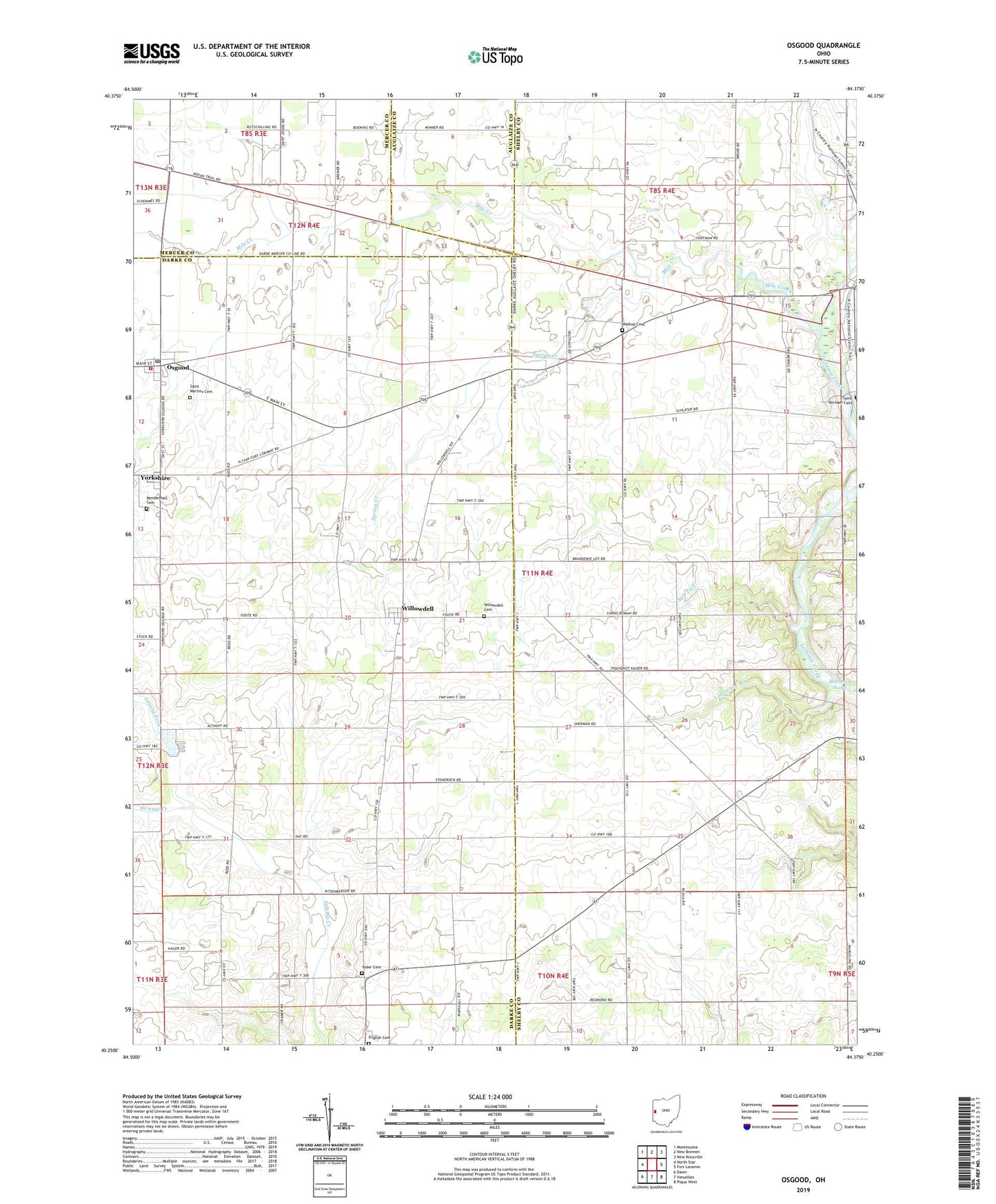
2019 topographic map quadrangle Osgood in the state of Ohio. Scale: 1:24000. Based on the newly updated USGS 7.5' US Topo map series, this map is in the following counties: Darke, Shelby, Mercer, Auglaize. The map contains contour data, water features, and other items you are used to seeing on USGS maps, but also has updated roads and other features. This is the next generation of topographic maps. Printed on high-quality waterproof paper with UV fade-resistant inks.
Quads adjacent to this one:
West: North Star
Northwest: Montezuma
North: New Bremen
Northeast: New Knoxville
East: Fort Loramie
Southeast: Piqua West
South: Versailles
Southwest: Dawn
Contains the following named places: Barhorst Lake, Barhorst Lake Dam, Bruey School, English Cemetery, Fort Loramie Park, Frantz School, Grassy Fork, Kramer Farms, Lawrence Run, Mendenhall Cemetery, Mile Creek, Nason School, Osgood, Osgood Area Rescue Squad, Osgood Community Volunteer Fire Department, Osgood Post Office, Poppleman School, Ridge School, Saint Martins Cemetery, Saint Nicholas Catholic Church, Salt Lick, Schafer Dairy Farms, School Number 6, Spring Creek, Steinman, Straker School, Strakers, Township of Patterson, Tuente Farms, Turner School, Village of Osgood, Village of Yorkshire, Walkup Cemetery, Walkup Country Club, Walkup School, Willowdell, Willowdell Cemetery, Willowdell Post Office, Willowdell School, Yoder Cemetery, Yorkshire, Yorkshire Post Office, ZIP Codes: 45351, 45388, 45845