MyTopo
Dawn Ohio US Topo Map
Couldn't load pickup availability
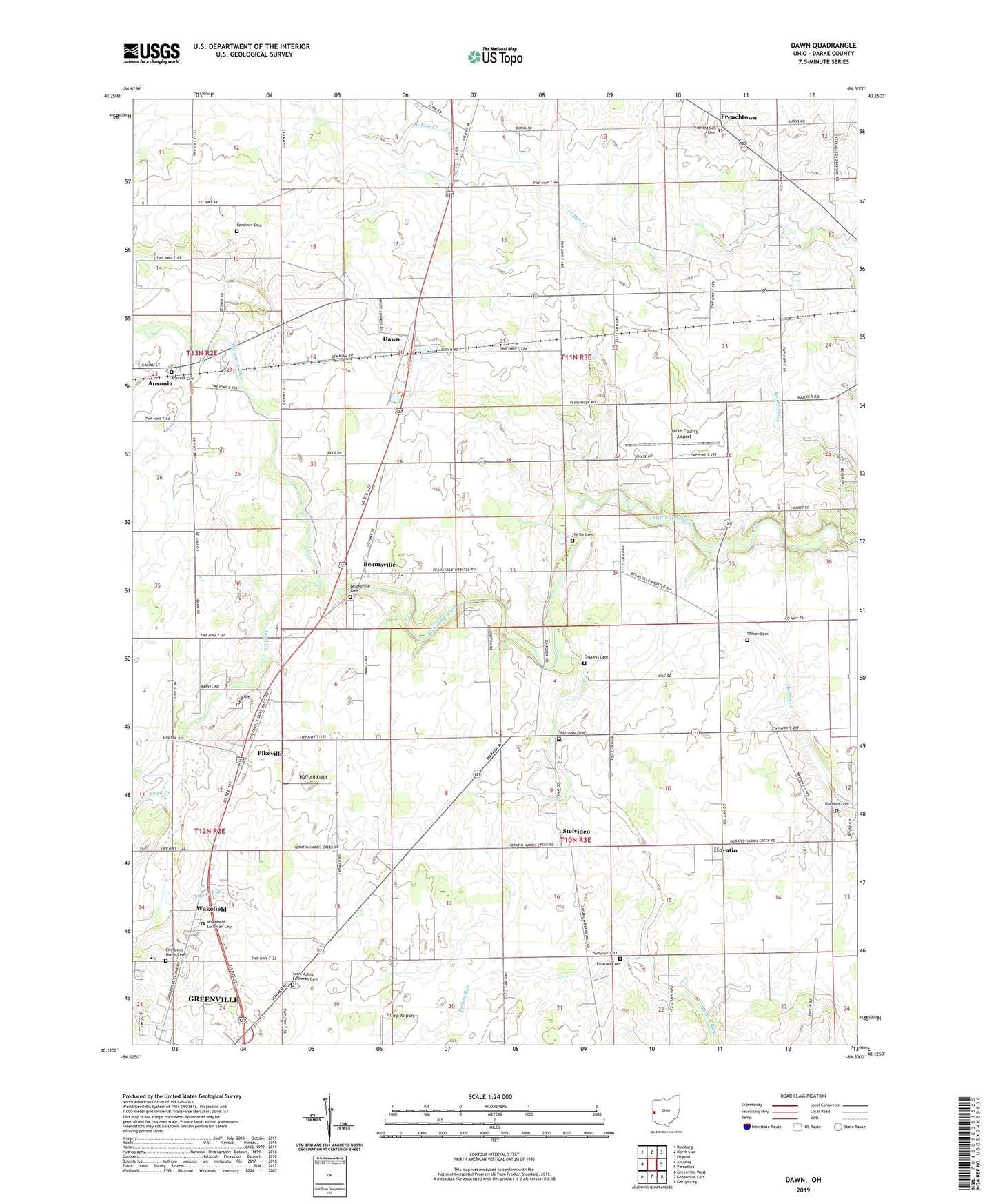
2023 topographic map quadrangle Dawn in the state of Ohio. Scale: 1:24000. Based on the newly updated USGS 7.5' US Topo map series, this map is in the following counties: Darke. The map contains contour data, water features, and other items you are used to seeing on USGS maps, but also has updated roads and other features. This is the next generation of topographic maps. Printed on high-quality waterproof paper with UV fade-resistant inks.
Quads adjacent to this one:
West: Ansonia
Northwest: Rossburg
North: North Star
Northeast: Osgood
East: Versailles
Southeast: Gettysburg
South: Greenville East
Southwest: Greenville West
This map covers the same area as the classic USGS quad with code o40084b5.
Contains the following named places: Ansonia Cemetery, Beamsville, Beamsville Cemetery, Beamsville Post Office, Boyd Creek, Boyer Ditch, Brandt Hog Farm, Brunswick Dairy Farms, Camelot Farm, Childrens Home Cemetery, Coppess Cemetery, Cowlick Farms, Darke County, Darke County Airport, Darke County Childrens Home, Dawn, Dawn Post Office, E and J Mobile Home Park, Erisman Cemetery, Fischer Farms, Frenchtown, Green Villa Mobile Park, Greenville Shopping Center, Grilliot Farms, Harte Run, Hartle Cemetery, Hazeldale School, Holy Family Catholic Church, Holy Family Cemetery, Horatio, Horatio Post Office, Hufford Field, Indian Stone Farms, Kershner Cemetery, Lyons School, Marshal Poultry Farm, Mayo Farm, Miller School, Needmore, Oak Grove Church, Oakland Cemetery, Oakland Church of the Brethren, Pikeville, Pikeville Post Office, Plessinger Farms, Price Farm, Reed School, Saint John, Saint Johns Lutheran Cemetery, Saint John's Lutheran Church, Schmitmeyer Farms, Schrader Dairy Farm, Skylane Field, Stelvideo, Stelvideo Cemetery, Stelvideo Post Office, Stoner Cemetery, Township of Richland, Wakefield, Wakefield Lutheran Cemetery, Warrick Farms, WLSN-FM (Greenville), ZIP Code: 45380