MyTopo
North Star Ohio US Topo Map
Couldn't load pickup availability
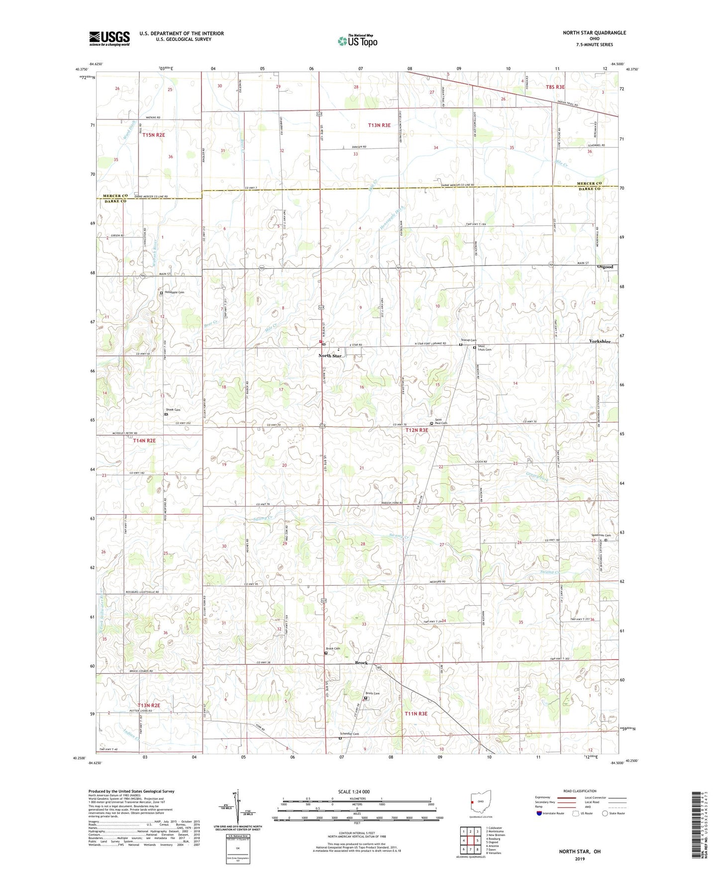
2023 topographic map quadrangle North Star in the state of Ohio. Scale: 1:24000. Based on the newly updated USGS 7.5' US Topo map series, this map is in the following counties: Darke, Mercer. The map contains contour data, water features, and other items you are used to seeing on USGS maps, but also has updated roads and other features. This is the next generation of topographic maps. Printed on high-quality waterproof paper with UV fade-resistant inks.
Quads adjacent to this one:
West: Rossburg
Northwest: Coldwater
North: Montezuma
Northeast: New Bremen
East: Osgood
Southeast: Versailles
South: Dawn
Southwest: Ansonia
This map covers the same area as the classic USGS quad with code o40084c5.
Contains the following named places: Albers Acres, Allen View Farms, Billenstein Farms, Brock, Brock Cemetery, Brock Post Office, Buschur Dairy Farms, County Line Farms, Delvin, Delvin Post Office, Hillandale Farms, Holsapple Cemetery, Honsapple Ditch, Keiser Farm, North Star, North Star Community Fire Department, North Star Post Office, Ohio Valley Farms, Prairie Star Farms, Saint Louis Catholic Church, Saint Louis Cemetery, Saint Paul Cemetery, Saint Paul Church, Scheidler Cemetery, Shooks Cemetery, Shooks Chapel, Speelman Cemetery, Star Greenhouses, Stucke Grain Farms, Tea Cup Cemetery, Township of Wabash, Township of York, Village of North Star, Ward Ditch, ZIP Code: 45350