MyTopo
Pleasant Plain Ohio US Topo Map
Couldn't load pickup availability
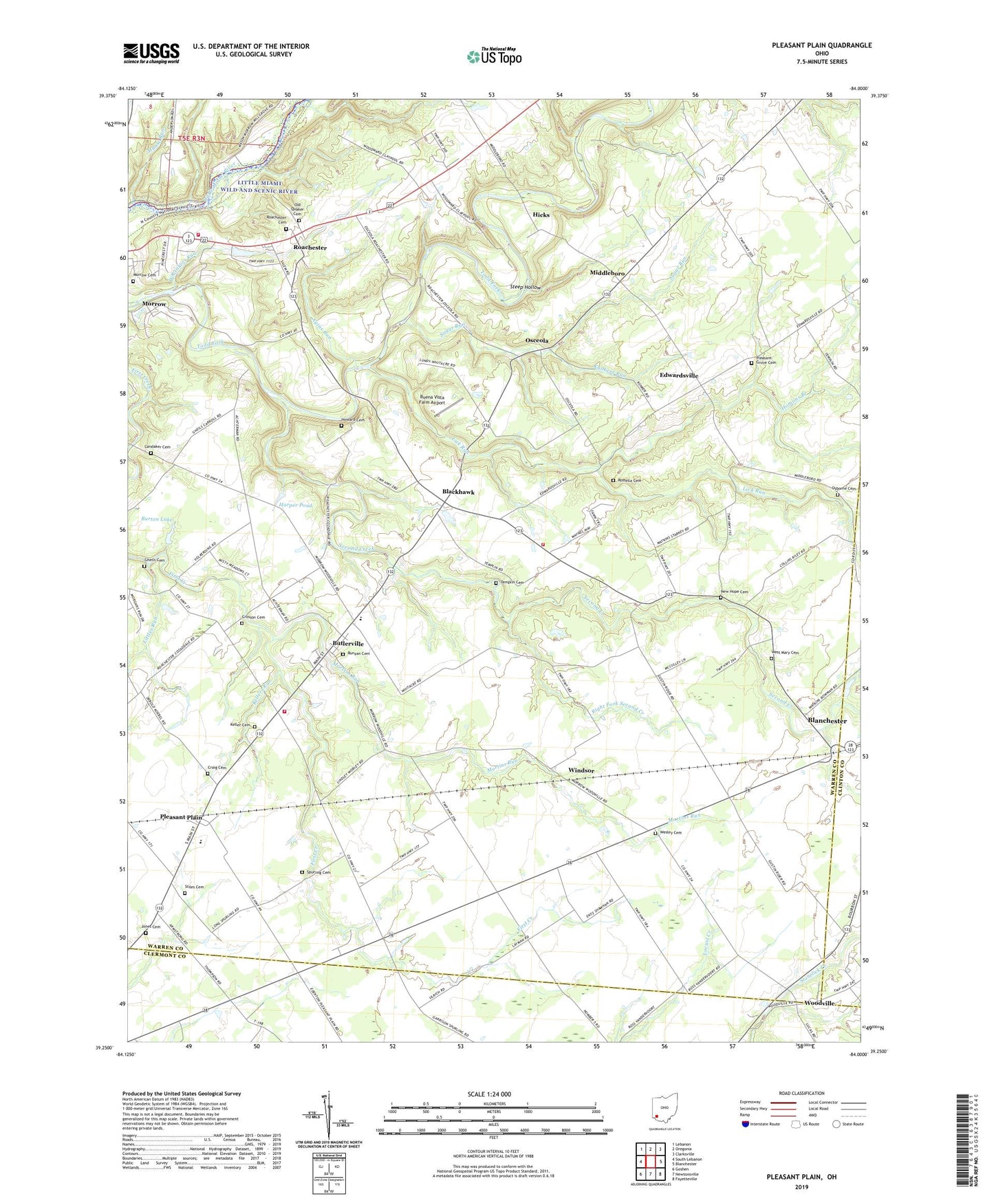
2023 topographic map quadrangle Pleasant Plain in the state of Ohio. Scale: 1:24000. Based on the newly updated USGS 7.5' US Topo map series, this map is in the following counties: Warren, Clermont, Clinton. The map contains contour data, water features, and other items you are used to seeing on USGS maps, but also has updated roads and other features. This is the next generation of topographic maps. Printed on high-quality waterproof paper with UV fade-resistant inks.
Quads adjacent to this one:
West: South Lebanon
Northwest: Lebanon
North: Oregonia
Northeast: Clarksville
East: Blanchester
Southeast: Fayetteville
South: Newtonsville
Southwest: Goshen
This map covers the same area as the classic USGS quad with code o39084c1.
Contains the following named places: Agins Run, Blackhawk, Brimstone School, Buena Vista Farm Airport, Burton Lake, Burton Lake Dam, Butlerville, Craig Cemetery, Craigs Airport, Crosson Cemetery, Edwardsville, Edwardsville School, Frith Airport, Gheils Cemetery, Glenview Farms, Grove School, Harlan Township Fire and Rescue Station 81, Harlan Township Fire and Rescue Station 82, Harlan-Butlerville Elementary School, Harper Pond, Harper Pond Dam, Harpers Run, Hicks, Homans Branch, Howard Cemetery, Jones Cemetery, Keller Cemetery, Kellers Run, Kunkers Run, Landaker Cemetery, Leather Ear Church, Level High School, Lick Run, Littles Run, Martins Run, Middleboro, Morrow Cemetery, Muntz Run, New Hope Cemetery, New Hope School, Oak Grove School, Old Quaker Cemetery, Osborne Cemetery, Osceola, Pleasant Grove Cemetery, Pleasant Plain, Pleasant Plain Post Office, Poe's Trailer Park, Right Fork Second Creek, Roachester, Roachester Cemetery, Roachester Census Designated Place, Rossburg, Rossella Cemetery, Runyan Cemetery, Salem / Morrow Fire Department Station 71, San Je Village, Schoellman Dairy Farm, Second Creek, Sharps Run, Spurling Cemetery, Steep Hollow, Stiles Cemetery, Sugar Run, Sugar Run Church, Templin Cemetery, Township of Harlan, Township of Salem, Victor School, Village of Butlerville, Village of Morrow, Village of Pleasant Plain, Watkins Run, Wesley Cemetery, West Mary Cemetery, Whip-Poor-Will Camp, Whitakers Run, Windsor, Woodville, Woodville Baptist Church, ZIP Codes: 45152, 45162