MyTopo
Rushsylvania Ohio US Topo Map
Couldn't load pickup availability
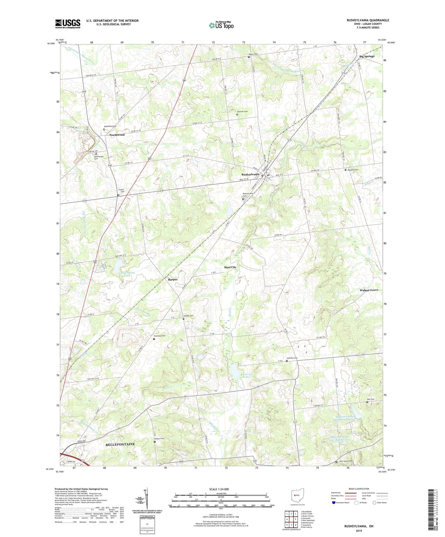
2019 topographic map quadrangle Rushsylvania in the state of Ohio. Scale: 1:24000. Based on the newly updated USGS 7.5' US Topo map series, this map is in the following counties: Logan. The map contains contour data, water features, and other items you are used to seeing on USGS maps, but also has updated roads and other features. This is the next generation of topographic maps. Printed on high-quality waterproof paper with UV fade-resistant inks.
Quads adjacent to this one:
West: Huntsville
Northwest: Roundhead
North: Silver Creek
Northeast: Mount Victory
East: West Mansfield
Southeast: East Liberty
South: Zanesfield
Southwest: Bellefontaine
Contains the following named places: Appleseed Ridge Lake Number One, Appleseed Ridge Lake Number One Dam, Appleseed Ridge Lake Number Two, Appleseed Ridge Lake Number Two Dam, Bellefontaine Municipal Airport, Benjamin Logan Middle School, Camp Wesley, Camp Wesley Lake, Camp Wesley Lake Dam, Cherokee Run Landfill, Culp Field, Day Cemetery, Dorman Cemetery, Easton Cemetery, Equality Cemetery, Equality School, Fulton Cemetery, Harper, Harper Cemetery, Harper Post Office, Hopewell Church, Jasinsky Cemetery, Marl City, McKirahan Cemetery, Miami Cemetery, Mountain Lake Camp, New Salem Cemetery, New Salem Church, Northwood, Northwood Cemetery, Northwood Post Office, Rushcreek Lake, Rushcreek Township Volunteer Fire Department, Rushsylvania, Rushsylvania Cemetery, Rushsylvania Post Office, School Number 1, School Number 10, School Number 2, School Number 5, Smoky Row School, Stanfield Cemetery, Township of Rushcreek, Turkey Ridge School, Village of Rushsylvania, ZIP Code: 43347