MyTopo
West Mansfield Ohio US Topo Map
Couldn't load pickup availability
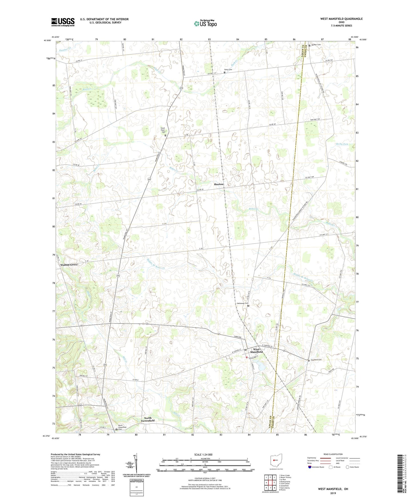
2023 topographic map quadrangle West Mansfield in the state of Ohio. Scale: 1:24000. Based on the newly updated USGS 7.5' US Topo map series, this map is in the following counties: Logan, Union. The map contains contour data, water features, and other items you are used to seeing on USGS maps, but also has updated roads and other features. This is the next generation of topographic maps. Printed on high-quality waterproof paper with UV fade-resistant inks.
Quads adjacent to this one:
West: Rushsylvania
Northwest: Silver Creek
North: Mount Victory
Northeast: La Rue
East: York Center
Southeast: Peoria
South: East Liberty
Southwest: Zanesfield
This map covers the same area as the classic USGS quad with code o40083d5.
Contains the following named places: Bell School, Benjamin Logan Elementary School, Bethany School, Bethel Church, Bethel School, Bokescreek Township Fire Department, Camp Macochee, Centennial School, Early Cemetery, Good Hope Cemetery, Good Hope School, Hathaway Cemetery, Heartland Quality Egg Farm, Horton, Horton Post Office, North Greenfield, North Greenfield Cemetery, North Greenfield Post Office, Pullet Farm, Quaker Cemetery, Quaking Asp School, School Number 10, Southard Cemetery, Township of Bokescreek, Village of West Mansfield, Walnut Grove, Walnutgrove Post Office, West Mansfield, West Mansfield Baptist Church, West Mansfield Post Office, West Mansfield United Methodist Church, White Swan School, ZIP Code: 43358