MyTopo
Huntsville Ohio US Topo Map
Couldn't load pickup availability
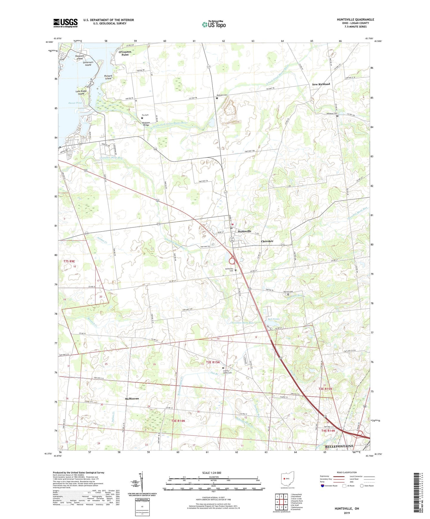
2023 topographic map quadrangle Huntsville in the state of Ohio. Scale: 1:24000. Based on the newly updated USGS 7.5' US Topo map series, this map is in the following counties: Logan. The map contains contour data, water features, and other items you are used to seeing on USGS maps, but also has updated roads and other features. This is the next generation of topographic maps. Printed on high-quality waterproof paper with UV fade-resistant inks.
Quads adjacent to this one:
West: Russells Point
Northwest: Waynesfield
North: Roundhead
Northeast: Silver Creek
East: Rushsylvania
Southeast: Zanesfield
South: Bellefontaine
Southwest: De Graff
This map covers the same area as the classic USGS quad with code o40083d7.
Contains the following named places: Bell Pond, Bell Pond Dam, Bickham Bridge, Calvary Christian School, Cherokee, Cherokee Hills Golf Course, Cherokee Run, County Home Cemetery, Crane Town Island, Flat Branch, Fry Cemetery, Governors Island, Harrod Cemetery, Huntsville, Huntsville Cemetery, Huntsville Elementary School, Huntsville Fire Department, Huntsville Post Office, Huntsville United Methodist Church, Hurley Farm, Indian Lake State Park, Johnston Cemetery, Lake Ridge Island, Local School, Logan County, Logan County Home, Mary Rutan Heliport, McGraw Cemetery, McMorran, New Richland, New Richland Baptist Church, New Richland Post Office, O'Connor Point, Rabbitsville School, Richard Island, Robinaugh Emergency Medical Services, Rushwood Farms, School Number 1, School Number 2, School Number 4, School Number 6, School Number 7, School Number 9, Shawnee Island, South Fork Great Miami River, Township of Lake, Township of McArthur, Township of Richland, Turkey Foot Island, Turtle Shell Island, Village of Huntsville, Wagner Farm, ZIP Code: 43324