MyTopo
Trinway Ohio US Topo Map
Couldn't load pickup availability
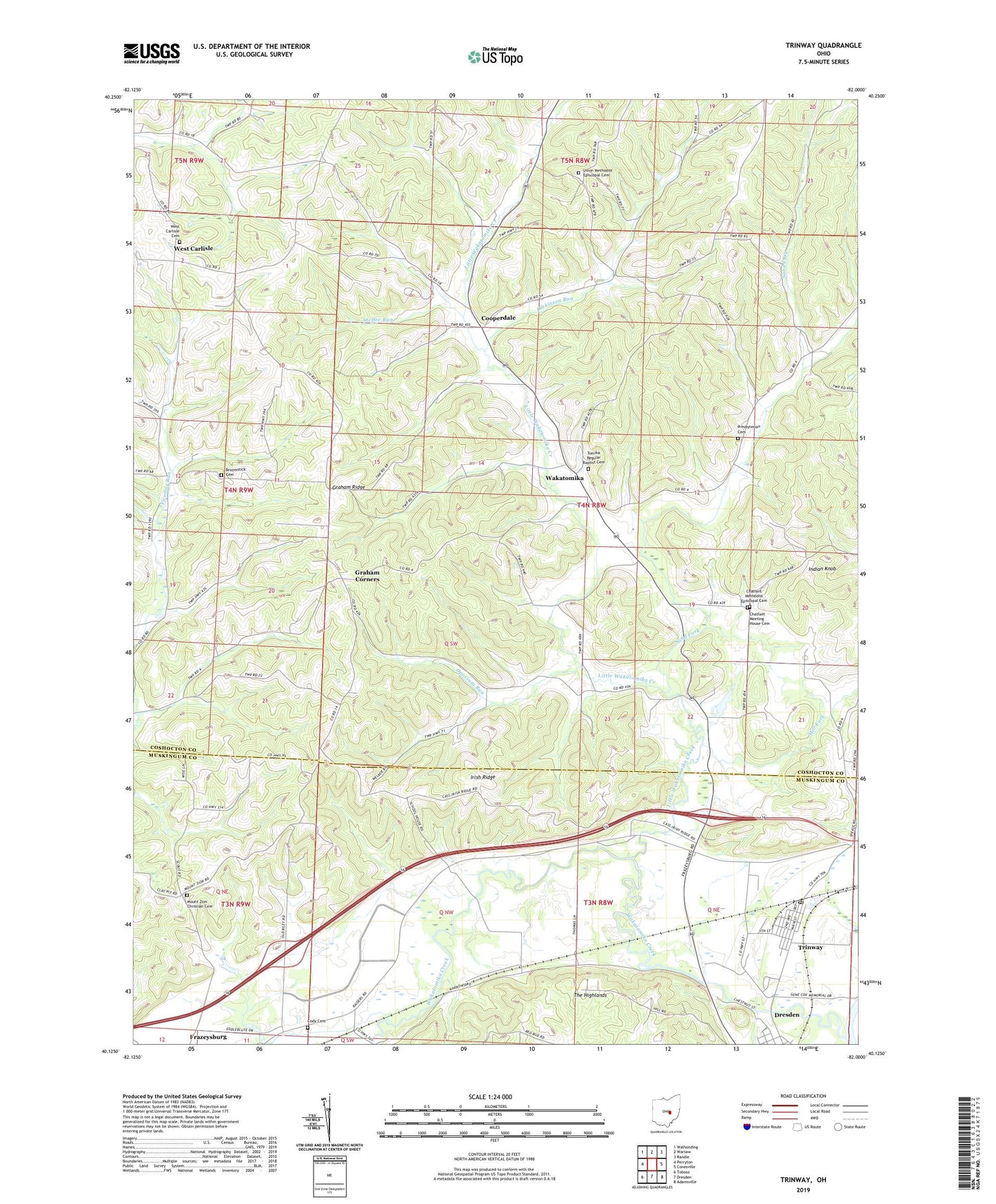
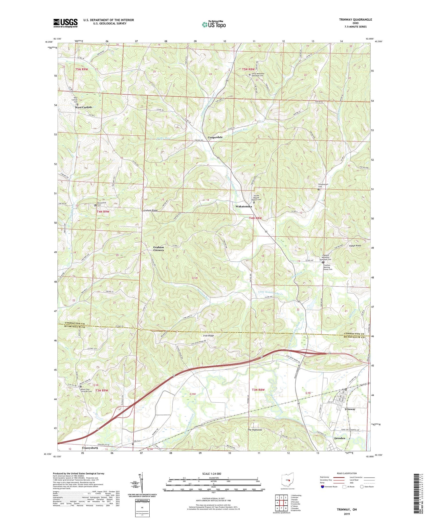
2019 topographic map quadrangle Trinway in the state of Ohio. Scale: 1:24000. Based on the newly updated USGS 7.5' US Topo map series, this map is in the following counties: Coshocton, Muskingum. The map contains contour data, water features, and other items you are used to seeing on USGS maps, but also has updated roads and other features. This is the next generation of topographic maps. Printed on high-quality waterproof paper with UV fade-resistant inks.
Quads adjacent to this one:
West: Perryton
Northwest: Walhonding
North: Warsaw
Northeast: Randle
East: Conesville
Southeast: Adamsville
South: Dresden
Southwest: Toboso
Contains the following named places: Arnold Farm, Broomstick Cemetery, Chalfant Church, Chalfant Meeting House Cemetery, Chalfant Methodist Episcopal Cemetery, Clark School, Cody Cemetery, Cooperdale, Cooperdale Nazarene Church, Cooperdale Post Office, Dickinson Run, Graham Corners, Graham Ridge, Hamilton School, Hill N Dale Dairy Farm, Indian Knob, Irish Ridge, Irish School, Little Wakatomika Creek, McCurty School, Mill Fork, Moore Lake, Moore Lake Dam, Mount Zion Christian Cemetery, Opossum Run, Presbyterian Cemetery, Sand Fork, Steffee Run, Tomika Regular Baptist Cemetery, Township of Cass, Township of Washington, Trinway, Trinway Census Designated Place, Trinway Methodist Church, Trinway Post Office, Union Church, Union Methodist Episcopal Cemetery, Wakatomika, Wakatomika Creek, Wakatomika Post Office, West Carlisle, West Carlisle Cemetery, West Carlisle Post Office, ZIP Codes: 43821, 43842