MyTopo
Adamsville Ohio US Topo Map
Couldn't load pickup availability
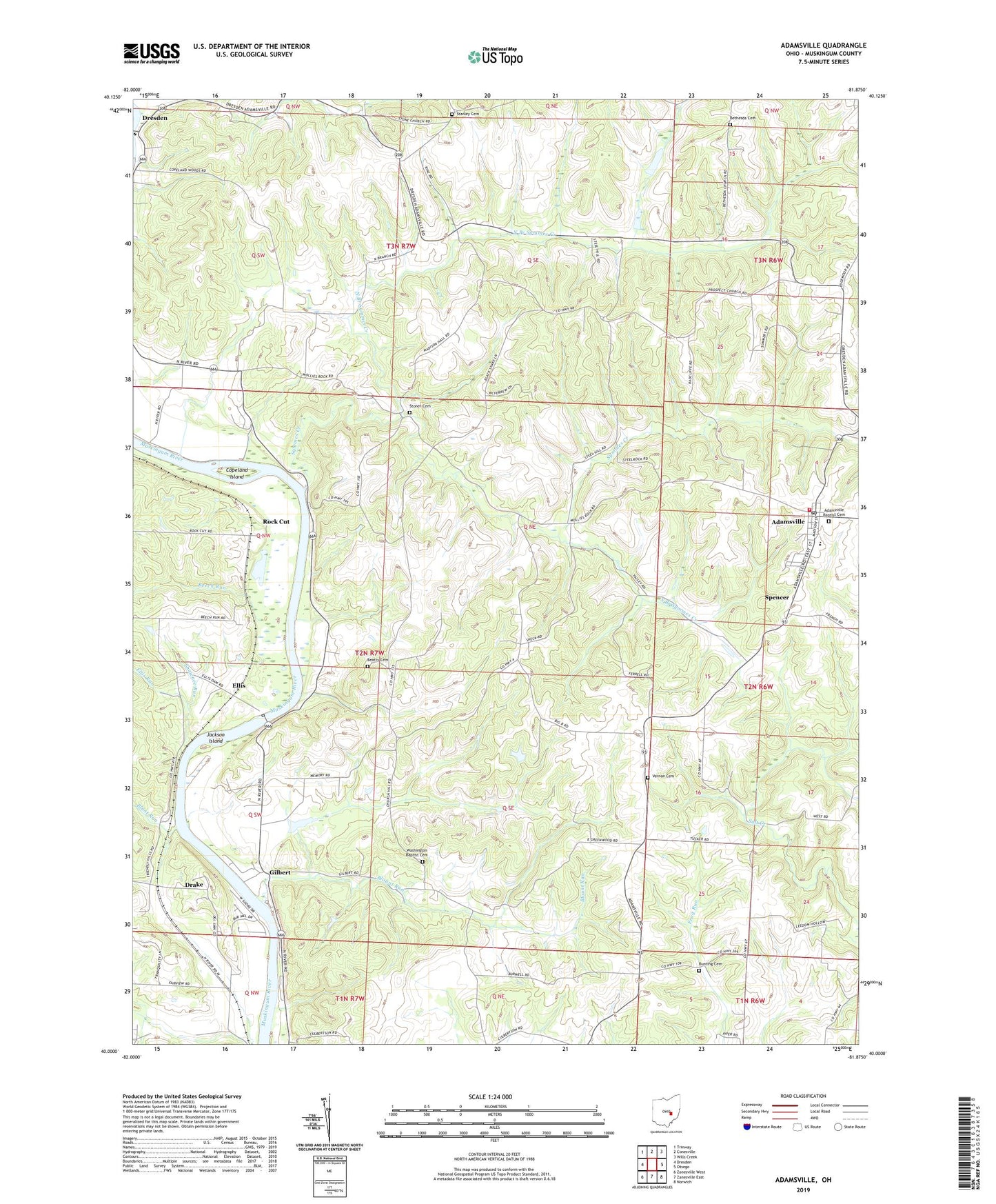
2023 topographic map quadrangle Adamsville in the state of Ohio. Scale: 1:24000. Based on the newly updated USGS 7.5' US Topo map series, this map is in the following counties: Muskingum. The map contains contour data, water features, and other items you are used to seeing on USGS maps, but also has updated roads and other features. This is the next generation of topographic maps. Printed on high-quality waterproof paper with UV fade-resistant inks.
Quads adjacent to this one:
West: Dresden
Northwest: Trinway
North: Conesville
Northeast: Wills Creek
East: Otsego
Southeast: Norwich
South: Zanesville East
Southwest: Zanesville West
This map covers the same area as the classic USGS quad with code o40081a8.
Contains the following named places: Adamsville, Adamsville Baptist Cemetery, Adamsville Elementary School, Adamsville Fire Department, Adamsville Post Office, Beatty Cemetery, Beech Run, Bethesda Cemetery, Bethesda Methodist Church, Blount Run, Blunt Run, Bunting Cemetery, Chestnut Ridge School, Church of Christ, Copeland Island, Deadmans, Drake, East Greenwood, East Greenwood Post Office, East Greenwood School, Ellis, Ellis Dam, Ellis Post Office, Ellis Run, Ellis School, Fritz School, Gilbert, Gilbert Post Office, Jackson Island, Littles School, Maddens, Muskingum River Lock and Dam Number, Muskingum River Lock and Dam Number 11, Muskingum River Parkway State Park, New Victory School, North Branch Symmes Creek, Otterbein School, Prospect Methodist Church, Prospect School, Rock Cut, Salem Church Cemetery, Salem Methodist Church, Salem School, Shawnee Run, South Branch Symmes Creek, Spencer, Stanley Cemetery, Stoner Cemetery, Symmes Creek, Terrace Shores, Township of Madison, Tremleys, Vernon Cemetery, Village of Adamsville, Washington Baptist Cemetery, Washington Township Baptist Church, Whites School, Zanesville Honor Camp, Zanesville State Nursery