MyTopo
Walhonding Ohio US Topo Map
Couldn't load pickup availability
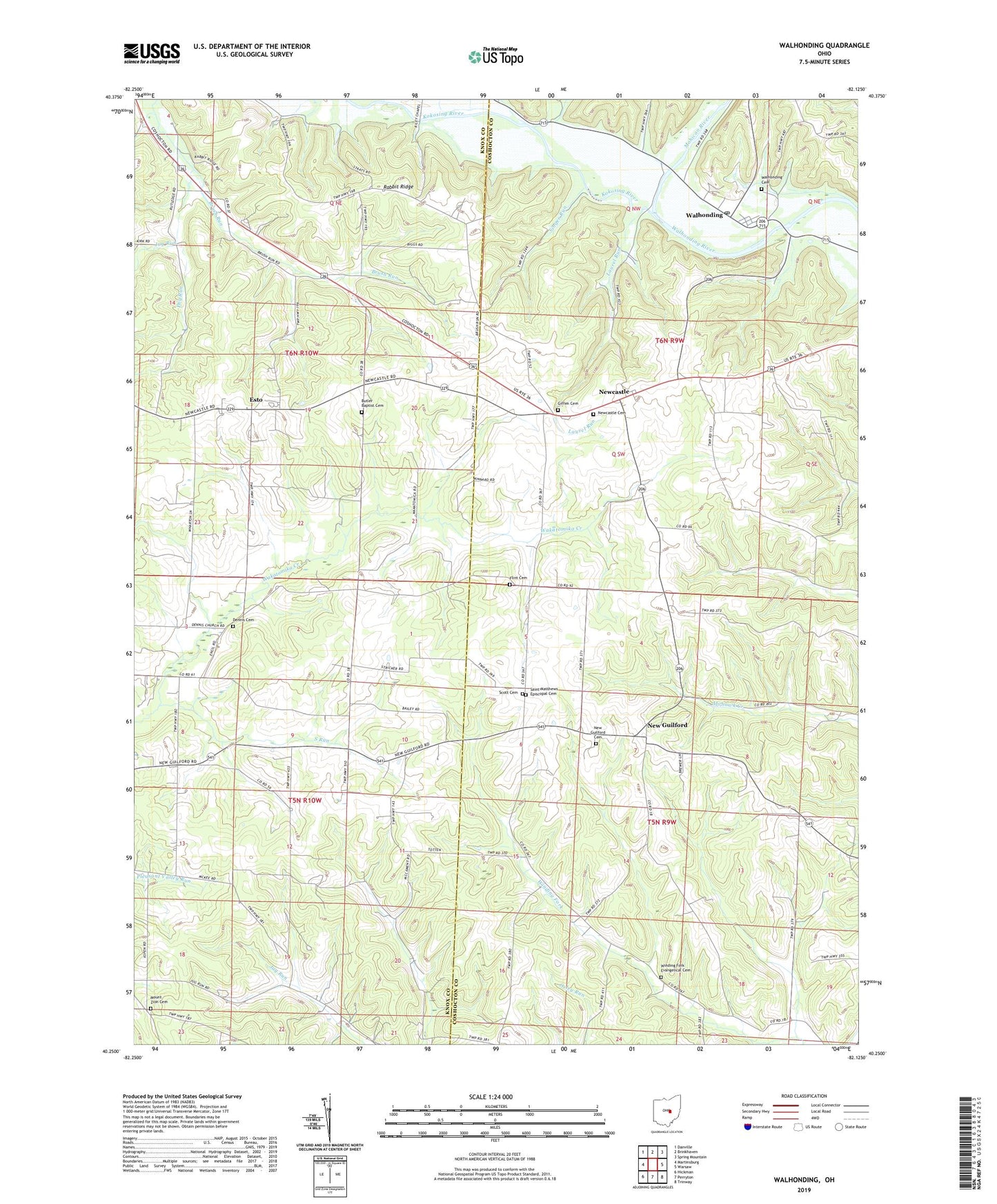
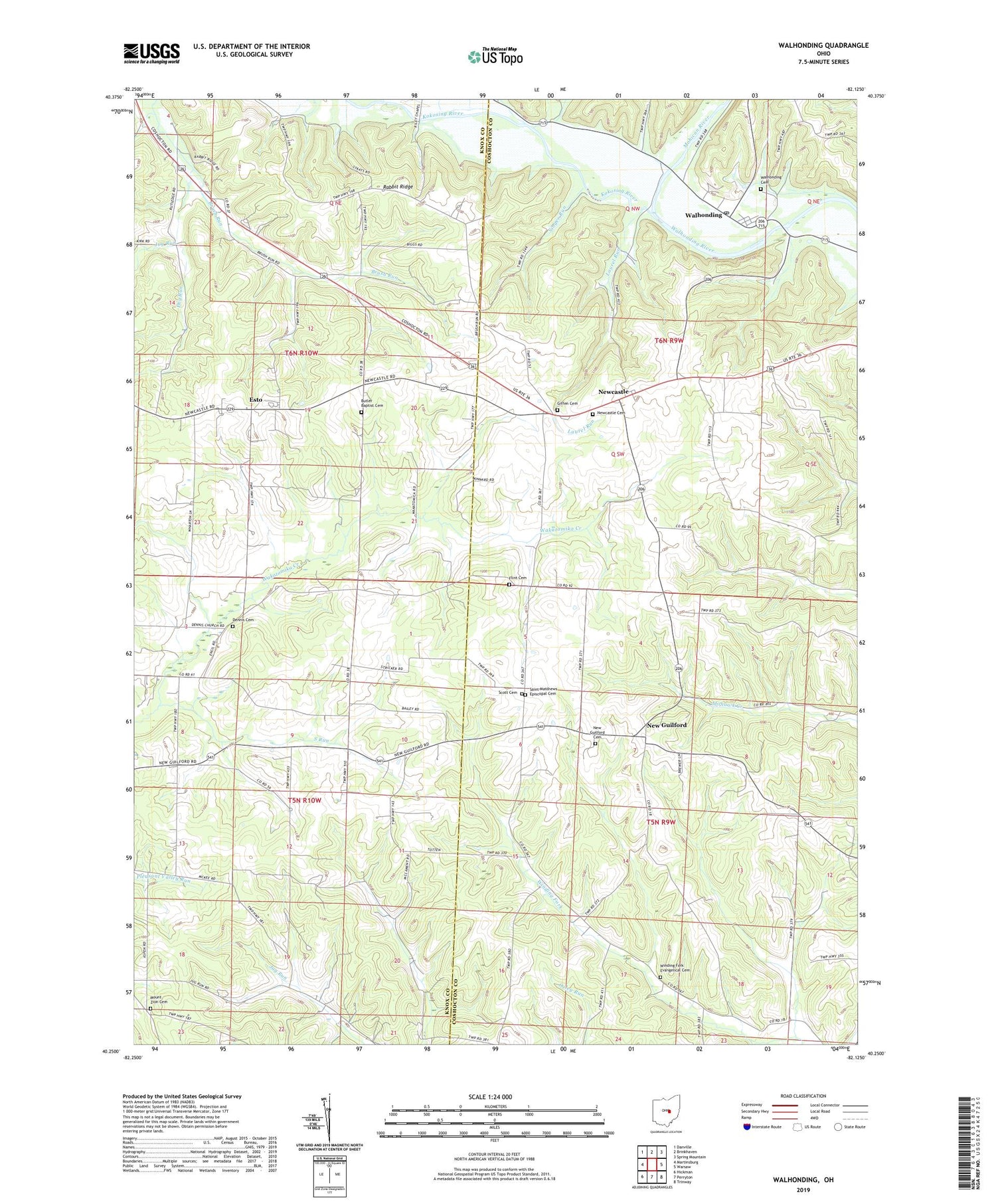
2019 topographic map quadrangle Walhonding in the state of Ohio. Scale: 1:24000. Based on the newly updated USGS 7.5' US Topo map series, this map is in the following counties: Knox, Coshocton. The map contains contour data, water features, and other items you are used to seeing on USGS maps, but also has updated roads and other features. This is the next generation of topographic maps. Printed on high-quality waterproof paper with UV fade-resistant inks.
Quads adjacent to this one:
West: Martinsburg
Northwest: Danville
North: Brinkhaven
Northeast: Spring Mountain
East: Warsaw
Southeast: Trinway
South: Perryton
Southwest: Hickman
Contains the following named places: Brush Run School, Butler Baptist Cemetery, Butler Church, California Farm, Dennis Cemetery, Dennis Chapel, Dry Run, Esto, Esto Post Office, Farmers Orchards, Flint Cemetery, Giffen Cemetery, Jug Run, Jug Run School, Kokosing River, Laurel Run, Maverick Farms, Mohican River, Mount Zion Cemetery, Mount Zion Church, New Castle Methodist Church, New Guilford, New Guilford Cemetery, New Guilford Methodist Church, New Guilford Post Office, Newcastle, Newcastle Cemetery, Owls Town, Rabbit Ridge, Rabbit Ridge School, Saint Matthews Episcopal Cemetery, School Number 4, School Number 5, Scott Cemetery, Singer Run, South Run, Stricker School, Township of Butler, Township of Jackson, Township of Newcastle, Township of Perry, Walhonding, Walhonding Cemetery, Walhonding Post Office, Widows Point Farms, Winding Fork Evangelical Cemetery, Winding Fork School, Wood School, ZIP Code: 43843