MyTopo
Adair Oklahoma US Topo Map
Couldn't load pickup availability
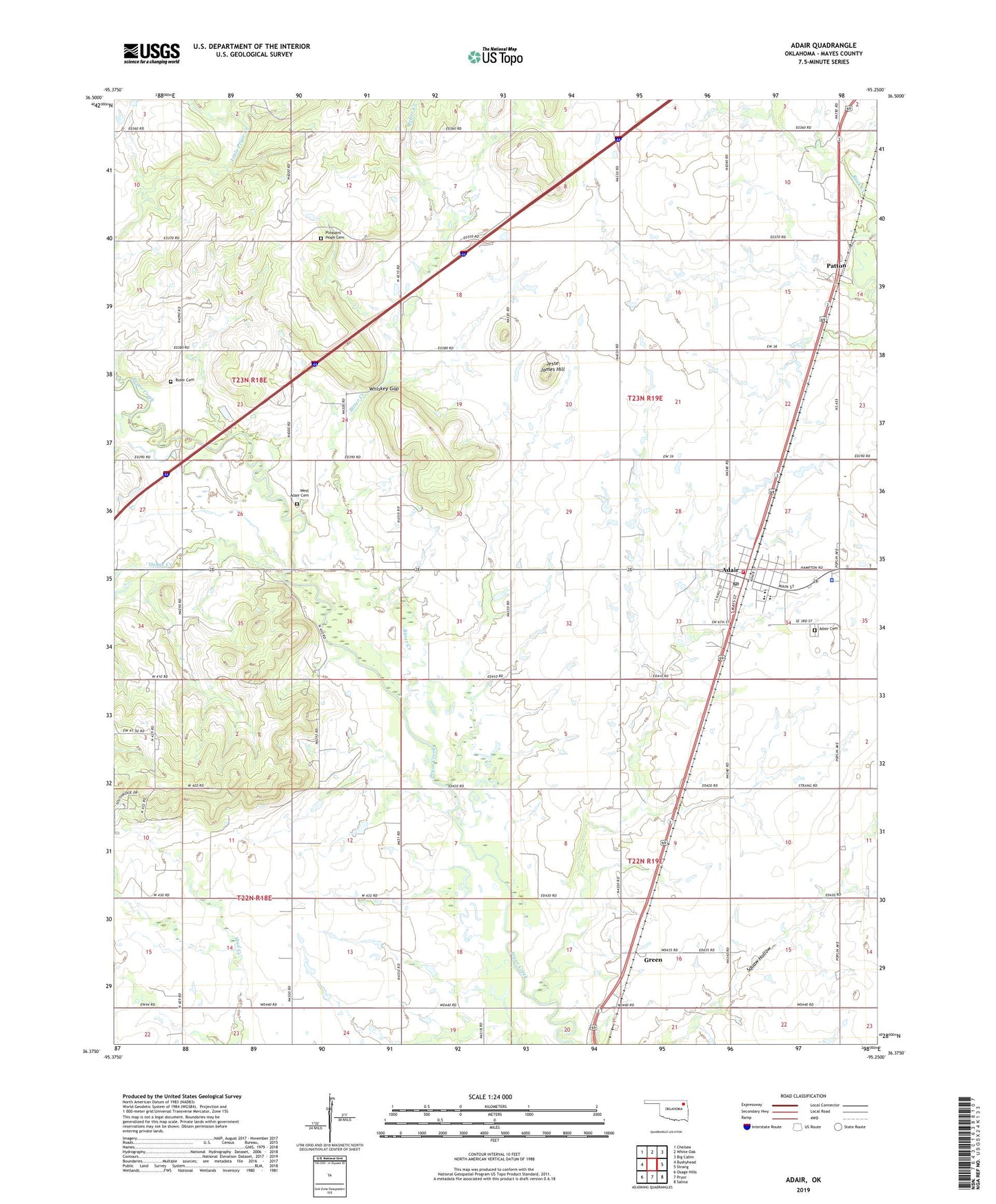
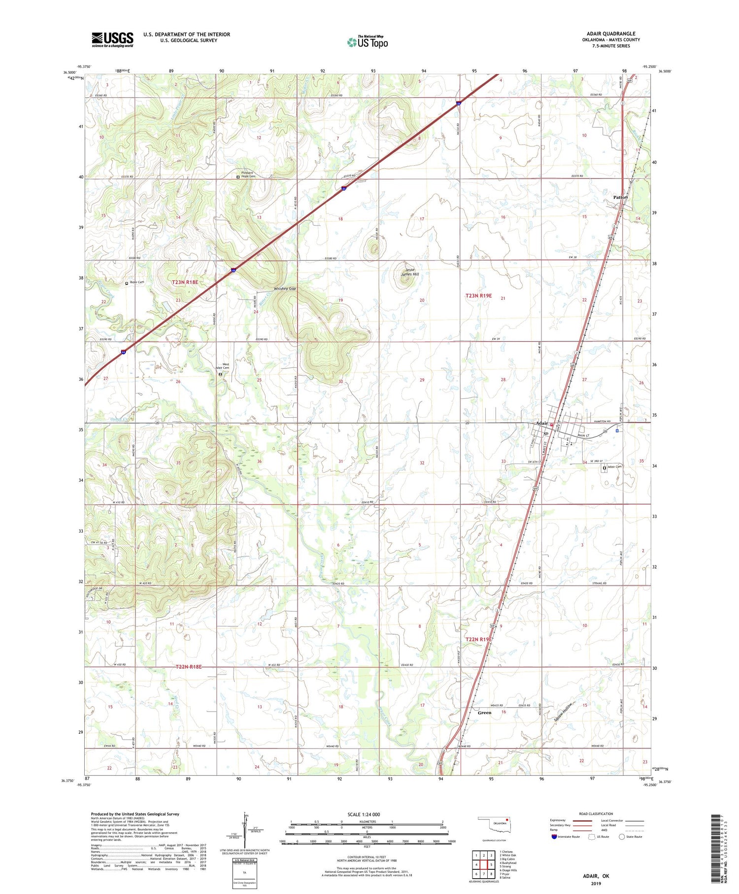
2019 topographic map quadrangle Adair in the state of Oklahoma. Scale: 1:24000. Based on the newly updated USGS 7.5' US Topo map series, this map is in the following counties: Mayes. The map contains contour data, water features, and other items you are used to seeing on USGS maps, but also has updated roads and other features. This is the next generation of topographic maps. Printed on high-quality waterproof paper with UV fade-resistant inks.
Quads adjacent to this one:
West: Bushyhead
Northwest: Chelsea
North: White Oak
Northeast: Big Cabin
East: Strang
Southeast: Salina
South: Pryor
Southwest: Osage Hills
Contains the following named places: Adair, Adair Cemetery, Adair Division, Adair Fire Department, Adair High School, Adair Middle School, Adair Police Department, Adair Post Office, Bernita Hughes Elementary School, Bitter Creek, Green, Jesse James Hill, Mayes Emergency Services Trust Authority Station 4, Oak Grove Church, Osage Creek, Patton, Pleasant Hope Cemetery, Pleasant Hope Church, Rider Cemetery, Town of Adair, Township of Rider, West Adair Cemetery, Whiskey Gap, ZIP Code: 74330