MyTopo
White Oak Oklahoma US Topo Map
Couldn't load pickup availability
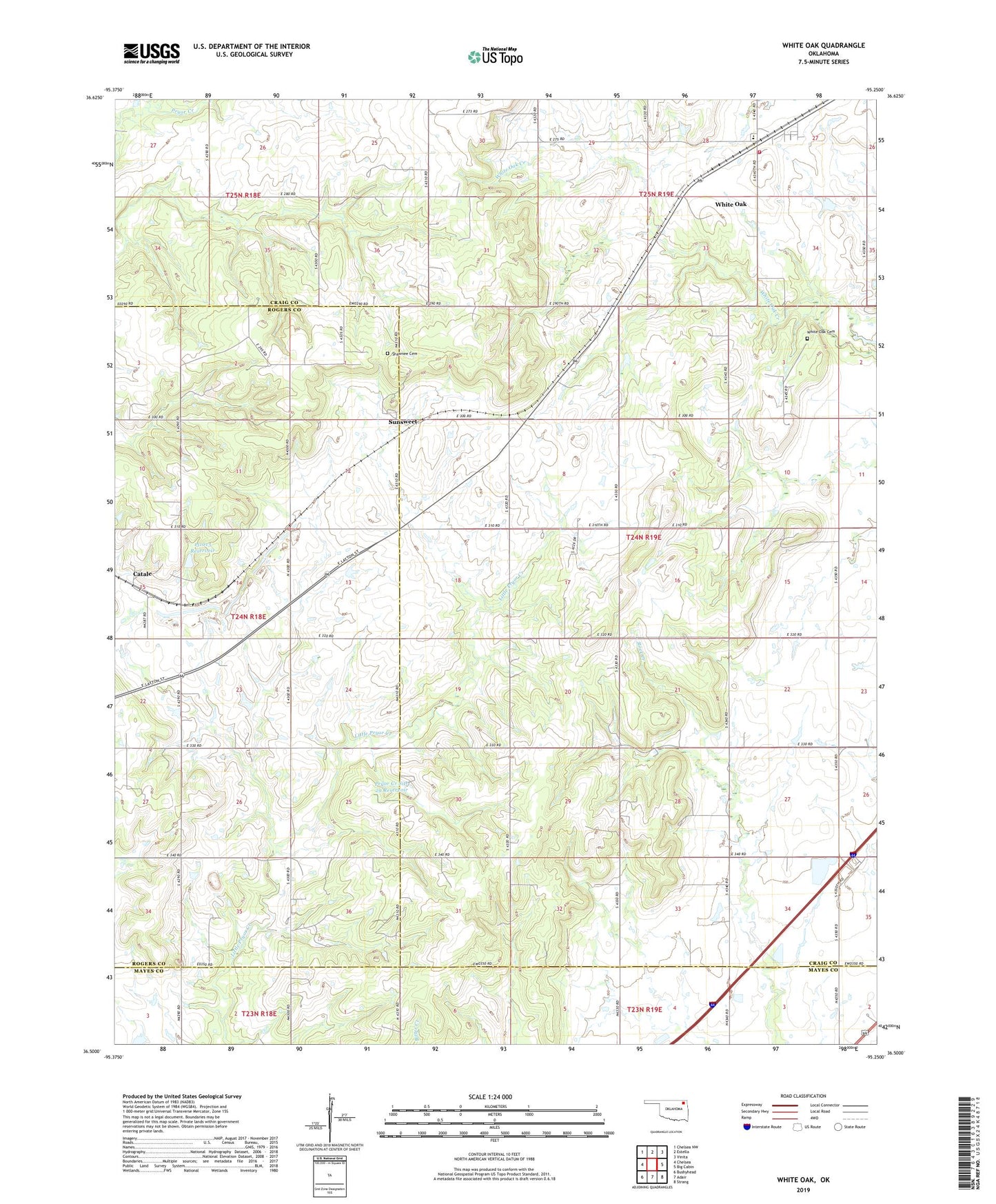
2022 topographic map quadrangle White Oak in the state of Oklahoma. Scale: 1:24000. Based on the newly updated USGS 7.5' US Topo map series, this map is in the following counties: Craig, Rogers, Mayes. The map contains contour data, water features, and other items you are used to seeing on USGS maps, but also has updated roads and other features. This is the next generation of topographic maps. Printed on high-quality waterproof paper with UV fade-resistant inks.
Quads adjacent to this one:
West: Chelsea
Northwest: Chelsea NW
North: Estella
Northeast: Vinita
East: Big Cabin
Southeast: Strang
South: Adair
Southwest: Bushyhead
This map covers the same area as the classic USGS quad with code o36095e3.
Contains the following named places: Catale, Catale Oil Field, Condry Church, Council Grove Church, Craig County Fire Service, Lewis Shawnee Cemetery, Oknoname 131013 Dam, Oknoname 131013 Reservoir, Pryor Creek Site 29 Dam, Pryor Creek Site 29 Reservoir, Pryor Creek Watershed Site 27 Dam, Pryor Creek Watershed Site 27 Reservoir, Pryor Creek Watershed Site 30 Dam, Pryor Creek Watershed Site 30 Reservoir, Sunsweet, White Oak, White Oak Cemetery, White Oak Census Designated Place, White Oak Elementary School, White Oak High School