MyTopo
Battiest Oklahoma US Topo Map
Couldn't load pickup availability
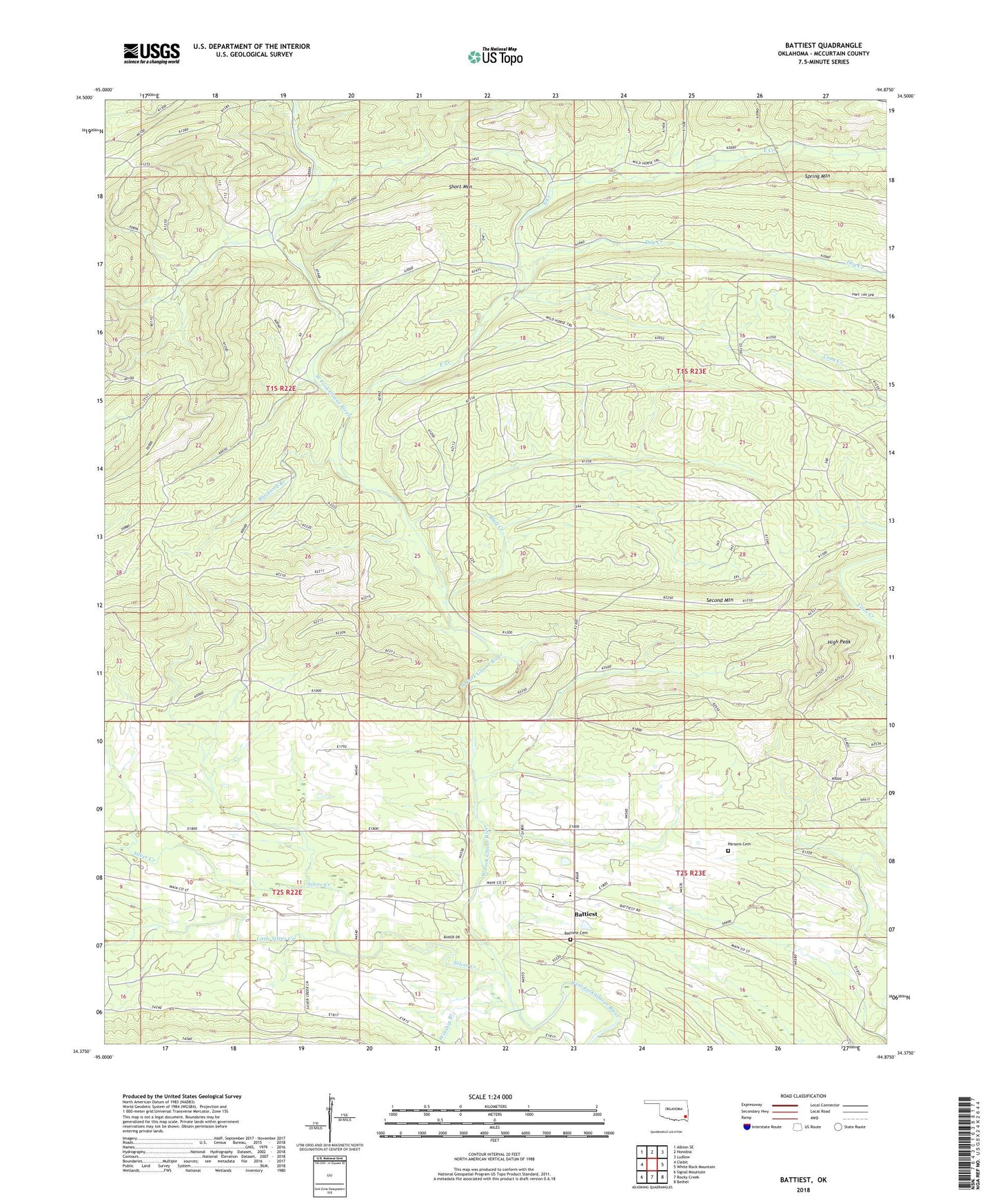
2018 topographic map quadrangle Battiest in the state of Oklahoma. Scale: 1:24000. Based on the newly updated USGS 7.5' US Topo map series, this map is in the following counties: McCurtain. The map contains contour data, water features, and other items you are used to seeing on USGS maps, but also has updated roads and other features. This is the next generation of topographic maps. Printed on high-quality waterproof paper with UV fade-resistant inks.
Quads adjacent to this one:
West: Clebit
Northwest: Albion SE
North: Honobia
Northeast: Ludlow
East: White Rock Mountain
Southeast: Bethel
South: Rocky Creek
Southwest: Signal Mountain
Contains the following named places: Battiest, Battiest Cemetery, Battiest Elementary School, Battiest High School, Battiest Volunteer Fire Department, Blackwell Branch, Bluff Creek, Dog Creek, East Creek, Edwards Creek, High Peak, Little Silver Creek, Mount Zion Church, Parsons Cemetery, Second Mountain, Short Mountain, Silver Creek, Silver Creek Church, Watson Branch, Winship Branch, ZIP Code: 74722