MyTopo
Bethel Oklahoma US Topo Map
Couldn't load pickup availability
Also explore the Bethel Forest Service Topo of this same quad for updated USFS data
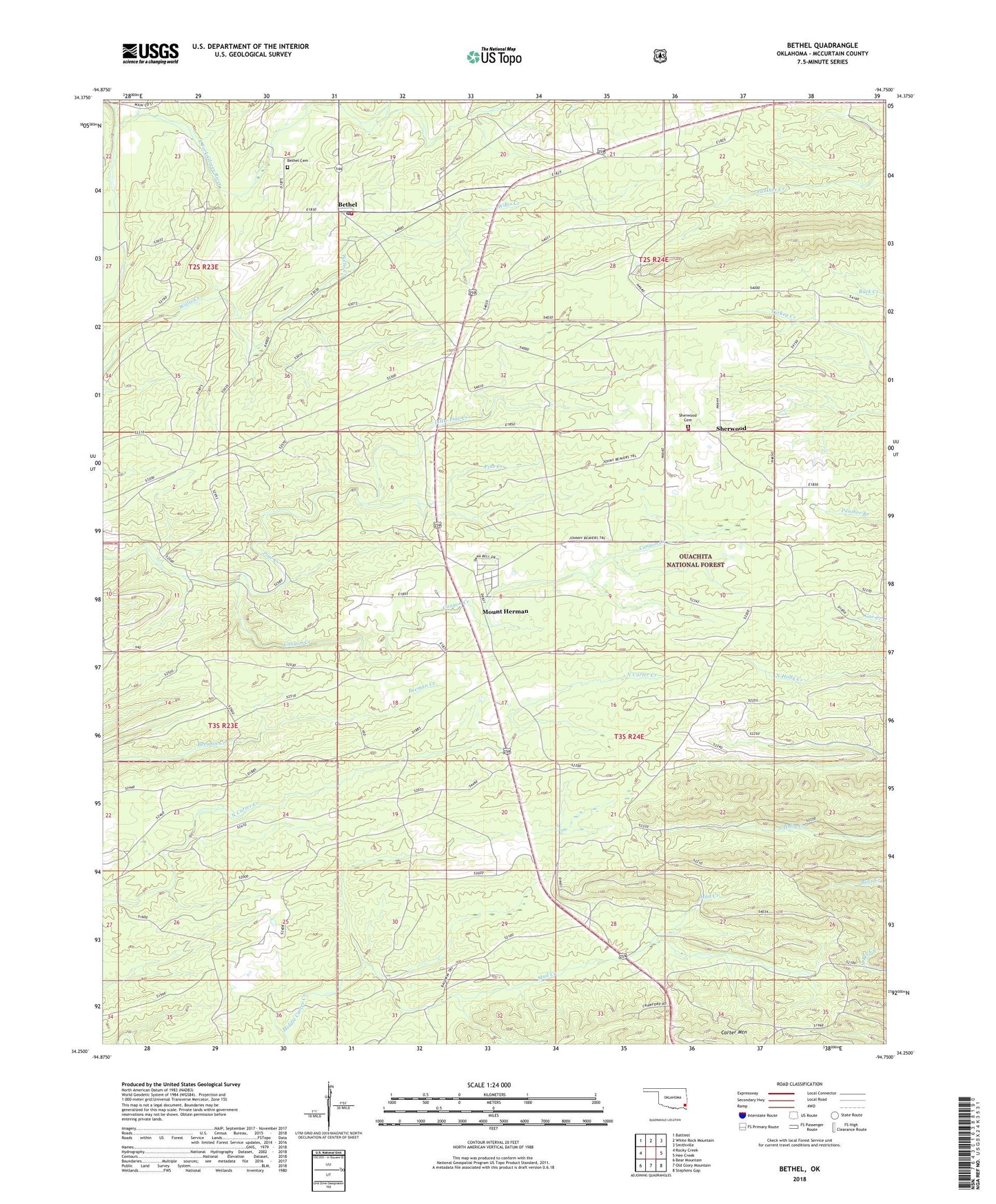
2022 topographic map quadrangle Bethel in the state of Oklahoma. Scale: 1:24000. Based on the newly updated USGS 7.5' US Topo map series, this map is in the following counties: McCurtain. The map contains contour data, water features, and other items you are used to seeing on USGS maps, but also has updated roads and other features. This is the next generation of topographic maps. Printed on high-quality waterproof paper with UV fade-resistant inks.
Quads adjacent to this one:
West: Rocky Creek
Northwest: Battiest
North: White Rock Mountain
Northeast: Smithville
East: Hee Creek
Southeast: Stephens Gap
South: Old Glory Mountain
Southwest: Bear Mountain
This map covers the same area as the classic USGS quad with code o34094c7.
Contains the following named places: Bethel, Bethel Cemetery, Bethel Post Office, Bethel Volunteer Fire Fighters Association, Canyon Creek, Carpenter Branch, Carter Mountain, Coon Creek, Little Pine Creek, Mount Herman, Mud Creek, Sherwood, Sherwood Cemetery, Sherwood Volunteer Fire Department, ZIP Code: 74724