MyTopo
Bradley Oklahoma US Topo Map
Couldn't load pickup availability
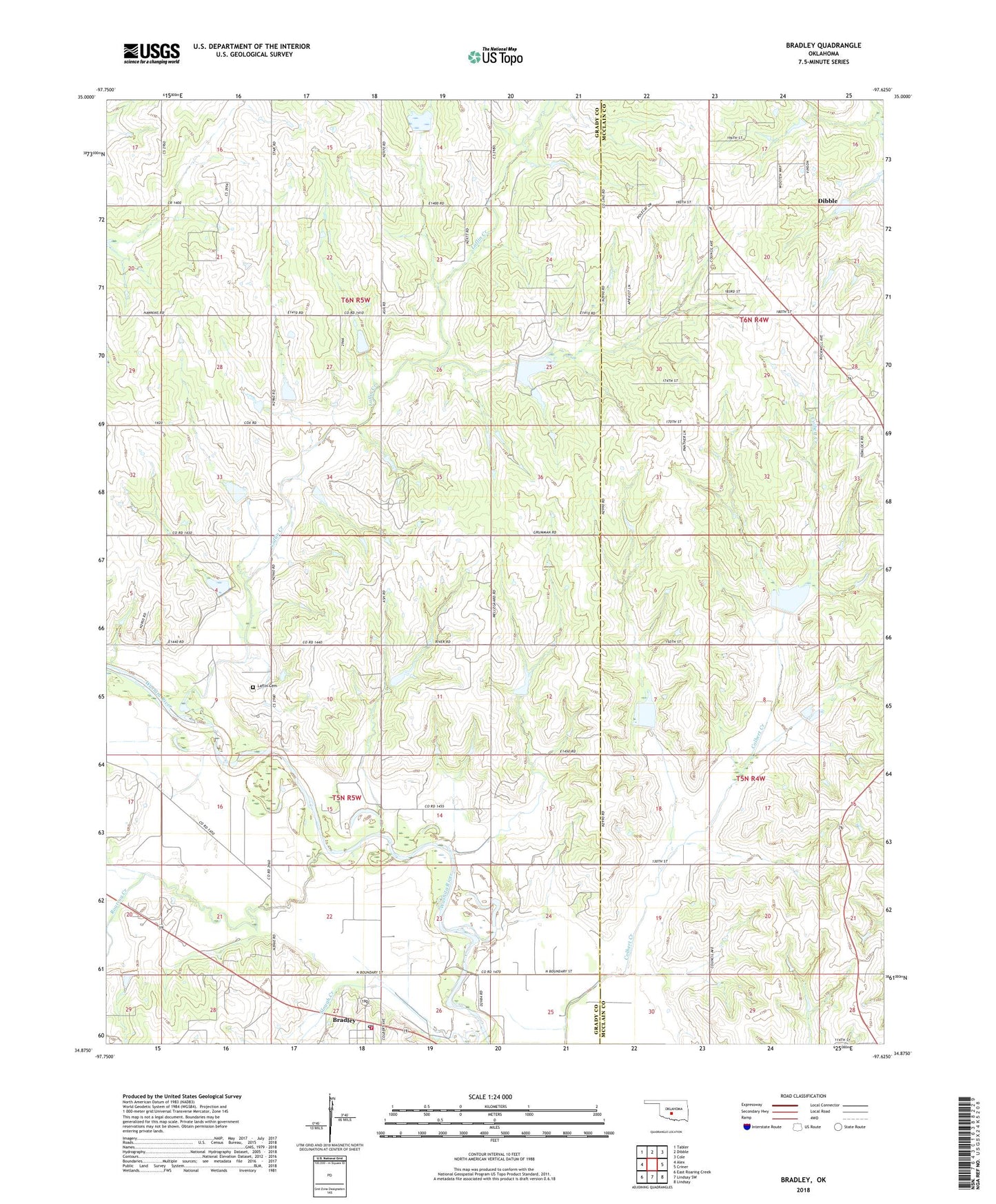
2018 topographic map quadrangle Bradley in the state of Oklahoma. Scale: 1:24000. Based on the newly updated USGS 7.5' US Topo map series, this map is in the following counties: Grady, McClain. The map contains contour data, water features, and other items you are used to seeing on USGS maps, but also has updated roads and other features. This is the next generation of topographic maps. Printed on high-quality waterproof paper with UV fade-resistant inks.
Quads adjacent to this one:
West: Alex
Northwest: Tabler
North: Dibble
Northeast: Cole
East: Criner
Southeast: Lindsay
South: Lindsay SW
Southwest: East Roaring Creek
Contains the following named places: Bear Hybarger Site 3a Dam, Bear Hybarger Site 3a Reservoir, Bradley, Bradley Post Office, Bradley Volunteer Fire Department, Colbert Creek Site 1 Dam, Colbert Creek Site 1 Reservoir, Colbert Creek Site 3 Dam, Colbert Creek Site 3 Reservoir, Criner Creek Site 101 Dam, Criner Creek Site 101 Reservoir, Laflin Cemetery, Laflin Creek, Northwest Bradley Oil Field, Oknoname 051029 Dam, Oknoname 051029 Reservoir, Roaring Creek, Roaring Creek Site 105 Dam, Roaring Creek Site 105 Reservoir, Town of Bradley, Township of Bradley, Township of Naples, Winter Creek Site 15 Dam, Winter Creek Site 15 Reservoir, Winter Creek Site 21 Dam, Winter Creek Site 21 Reservoir, ZIP Code: 73002