MyTopo
Lindsay Oklahoma US Topo Map
Couldn't load pickup availability
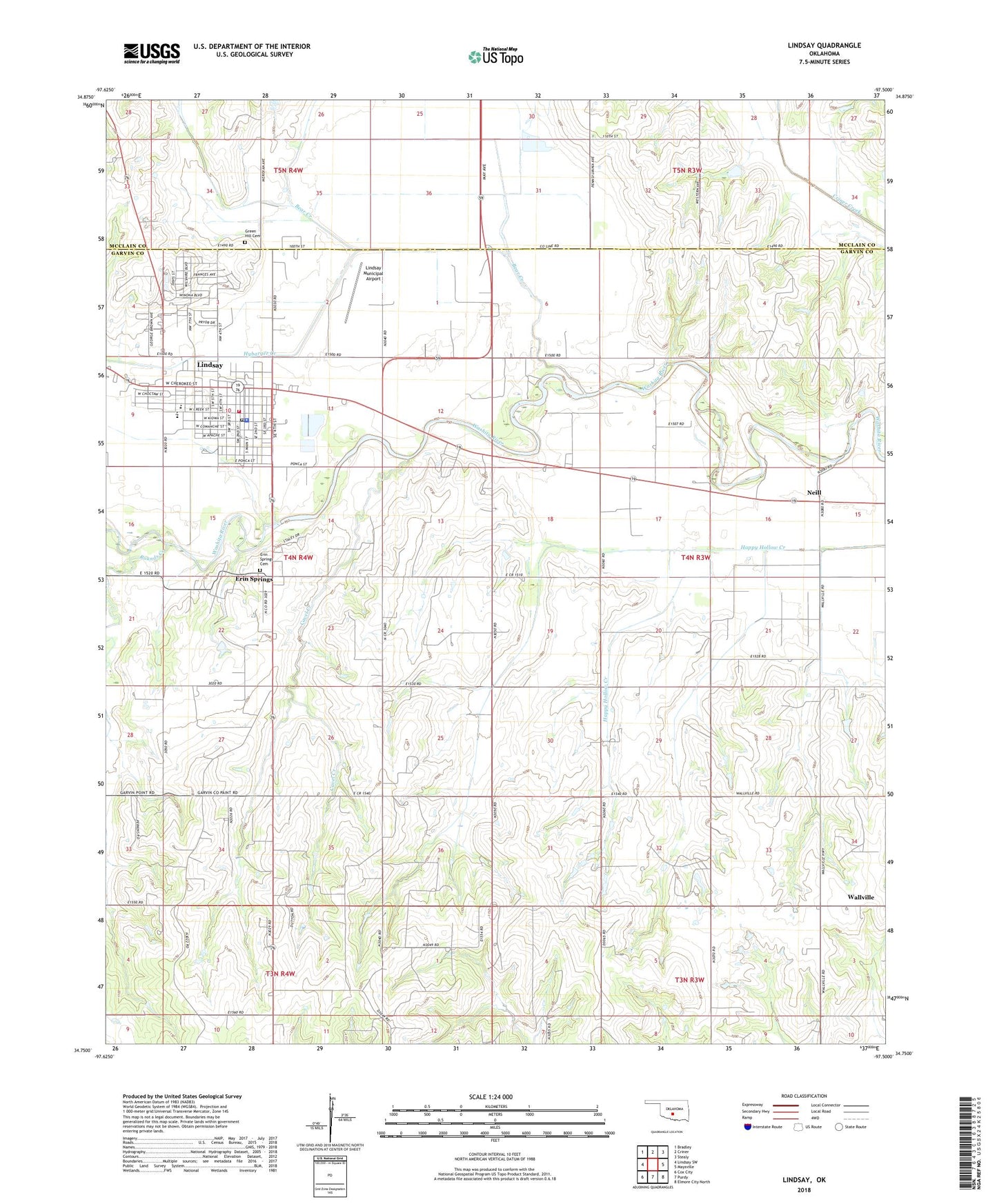
2022 topographic map quadrangle Lindsay in the state of Oklahoma. Scale: 1:24000. Based on the newly updated USGS 7.5' US Topo map series, this map is in the following counties: Garvin, McClain. The map contains contour data, water features, and other items you are used to seeing on USGS maps, but also has updated roads and other features. This is the next generation of topographic maps. Printed on high-quality waterproof paper with UV fade-resistant inks.
Quads adjacent to this one:
West: Lindsay SW
Northwest: Bradley
North: Criner
Northeast: Stealy
East: Maysville
Southeast: Elmore City North
South: Purdy
Southwest: Cox City
This map covers the same area as the classic USGS quad with code o34097g5.
Contains the following named places: Bear Creek, Bear Hybarger Site 5 Dam, Bear Hybarger Site 5 Reservoir, Calvary Baptist Church, Cavel Creek, Christian Church, City of Lindsay, Daugherty Gss Number 1 Dam, Daugherty Gss Number 1 Reservoir, Erin Springs, Erin Springs Cemetery, First Baptist Church, Golden Trend Oil Field, Green Hill Cemetery, Hughes School, Hybarger Creek, Lindsay, Lindsay Division, Lindsay Elementary School, Lindsay Emergency Medical Services, Lindsay Fire Department, Lindsay High School, Lindsay Middle School, Lindsay Municipal Airport, Lindsay Police Department, Lindsay Post Office, Maysville Laterals Site H2 Dam, Maysville Laterals Site H2 Reservoir, Maysville Laterals Site H-34 Dam, Maysville Laterals Site H-34 Reservoir, Maysville Laterals Site H5 Dam, Maysville Laterals Site H5 Reservoir, Maysville Laterals Site H6 Dam, Maysville Laterals Site H6 Reservoir, Maysville Laterals Site H7 Dam, Maysville Laterals Site H7 Reservoir, Neill, Oknoname 04916 Dam, Oknoname 04916 Reservoir, Oknoname 04917 Dam, Oknoname 04917 Reservoir, Rounds Creek, Saint Michaels Episcopal Church, Town of Erin Springs, Township of Lindsay, Wallville, ZIP Code: 73052