MyTopo
Cole Oklahoma US Topo Map
Couldn't load pickup availability
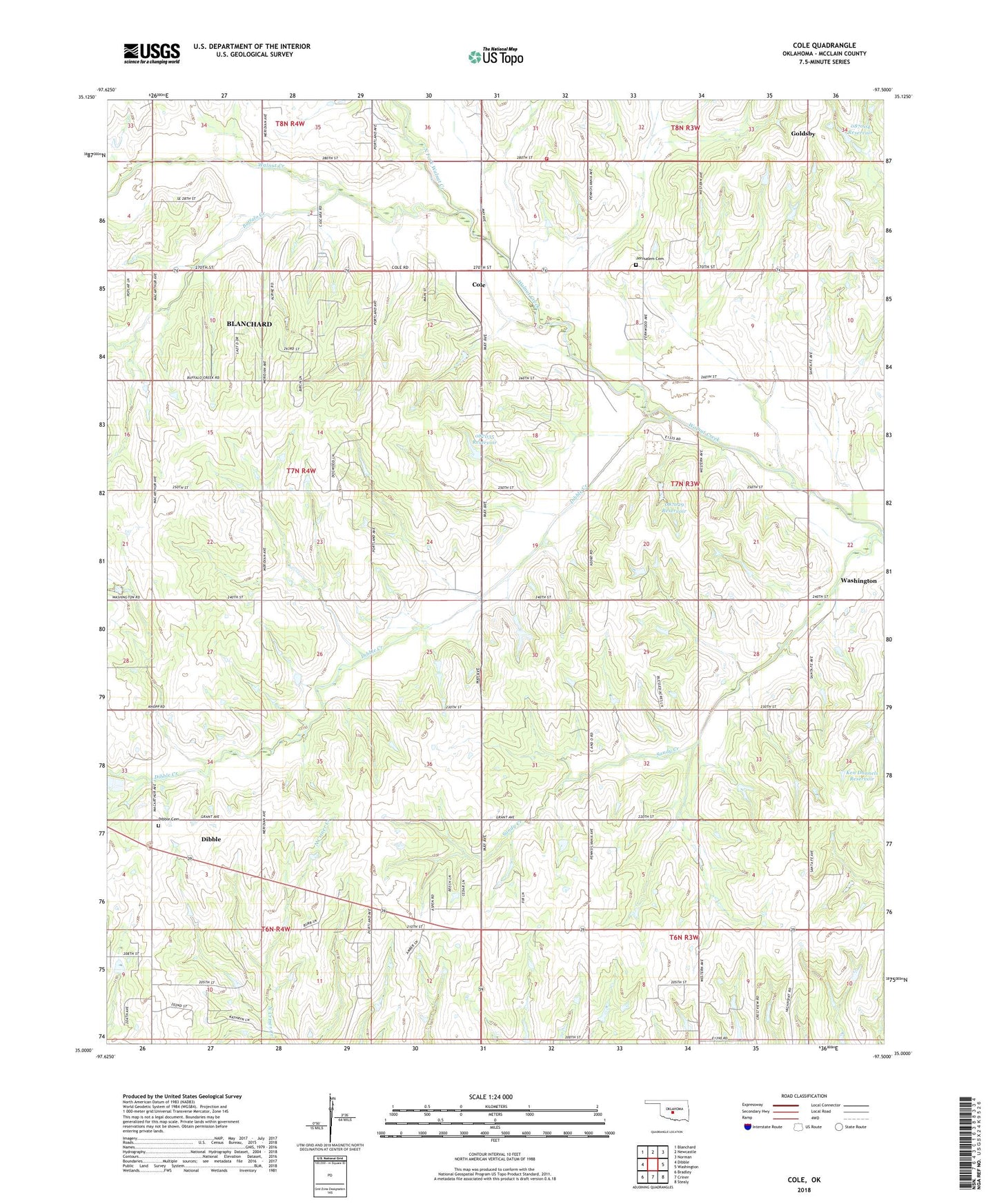
2022 topographic map quadrangle Cole in the state of Oklahoma. Scale: 1:24000. Based on the newly updated USGS 7.5' US Topo map series, this map is in the following counties: McClain. The map contains contour data, water features, and other items you are used to seeing on USGS maps, but also has updated roads and other features. This is the next generation of topographic maps. Printed on high-quality waterproof paper with UV fade-resistant inks.
Quads adjacent to this one:
West: Dibble
Northwest: Blanchard
North: Newcastle
Northeast: Norman
East: Washington
Southeast: Stealy
South: Criner
Southwest: Bradley
This map covers the same area as the classic USGS quad with code o35097a5.
Contains the following named places: Buffalo Creek, Cole, Cole Volunteer Fire Department, Dibble Cemetery, Dibble Creek, Flying A Ranch Airport, Iron Chapel, Iron Chapel Oil Field, Jerusalem Cemetery, Ken Dannels Dam, Ken Dannels Reservoir, North Dibble Oil Field, North Fork Walnut Creek, Northeast Dibble Oil Field, Oklahoma School Land Comm. Dam, Oklahoma School Land Comm. Reservoir, Oknoname 087004 Dam, Oknoname 087004 Reservoir, Oknoname 087029 Dam, Oknoname 087029 Reservoir, Oknoname 087035 Dam, Oknoname 087035 Reservoir, Southeast Iron Chapel Oil Field, Town of Cole, Township of Victor, Washington Oil Field, West Washington Oil Field