MyTopo
Breckinridge Oklahoma US Topo Map
Couldn't load pickup availability
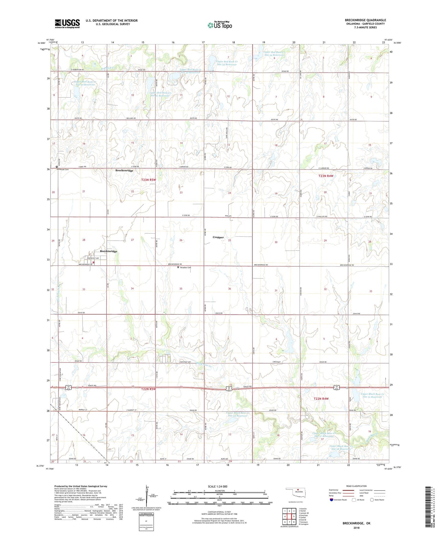
2022 topographic map quadrangle Breckinridge in the state of Oklahoma. Scale: 1:24000. Based on the newly updated USGS 7.5' US Topo map series, this map is in the following counties: Garfield. The map contains contour data, water features, and other items you are used to seeing on USGS maps, but also has updated roads and other features. This is the next generation of topographic maps. Printed on high-quality waterproof paper with UV fade-resistant inks.
Quads adjacent to this one:
West: Enid East
Northwest: Kremlin
North: Hunter
Northeast: Lamont SE
East: Garber
Southeast: Covington
South: Fairmont
Southwest: Enid SE
This map covers the same area as the classic USGS quad with code o36097d6.
Contains the following named places: Breckenridge Fire Department, Breckinridge, Cropper, Immanuel Cemetery, Lincoln Center School, Paradise Cemetery, Spring Valley School, Sunny Bower School, Town of Breckenridge, Township of Patterson, Township of Union, Upper Black Bear Creek Site 31 Dam, Upper Black Bear Creek Site 31 Reservoir, Upper Black Bear Creek Site 32 Dam, Upper Black Bear Creek Site 32 Reservoir, Upper Black Bear Creek Site 34 Dam, Upper Black Bear Creek Site 34 Reservoir, Upper Black Bear Creek Site 37 Dam, Upper Black Bear Creek Site 37 Reservoir, Upper Black Bear Creek Site 38 Dam, Upper Black Bear Creek Site 38 Reservoir, Upper Red Rock Creek Site 30 Dam, Upper Red Rock Creek Site 30 Reservoir, Upper Red Rock Creek Site 31 Dam, Upper Red Rock Creek Site 31 Reservoir, Upper Red Rock Creek Site 32 Dam, Upper Red Rock Creek Site 32 Reservoir, Upper Red Rock Creek Site 33 Dam, Upper Red Rock Creek Site 33 Reservoir, Upper Red Rock Creek Site 34 Reservoir