MyTopo
Cedar Crest Oklahoma US Topo Map
Couldn't load pickup availability
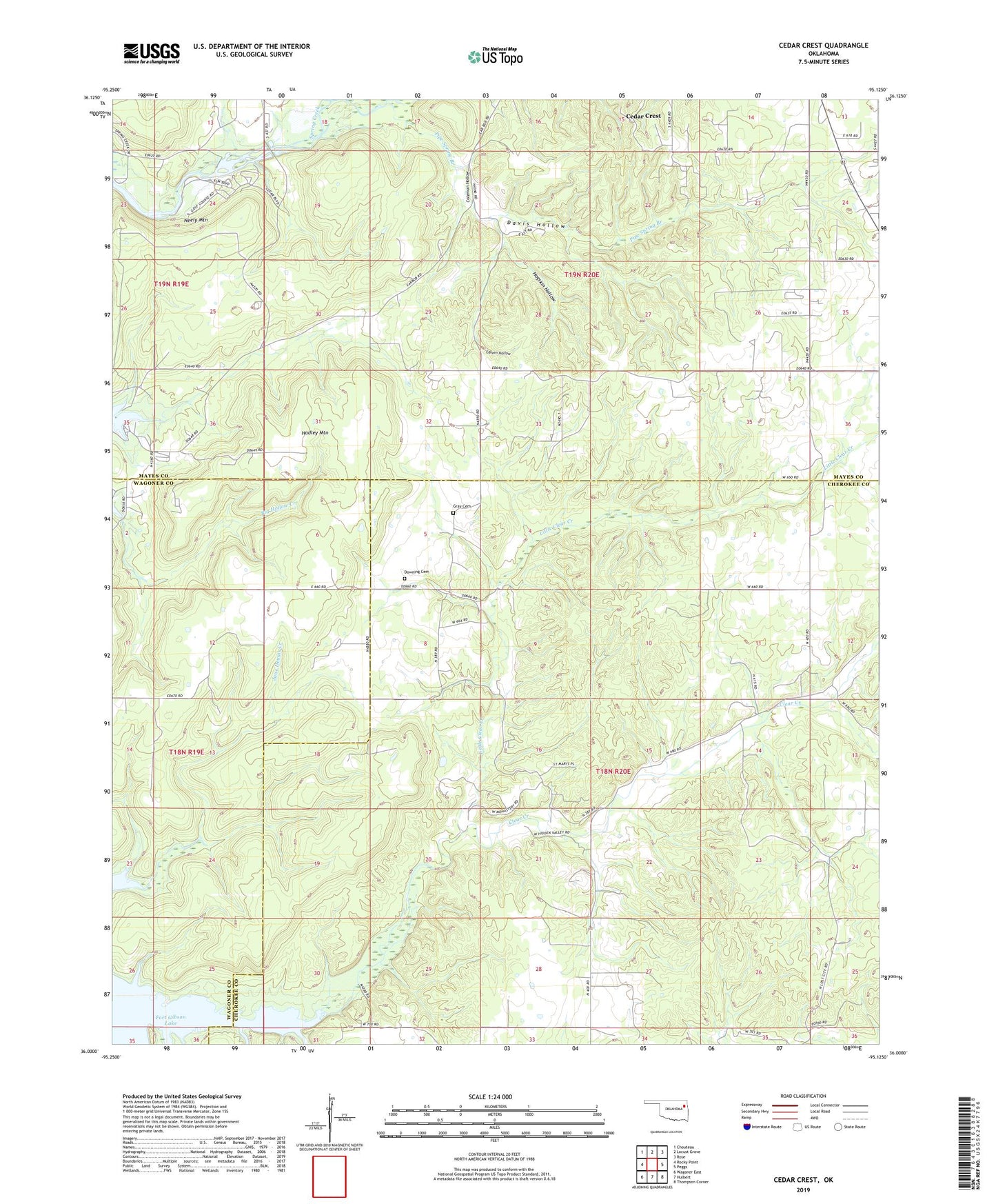
2019 topographic map quadrangle Cedar Crest in the state of Oklahoma. Scale: 1:24000. Based on the newly updated USGS 7.5' US Topo map series, this map is in the following counties: Cherokee, Mayes, Wagoner. The map contains contour data, water features, and other items you are used to seeing on USGS maps, but also has updated roads and other features. This is the next generation of topographic maps. Printed on high-quality waterproof paper with UV fade-resistant inks.
Quads adjacent to this one:
West: Rocky Point
Northwest: Chouteau
North: Locust Grove
Northeast: Rose
East: Peggs
Southeast: Thompson Corner
South: Hulbert
Southwest: Wagoner East
Contains the following named places: Big Hollow Public Use Area, Calven Hollow, Cedar Crest, Cedar Crest Census Designated Place, Cedar Crest Heliport, Cedar Crest Lake, Cedar Grove Church, Clear Creek, Coleman Hollow, Davis Hollow, Downing Cemetery, Earbob Ferry Recreation Area, Four Corners Church, Gray Cemetery, Hadley Mountain, Hare Branch, Hogskin Hollow, Little Clear Creek, Neely Mountain, Pipe Spring Branch, Spring Creek Recreation Area, Township of Murphy, Vo-Tech Heliport, Wooded Hollow