MyTopo
Thompson Corner Oklahoma US Topo Map
Couldn't load pickup availability
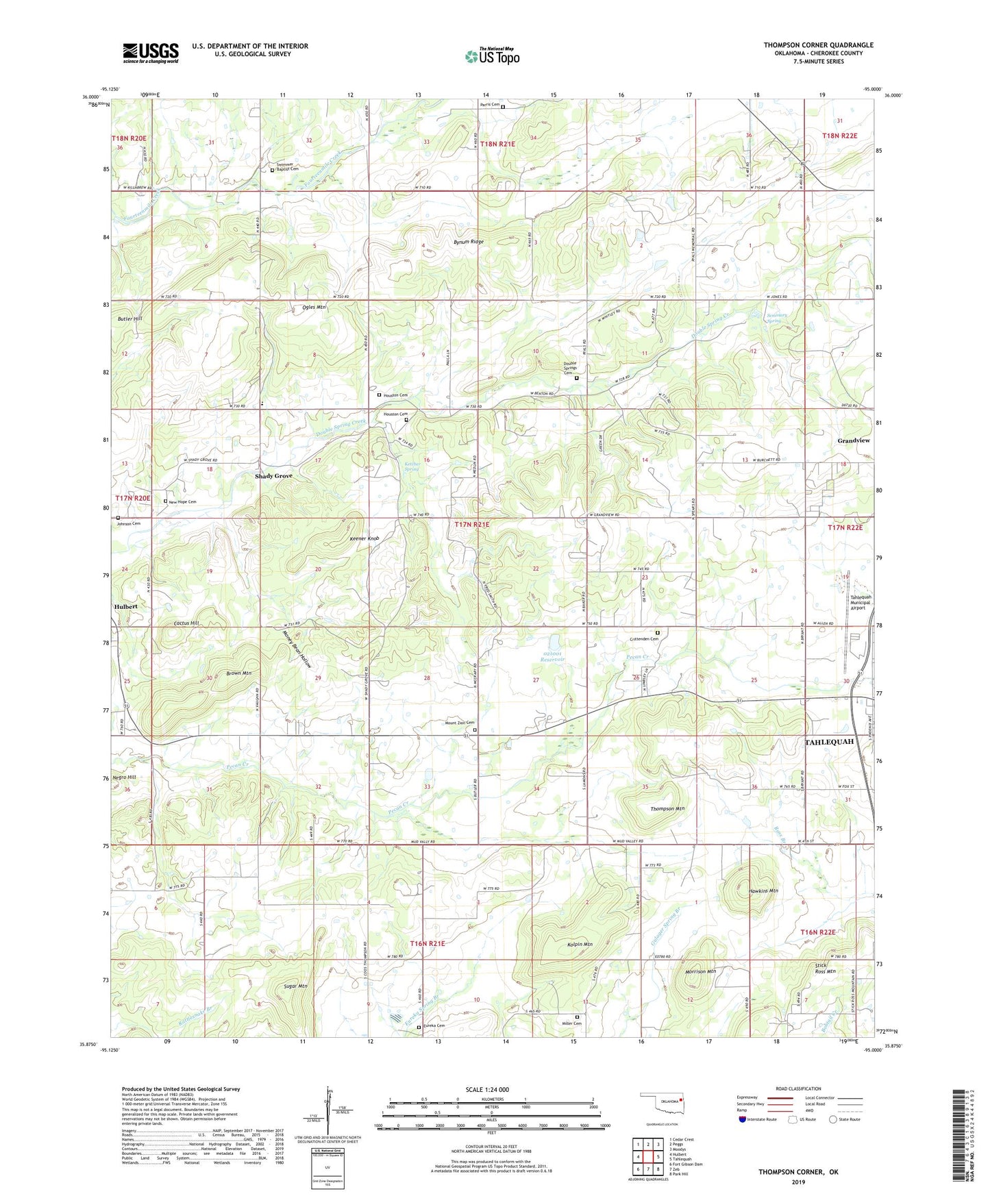
2022 topographic map quadrangle Thompson Corner in the state of Oklahoma. Scale: 1:24000. Based on the newly updated USGS 7.5' US Topo map series, this map is in the following counties: Cherokee. The map contains contour data, water features, and other items you are used to seeing on USGS maps, but also has updated roads and other features. This is the next generation of topographic maps. Printed on high-quality waterproof paper with UV fade-resistant inks.
Quads adjacent to this one:
West: Hulbert
Northwest: Cedar Crest
North: Peggs
Northeast: Moodys
East: Tahlequah
Southeast: Park Hill
South: Zeb
Southwest: Fort Gibson Dam
This map covers the same area as the classic USGS quad with code o35095h1.
Contains the following named places: Brown Mountain, Bynum Ridge, Cactus Hill, Crittenden Cemetery, Double Spring Church, Double Springs Cemetery, Eureka Cemetery, Gabriel, Gideon Census Designated Place, Grandview, Hawkins Mountain, Houston Cemetery, Johnson Cemetery, Keener Knob, Ketcher Spring, Kolpin Mountain, Miller Cemetery, Money Bean Hollow, Morrison Mountain, Mount Zion Cemetery, Mount Zion Church, New Hope Cemetery, New Hope Church, Ogles Mountain, Oknoname 021001 Dam, Oknoname 021001 Reservoir, Parris Cemetery, Seminary Spring, Shady Grove, Shady Grove Census Designated Place, Shady Grove School, Stick Ross Mountain, Sugar Mountain, Swimmer Cemetery, Swimmer Church, Tahlequah Division, Tahlequah Municipal Airport, Tahlequah Police Department, Thompson Corner, Thompson Mountain, Township of Crittenden, Wagoner Community Hospital Heliport