MyTopo
Hulbert Oklahoma US Topo Map
Couldn't load pickup availability
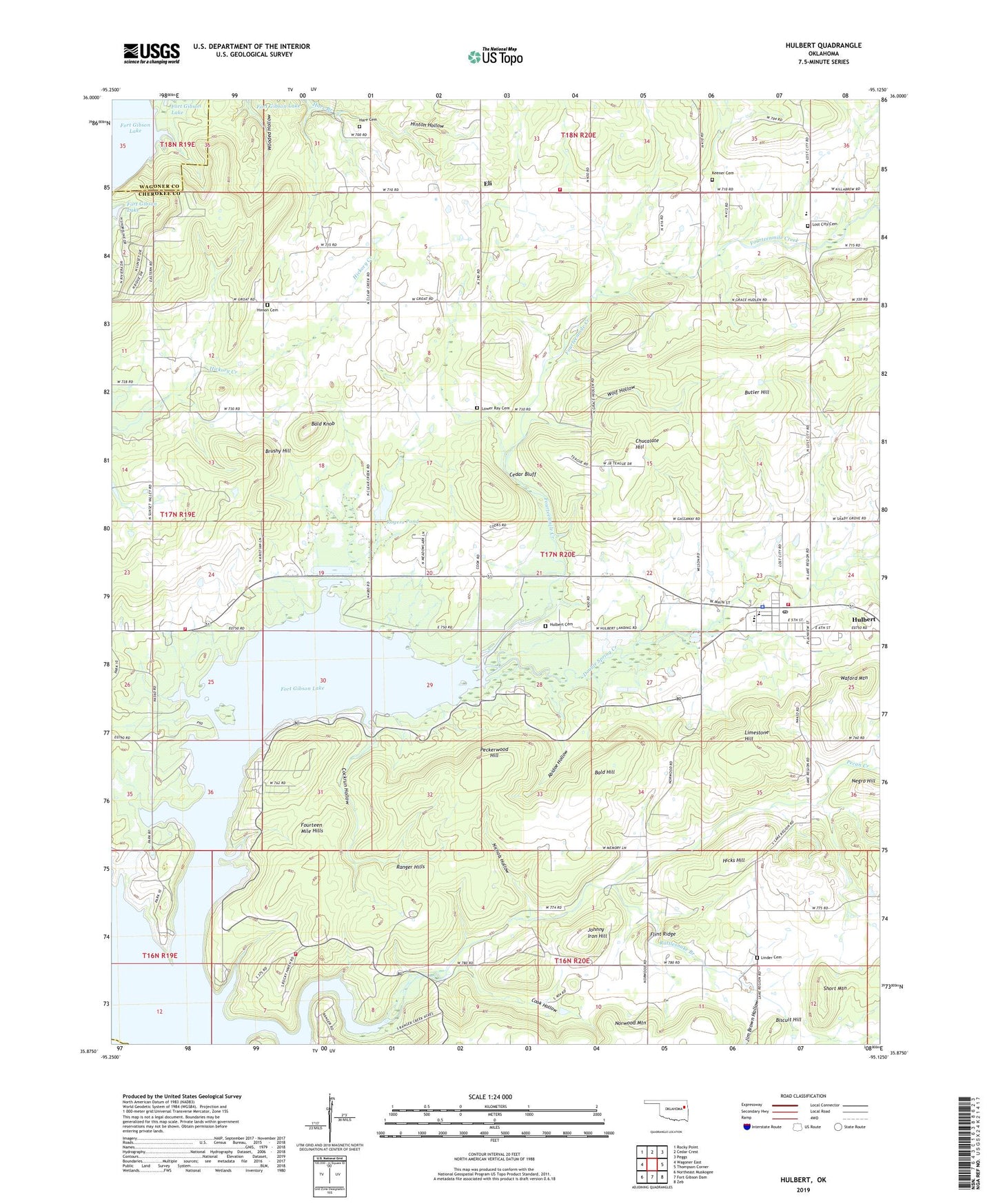
2022 topographic map quadrangle Hulbert in the state of Oklahoma. Scale: 1:24000. Based on the newly updated USGS 7.5' US Topo map series, this map is in the following counties: Cherokee, Wagoner. The map contains contour data, water features, and other items you are used to seeing on USGS maps, but also has updated roads and other features. This is the next generation of topographic maps. Printed on high-quality waterproof paper with UV fade-resistant inks.
Quads adjacent to this one:
West: Wagoner East
Northwest: Rocky Point
North: Cedar Crest
Northeast: Peggs
East: Thompson Corner
Southeast: Zeb
South: Fort Gibson Dam
Southwest: Northeast Muskogee
This map covers the same area as the classic USGS quad with code o35095h2.
Contains the following named places: Abidoe Hollow, Bald Hill, Bald Knob, Biscuit Hill, Brushy Hill, Butler Hill, Cedar Bluff, Chucalate Hill, Cockrum Hollow, Cockrun Hollow, Cook Hollow, Double Spring Creek, Eli, Flint Ridge, Fort Gibson Wildlife Management Area, Fourteen Mile Hills, Hare Cemetery, Hicks Hill, Hinson Cemetery, Hinton Hollow, Hulbert, Hulbert Cemetery, Hulbert Division, Hulbert Elementary School, Hulbert Fire Department, Hulbert Junior High School, Hulbert Landing Public Use Area, Hulbert Police Department, Hulbert Post Office, Hulbert Senior High School, Jim Brown Hollow, Johnny Iron Hill, Keener Cemetery, Keener Church, Limestone Hill, Linder Cemetery, Lost City, Lost City Cemetery, Lost City Elementary School, Lower Ray Cemetery, Melvin Church, Negro Hill, Nichols Hollow, Norwood Fire Department Station 2, Norwood Mountain, Pecan Creek, Peckerwood Hill, Ranger Creek, Ranger Hills, Rattlesnake Branch, Rogers Pond, Rogers Pond Dam, Sequoyah Park Airport, Short Mountain, Spring Valley Volunteer Fire Department Station 1, Spring Valley Volunteer Fire Department Station 2, Town of Hulbert, Township of Hulbert, Waford Mountain, Western Hill Lodge, Wildwood Public Use Area, Wolf Hollow, ZIP Code: 74441