MyTopo
Cedardale Oklahoma US Topo Map
Couldn't load pickup availability
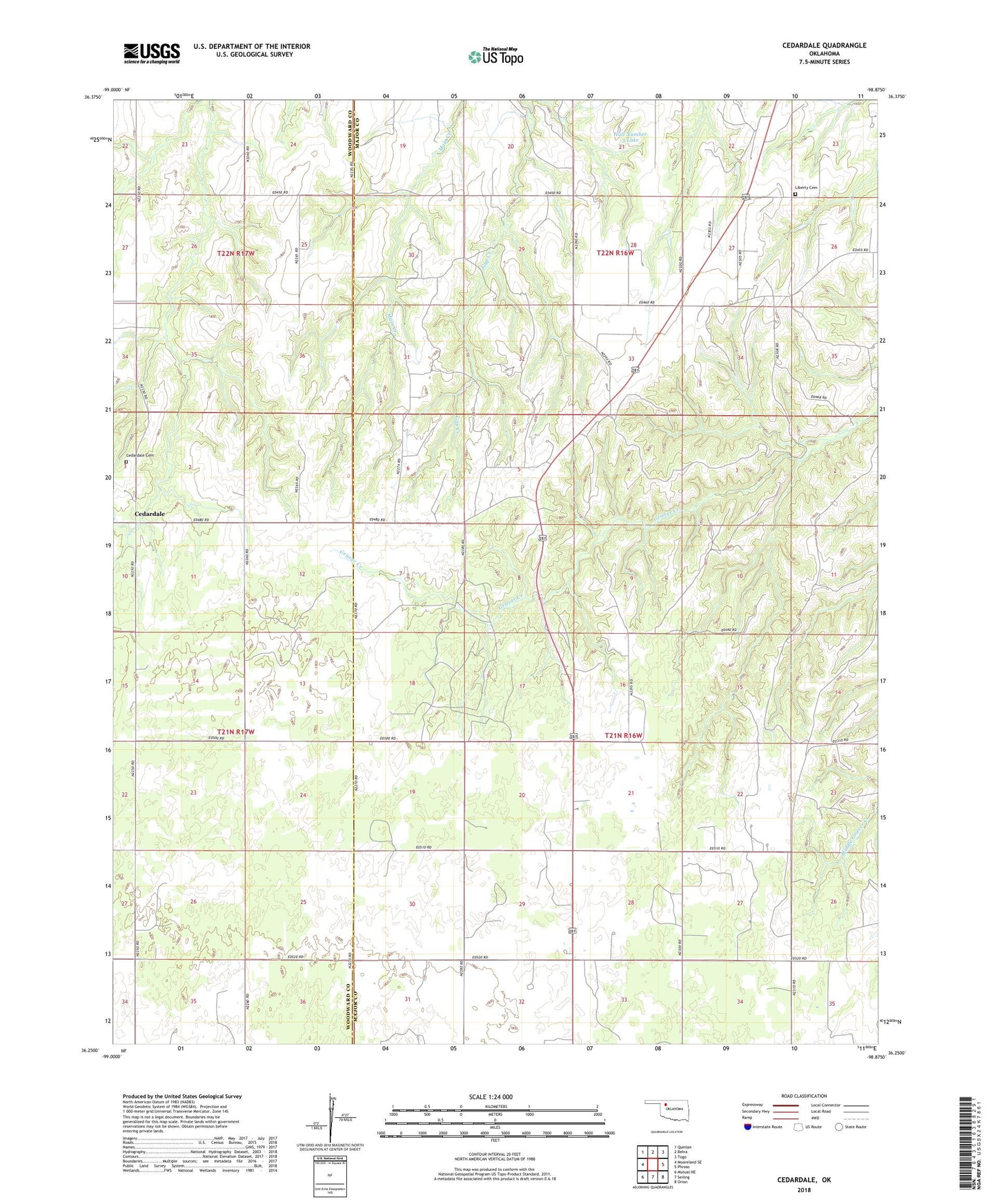
2018 topographic map quadrangle Cedardale in the state of Oklahoma. Scale: 1:24000. Based on the newly updated USGS 7.5' US Topo map series, this map is in the following counties: Major, Woodward. The map contains contour data, water features, and other items you are used to seeing on USGS maps, but also has updated roads and other features. This is the next generation of topographic maps. Printed on high-quality waterproof paper with UV fade-resistant inks.
Quads adjacent to this one:
West: Mooreland SE
Northwest: Quinlan
North: Belva
Northeast: Togo
East: Phroso
Southeast: Orion
South: Seiling
Southwest: Mutual NE
Contains the following named places: Cedardale, Cedardale Cemetery, Hall Number 3 Lake, Hall Number 3 Lake Dam, Liberty Cemetery