MyTopo
Seiling Oklahoma US Topo Map
Couldn't load pickup availability
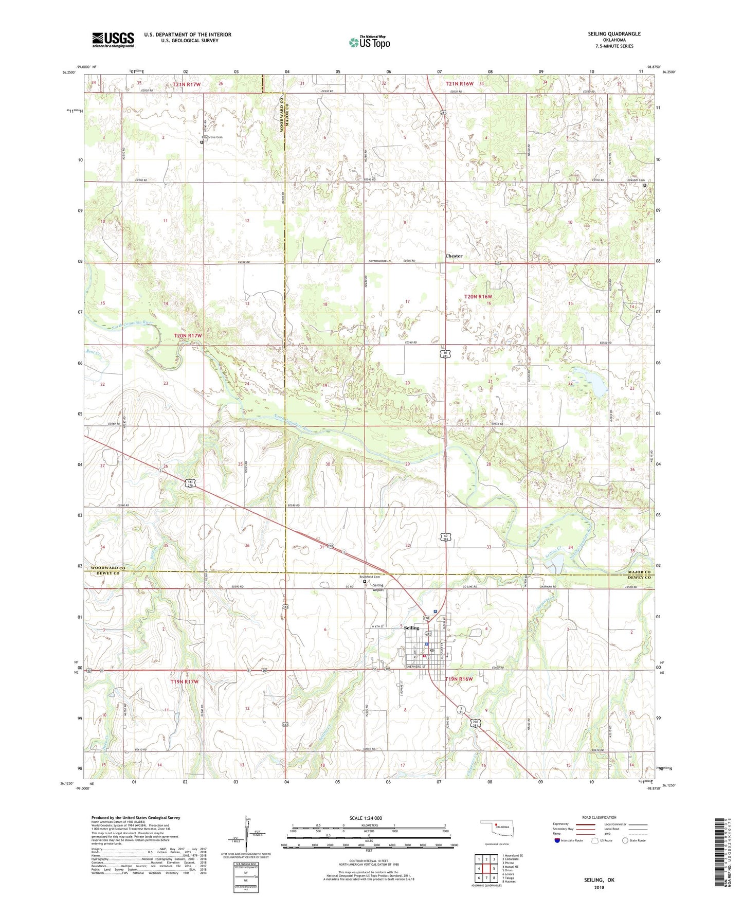
2022 topographic map quadrangle Seiling in the state of Oklahoma. Scale: 1:24000. Based on the newly updated USGS 7.5' US Topo map series, this map is in the following counties: Major, Dewey, Woodward. The map contains contour data, water features, and other items you are used to seeing on USGS maps, but also has updated roads and other features. This is the next generation of topographic maps. Printed on high-quality waterproof paper with UV fade-resistant inks.
Quads adjacent to this one:
West: Mutual NE
Northwest: Mooreland SE
North: Cedardale
Northeast: Phroso
East: Orion
Southeast: Hucmac
South: Taloga
Southwest: Lenora
This map covers the same area as the classic USGS quad with code o36098b8.
Contains the following named places: Assembly of God Church, Baptist Church, Bent Creek, Brumfield Cemetery, Chester, Chester Cemetery, Chester Census Designated Place, Cheyenne Creek, City of Seiling, Community Ambulance Service, Deep Creek, Elm Grove Cemetery, Elm Grove Church, First Christian Church, First United Methodist Church, Mennonite Indian Church, Saint Thomas Catholic Church, Seiling, Seiling Airport, Seiling Creek, Seiling Elementary School, Seiling Fire Department and Ambulance Service, Seiling Junior - Senior High School, Seiling Police Department, Seiling Post Office, Seiling Regional Medical Center, ZIP Code: 73838