MyTopo
Chelsea Oklahoma US Topo Map
Couldn't load pickup availability
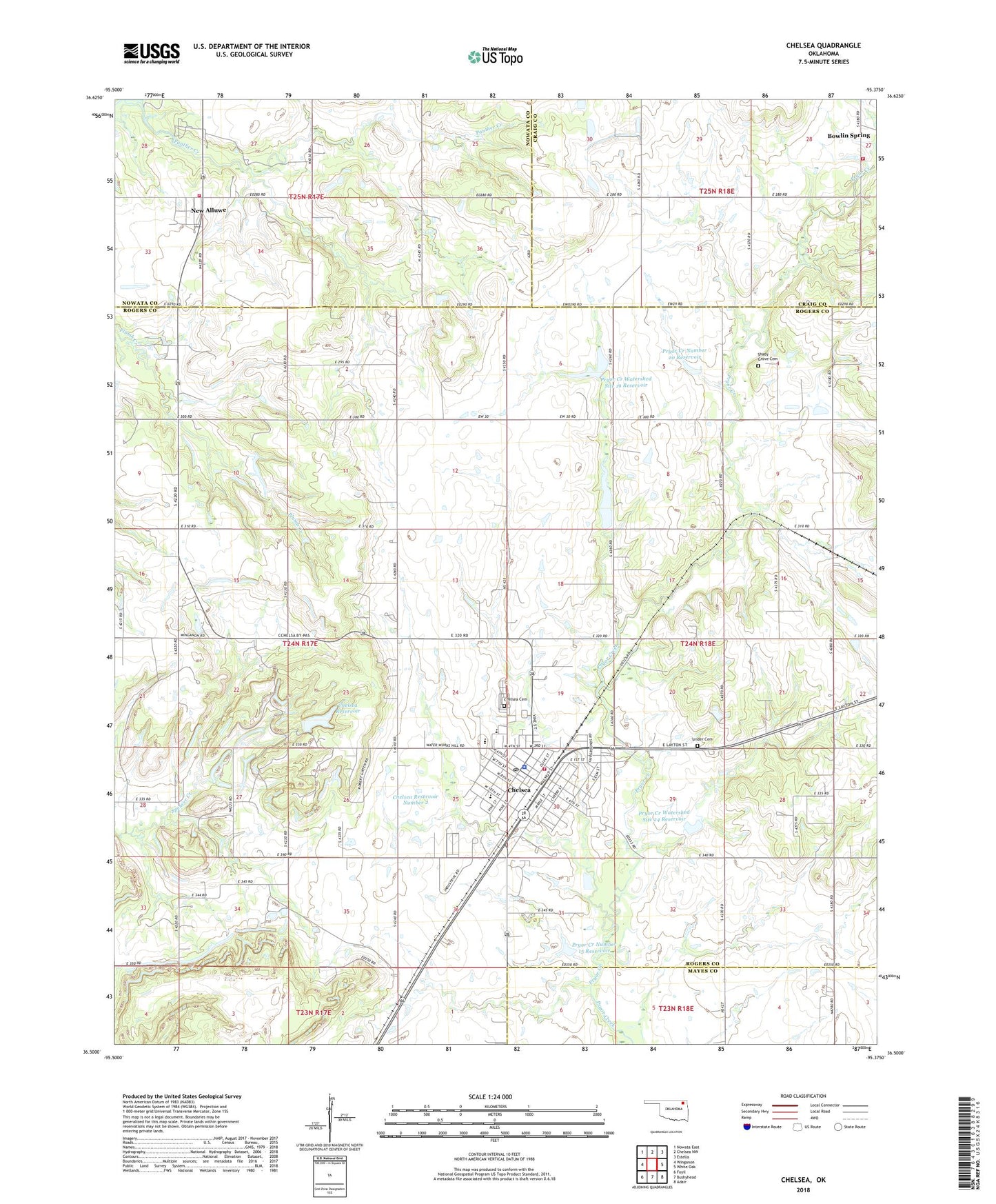
2018 topographic map quadrangle Chelsea in the state of Oklahoma. Scale: 1:24000. Based on the newly updated USGS 7.5' US Topo map series, this map is in the following counties: Rogers, Nowata, Craig, Mayes. The map contains contour data, water features, and other items you are used to seeing on USGS maps, but also has updated roads and other features. This is the next generation of topographic maps. Printed on high-quality waterproof paper with UV fade-resistant inks.
Quads adjacent to this one:
West: Winganon
Northwest: Nowata East
North: Chelsea NW
Northeast: Estella
East: White Oak
Southeast: Adair
South: Bushyhead
Southwest: Foyil
Contains the following named places: Alluwe, Art Goad Elementary School, Bowlin Spring, Bowlin Springs Fire Department, Chelsea, Chelsea Cemetery, Chelsea Division, Chelsea Fire Department, Chelsea High School, Chelsea Memorial United Methodist Church, Chelsea Middle School, Chelsea Police Department, Chelsea Post Office, Chelsea Reservoir, Chelsea Reservoir Number 1, Chelsea Reservoir Number 1 Dam, Chelsea Reservoir Number 2, Chelsea Reservoir Number 2 Dam, Delozier Airport, Fairview Church, First Baptist Church, McIntosh Elementary School, Monarch Field, New Alluwe Volunteer Fire Department, Pryor Creek Number 15 Dam, Pryor Creek Number 15 Reservoir, Pryor Creek Number 20 Dam, Pryor Creek Number 20 Reservoir, Pryor Creek Watershed Site 19 Dam, Pryor Creek Watershed Site 19 Reservoir, Pryor Creek Watershed Site 24 Dam, Pryor Creek Watershed Site 24 Reservoir, Shady Grove Cemetery, Snider Cemetery, Town of Chelsea, Town of New Alluwe, Township of Chelsea, United Pentecostal Church, ZIP Code: 74016