MyTopo
Coyle Oklahoma US Topo Map
Couldn't load pickup availability
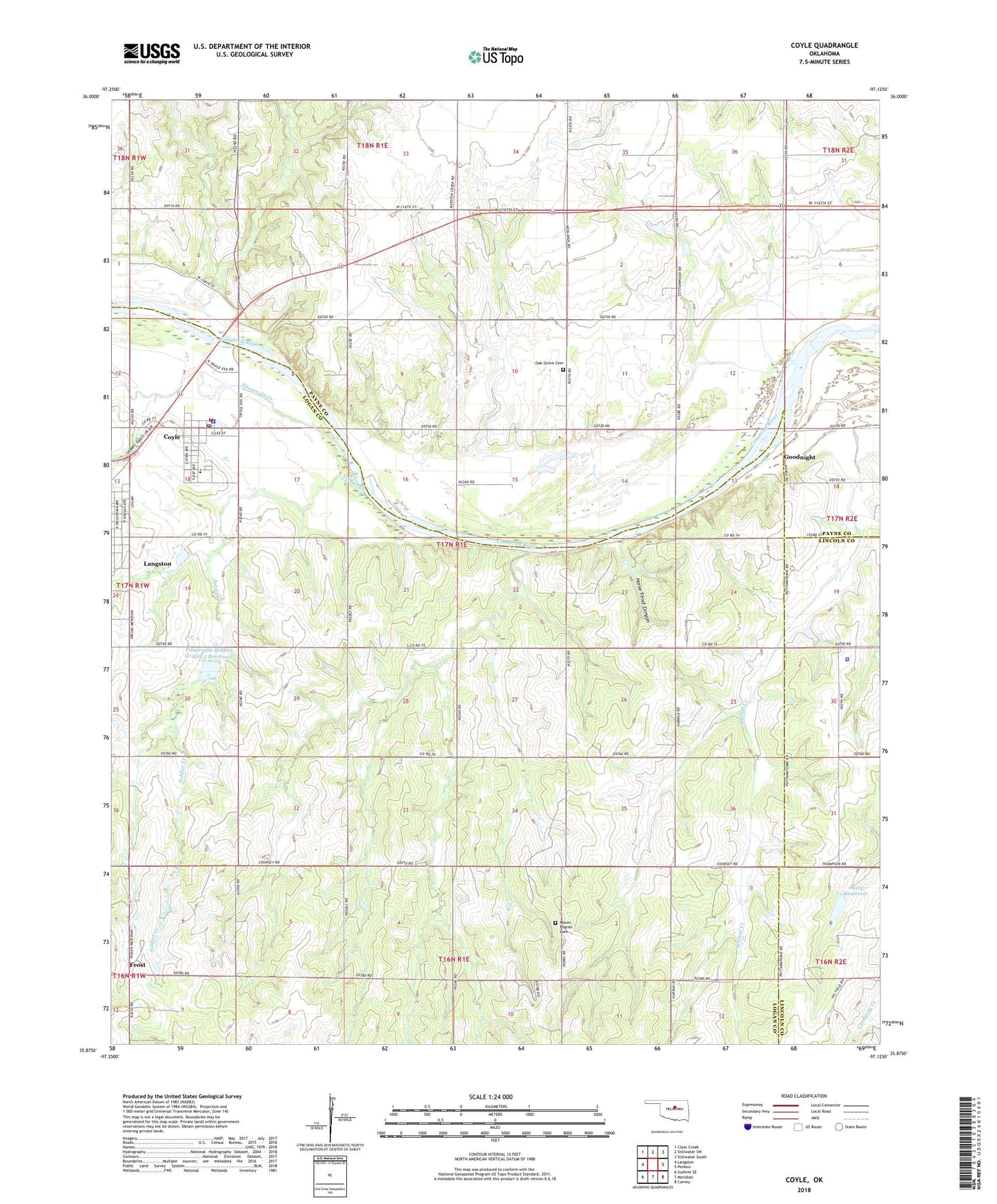
2018 topographic map quadrangle Coyle in the state of Oklahoma. Scale: 1:24000. Based on the newly updated USGS 7.5' US Topo map series, this map is in the following counties: Logan, Payne, Lincoln. The map contains contour data, water features, and other items you are used to seeing on USGS maps, but also has updated roads and other features. This is the next generation of topographic maps. Printed on high-quality waterproof paper with UV fade-resistant inks.
Quads adjacent to this one:
West: Langston
Northwest: Clear Creek
North: Stillwater SW
Northeast: Stillwater South
East: Perkins
Southeast: Carney
South: Meridian
Southwest: Guthrie SE
Contains the following named places: Camp Cimarron, Coyle, Coyle Elementary School, Coyle Fire Department, Coyle High School, Coyle Police Department, Coyle Post Office, Fitzgerald Creek, Fitzgerald-Soldier Creek Site 4 Dam, Fitzgerald-Soldier Creek Site 4 Reservoir, Fitzgerald-Soldier Creek Site 5 Dam, Fitzgerald-Soldier Creek Site 5 Reservoir, Fitzgerald-Soldier Site 4 Dam, Fitzgerald-Soldier Site 5 Dam, Friends Chapel, Frost, Goodnight, Horse Thief Canyon, Iowa City Cemetery, Iowa Tribe Police Department, Light Through the Gospel, Mount Pilgrim Cemetery, Mount Pilgrim Church, New Prospect Church, Oak Grove Cemetery, Oknoname 08112 Dam, Oknoname 08112 Reservoir, Soldier Creek, Town of Coyle, Township of North Cimarron