MyTopo
Langston Oklahoma US Topo Map
Couldn't load pickup availability
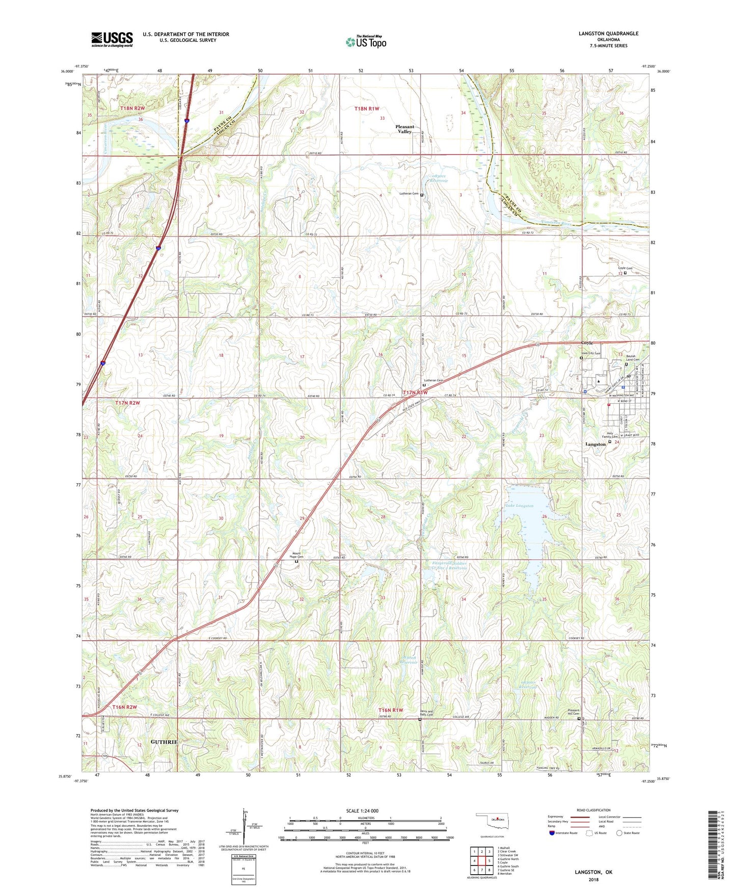
2022 topographic map quadrangle Langston in the state of Oklahoma. Scale: 1:24000. Based on the newly updated USGS 7.5' US Topo map series, this map is in the following counties: Logan, Payne. The map contains contour data, water features, and other items you are used to seeing on USGS maps, but also has updated roads and other features. This is the next generation of topographic maps. Printed on high-quality waterproof paper with UV fade-resistant inks.
Quads adjacent to this one:
West: Guthrie North
Northwest: Mulhall
North: Clear Creek
Northeast: Stillwater SW
East: Coyle
Southeast: Meridian
South: Guthrie SE
Southwest: Guthrie South
This map covers the same area as the classic USGS quad with code o35097h3.
Contains the following named places: Beulah Land Cemetery, Centerview Church, Coulter School, Coyle Cemetery, Davis and Balls Cemetery, Fair Valley Community Hall, Fitzgerald-Soldier Creek Site 2 Dam, Fitzgerald-Soldier Creek Site 2 Reservoir, Guthrie Gas and Oil Field, Holy Family Cemetery, KALU-FM (Langston), Lake Langston, Langston, Langston Dam, Langston Fire Station, Langston Gas and Oil Field, Langston Police Department, Langston Post Office, Langston University, Langston University Police Department, Lutheran Cemetery, Mount Hope, Mount Hope Cemetery, Mount Hope Church, Oakdale Community Hall, Oknoname 083007 Dam, Oknoname 083007 Reservoir, Oknoname 083008 Dam, Oknoname 083008 Reservoir, Oknoname 083011 Dam, Oknoname 083011 Reservoir, Pleasant Hill Cemetery, Pleasant Hill Gas and Oil Field, Pleasant Valley, Soldier-Fitzgerald Site 3m Dam, Soldier-Fitzgerald Site 3m Reservoir, Town of Langston, Township of Antelope, Victory Community Hall, ZIP Codes: 73027, 73050