MyTopo
Crescent NW Oklahoma US Topo Map
Couldn't load pickup availability
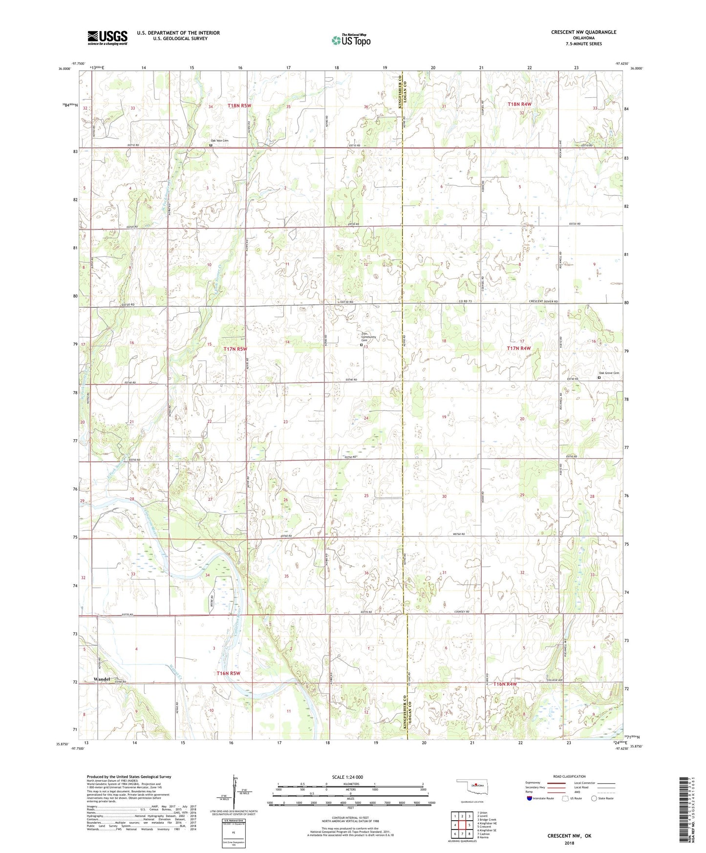
2018 topographic map quadrangle Crescent NW in the state of Oklahoma. Scale: 1:24000. Based on the newly updated USGS 7.5' US Topo map series, this map is in the following counties: Kingfisher, Logan. The map contains contour data, water features, and other items you are used to seeing on USGS maps, but also has updated roads and other features. This is the next generation of topographic maps. Printed on high-quality waterproof paper with UV fade-resistant inks.
Quads adjacent to this one:
West: Kingfisher NE
Northwest: Union
North: Lovell
Northeast: Bridge Creek
East: Crescent
Southeast: Navina
South: Cashion
Southwest: Kingfisher SE
Contains the following named places: Borelli Ditch, Colbert Creek Site 2 Dam, Colbert Creek Site 2 Reservoir, East Fork Sooner Creek, Mount Pleasant Church, Oak Grove Cemetery, Oak Vale Cemetery, Oak Valley Church, Sooner Creek, Sooner Trend Oil Field, Township of Excelsior, Wandel, West Fork Sooner Creek, Winter Creek Site 11 Dam, Winter Creek Site 11 Reservoir, Winter Creek Site 12 Dam, Winter Creek Site 12 Reservoir, Winter Creek Site 13 Dam, Winter Creek Site 13 Reservoir, Winter Creek Site 14 Dam, Winter Creek Site 14 Reservoir, Winter Creek Site 16 Dam, Winter Creek Site 16 Reservoir, Winter Creek Site 20 Dam, Winter Creek Site 20 Reservoir, Winter Creek Site 22 Dam, Winter Creek Site 22 Reservoir, Zion, Zion Community Cemetery, ZIP Code: 73028