MyTopo
Navina Oklahoma US Topo Map
Couldn't load pickup availability
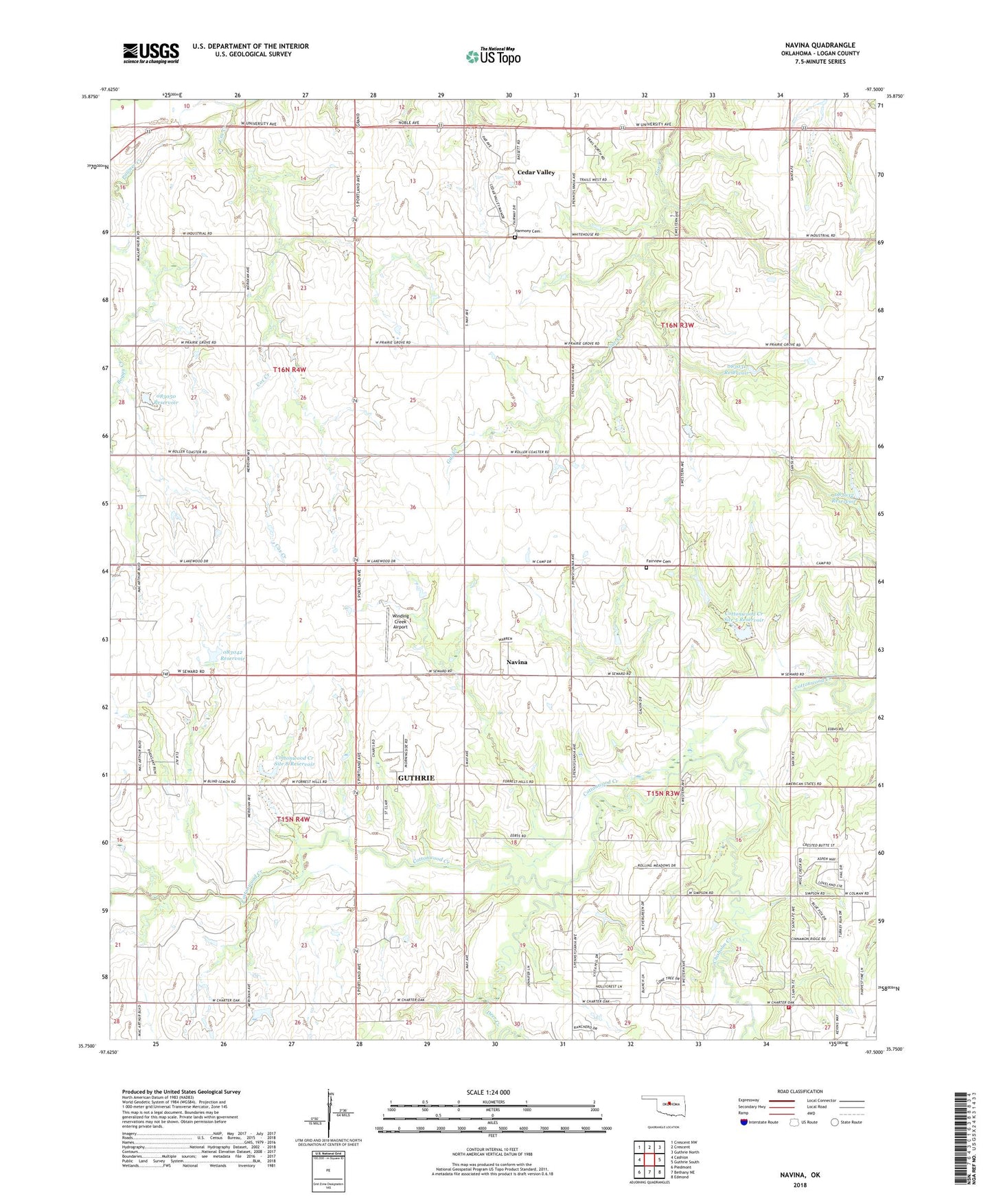
2022 topographic map quadrangle Navina in the state of Oklahoma. Scale: 1:24000. Based on the newly updated USGS 7.5' US Topo map series, this map is in the following counties: Logan. The map contains contour data, water features, and other items you are used to seeing on USGS maps, but also has updated roads and other features. This is the next generation of topographic maps. Printed on high-quality waterproof paper with UV fade-resistant inks.
Quads adjacent to this one:
West: Cashion
Northwest: Crescent NW
North: Crescent
Northeast: Guthrie North
East: Guthrie South
Southeast: Edmond
South: Bethany NE
Southwest: Piedmont
This map covers the same area as the classic USGS quad with code o35097g5.
Contains the following named places: Boggy Creek, Cedar Valley, Chisholm Creek, Cottonwood Creek Site 5 Dam, Cottonwood Creek Site 5 Reservoir, Cottonwood Creek Site 8 Dam, Cottonwood Creek Site 8 Reservoir, Cox Creek, Deer Creek, Fairview Cemetery, Harmony Cemetery, Harmony Church, Hawk Haven Airport, Highley Field, Navina, Oak Cliff Fire Protection District Station 2, Oknoname 083031 Dam, Oknoname 083031 Reservoir, Oknoname 083032 Dam, Oknoname 083032 Reservoir, Oknoname 083042 Dam, Oknoname 083042 Reservoir, Oknoname 083050 Dam, Oknoname 083050 Reservoir, Oknoname 087033 Dam, Oknoname 087033 Reservoir, The Highlands Airport, Township of Cedar, Township of Iron Mound, Township of Seward, Township of Spring Creek, Winding Creek Airport