MyTopo
Kingfisher SE Oklahoma US Topo Map
Couldn't load pickup availability
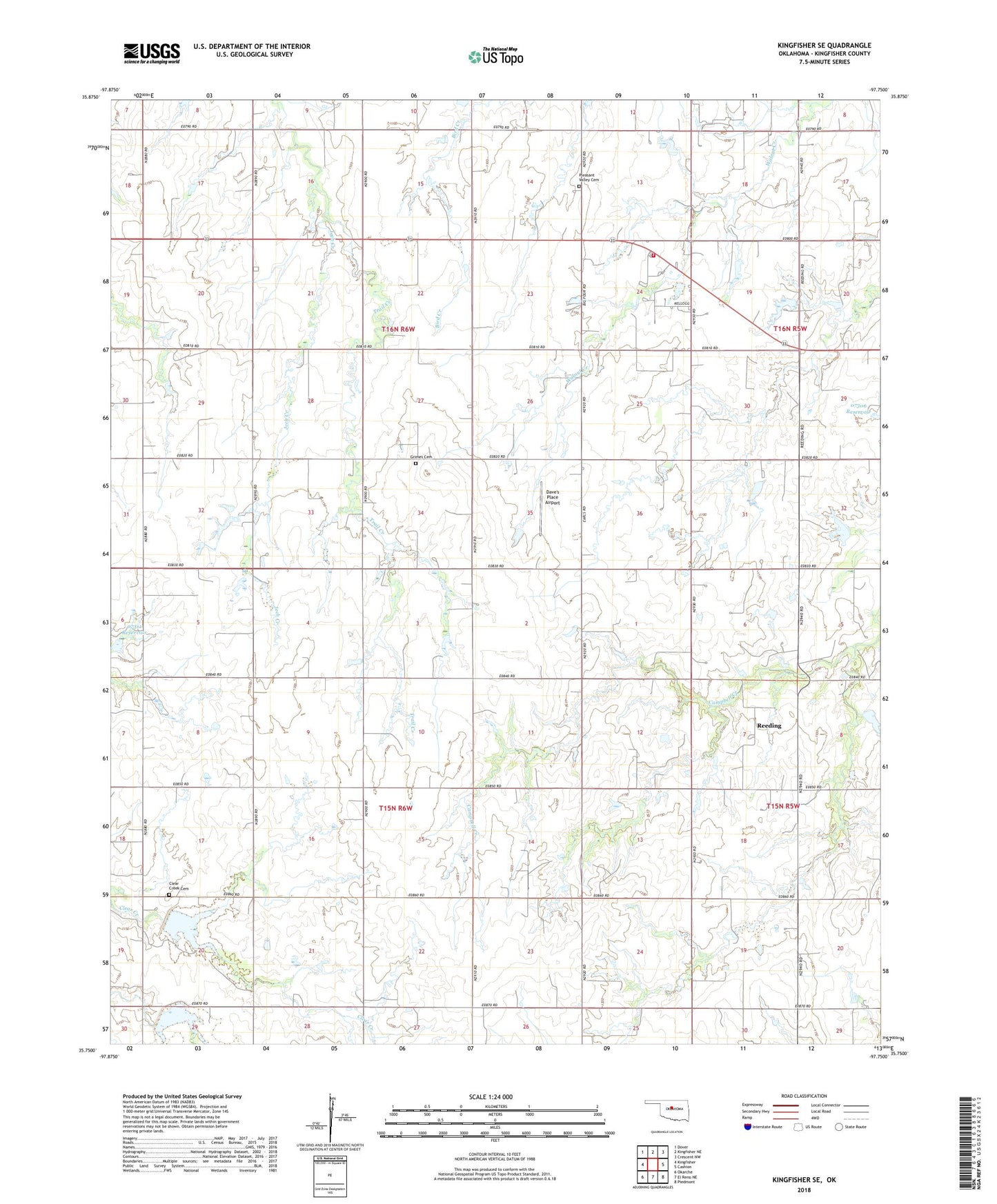
2022 topographic map quadrangle Kingfisher SE in the state of Oklahoma. Scale: 1:24000. Based on the newly updated USGS 7.5' US Topo map series, this map is in the following counties: Kingfisher. The map contains contour data, water features, and other items you are used to seeing on USGS maps, but also has updated roads and other features. This is the next generation of topographic maps. Printed on high-quality waterproof paper with UV fade-resistant inks.
Quads adjacent to this one:
West: Kingfisher
Northwest: Dover
North: Kingfisher NE
Northeast: Crescent NW
East: Cashion
Southeast: Piedmont
South: El Reno NE
Southwest: Okarche
This map covers the same area as the classic USGS quad with code o35097g7.
Contains the following named places: Big 4 Rural Volunteer Fire Department, Clear Creek Cemetery, Dave's Place Airport, Grimes Cemetery, Jech Creek, Oknoname 07303 Dam, Oknoname 07303 Reservoir, Oknoname 07311 Reservoir, Oknoname 083022 Dam, Oknoname 083022 Reservoir, Pleasant Valley Cemetery, Reeding, Township of Grant, Township of Lynn, Uncle John Creek Site 12 Dam, Uncle John Creek Site 12 Reservoir, Uncle John Creek Site 13 Dam, Uncle John Creek Site 13 Reservoir