MyTopo
Cromwell Oklahoma US Topo Map
Couldn't load pickup availability
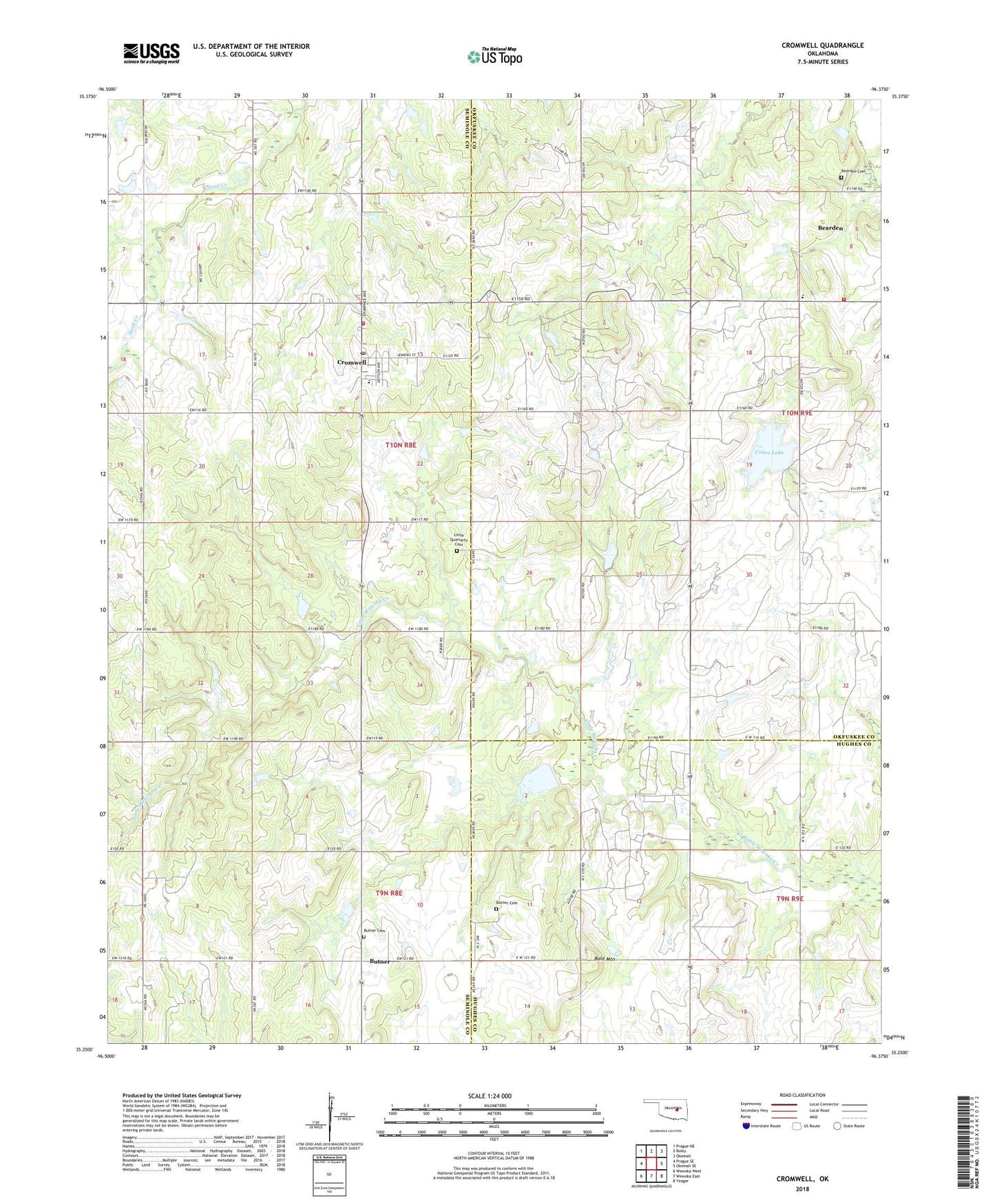
2018 topographic map quadrangle Cromwell in the state of Oklahoma. Scale: 1:24000. Based on the newly updated USGS 7.5' US Topo map series, this map is in the following counties: Seminole, Okfuskee, Hughes. The map contains contour data, water features, and other items you are used to seeing on USGS maps, but also has updated roads and other features. This is the next generation of topographic maps. Printed on high-quality waterproof paper with UV fade-resistant inks.
Quads adjacent to this one:
West: Prague SE
Northwest: Prague NE
North: Boley
Northeast: Okemah
East: Okemah SE
Southeast: Yeager
South: Wewoka East
Southwest: Wewoka West
Contains the following named places: Bald Mountain, Bearden, Bearden Cemetery, Bearden Elementary School, Bearden Fire Department, Butner, Butner Cemetery, Butner Church, Butner Elementary School, Butner High School, Cohee Lake, Cohee Lake Dam, Creek/Seminole Joint-Use Oklahoma Tribal Statistical Area, Cromwell, Cromwell Oil Field, Cromwell Post Office, Cromwell Volunteer Fire Department, Little Quarsarty Cemetery, Little Wewoka Creek Site 5 Dam, Little Wewoka Creek Site 5 Reservoir, Little Wewoka Creek Site 6 Dam, Little Wewoka Creek Site 6 Reservoir, Little Wewoka Site 1 Dam, Little Wewoka Site 1 Reservoir, Little Wewoka Site 4 Dam, Little Wewoka Site 4 Reservoir, Oknoname 037031 Dam, Oknoname 037031 Reservoir, Oknoname 037051 Dam, Oknoname 037051 Reservoir, Quarsarty Church, South Cromwell Oil Field, Town of Bearden, Town of Cromwell, ZIP Code: 74837