MyTopo
Prague NE Oklahoma US Topo Map
Couldn't load pickup availability
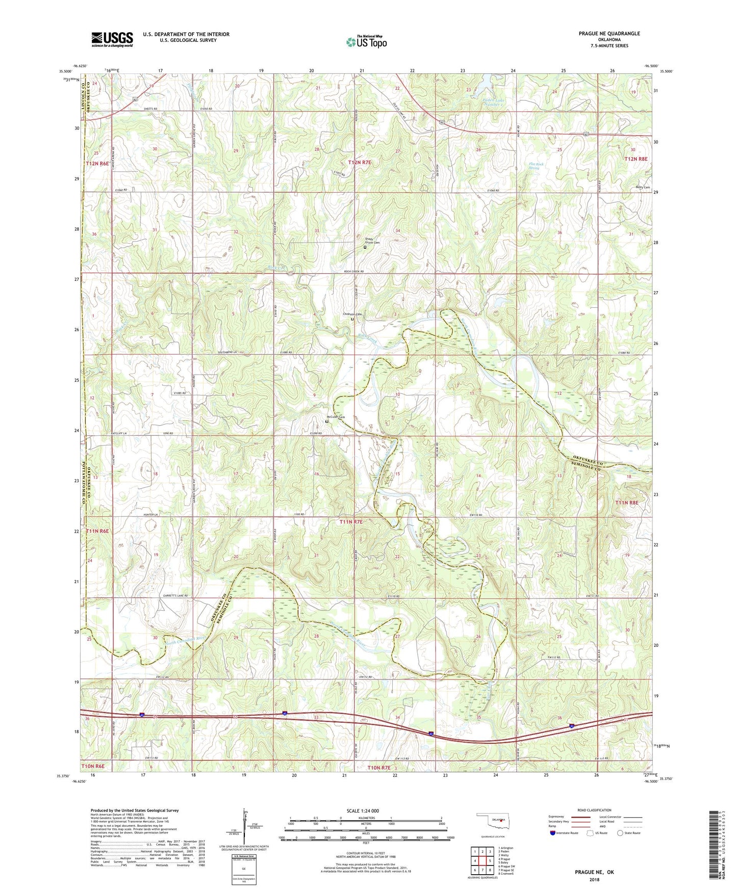
2022 topographic map quadrangle Prague NE in the state of Oklahoma. Scale: 1:24000. Based on the newly updated USGS 7.5' US Topo map series, this map is in the following counties: Okfuskee, Seminole, Pottawatomie, Lincoln. The map contains contour data, water features, and other items you are used to seeing on USGS maps, but also has updated roads and other features. This is the next generation of topographic maps. Printed on high-quality waterproof paper with UV fade-resistant inks.
Quads adjacent to this one:
West: Prague
Northwest: Arlington
North: Paden
Northeast: Welty
East: Boley
Southeast: Cromwell
South: Prague SE
Southwest: Prague SW
This map covers the same area as the classic USGS quad with code o35096d5.
Contains the following named places: Chisholm Cemetery, Fiftytwo Creek, Flat Rock Spring, Gar Creek, McCulah Cemetery, Oknoname 107031 Dam, Oknoname 107031 Reservoir, Oknoname 107032 Dam, Oknoname 107032 Reservoir, Paden Lake Number One, Pleasant Hill Church, Rock Creek, Shady Grove Cemetery, Southwest Paden Oil Field, Township of Paden, Vanzant Church