MyTopo
Yeager Oklahoma US Topo Map
Couldn't load pickup availability
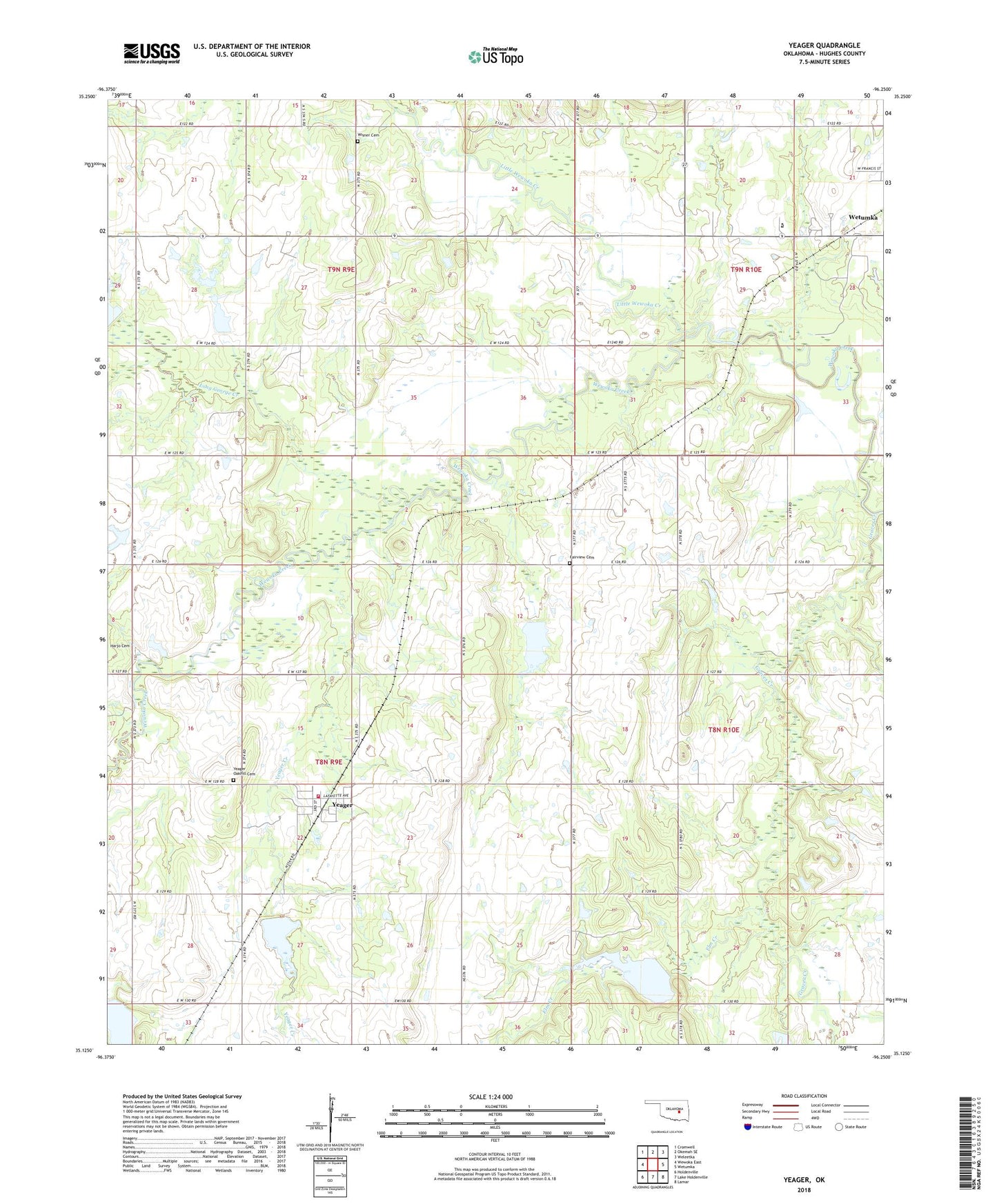
2022 topographic map quadrangle Yeager in the state of Oklahoma. Scale: 1:24000. Based on the newly updated USGS 7.5' US Topo map series, this map is in the following counties: Hughes. The map contains contour data, water features, and other items you are used to seeing on USGS maps, but also has updated roads and other features. This is the next generation of topographic maps. Printed on high-quality waterproof paper with UV fade-resistant inks.
Quads adjacent to this one:
West: Wewoka East
Northwest: Cromwell
North: Okemah SE
Northeast: Weleetka
East: Wetumka
Southeast: Lamar
South: Lake Holdenville
Southwest: Holdenville
This map covers the same area as the classic USGS quad with code o35096b3.
Contains the following named places: Big Wewoka Creek Site 39 Dam, Big Wewoka Creek Site 39 Reservoir, Big Wewoka Creek Site 40 Dam, Big Wewoka Creek Site 40 Reservoir, Big Wewoka Creek Site 41 Dam, Big Wewoka Creek Site 41 Reservoir, Big Wewoka Creek Site 42 Dam, Big Wewoka Creek Site 42 Reservoir, Elm Creek, Fairview Cemetery, Fairview Church, Graves Creek, Little Wewoka Creek, Little Wewoka Creek Site 12 Dam, Little Wewoka Creek Site 12 Reservoir, Long George Creek, Maynard Richmond Dam, Maynard Richmond Reservoir, New Hope Church, Oknoname 037040 Dam, Oknoname 037040 Reservoir, Oknoname 037082 Dam, Oknoname 037082 Reservoir, Oknoname 063009 Dam, Oknoname 063009 Reservoir, Oknoname 063010 Dam, Oknoname 063010 Reservoir, Oknoname 063015 Dam, Oknoname 063015 Reservoir, Oknoname 063017 Dam, Oknoname 063017 Reservoir, Oknoname 063031 Dam, Oknoname 063031 Reservoir, Pecan Church, Salt Creek Church, Town of Yeager, Township of Yeager, Tuckabatchee Church, Unity Church, Wes Watkins Technology Center, Wewoka Church, Wewoka Indian Methodist Church Cemetery, Wisner Cemetery, Yeager, Yeager Cemetery, Yeager Creek, Yeager Volunteer Fire Department