MyTopo
Crowder Lake Oklahoma US Topo Map
Couldn't load pickup availability
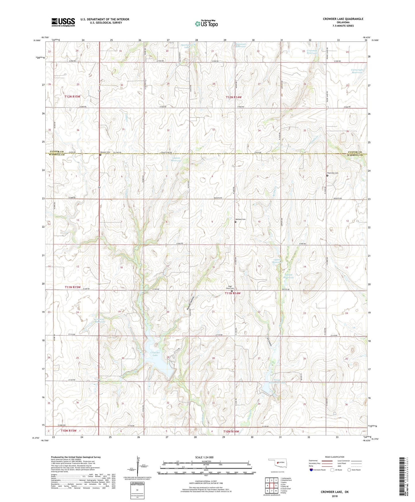
2018 topographic map quadrangle Crowder Lake in the state of Oklahoma. Scale: 1:24000. Based on the newly updated USGS 7.5' US Topo map series, this map is in the following counties: Washita, Custer. The map contains contour data, water features, and other items you are used to seeing on USGS maps, but also has updated roads and other features. This is the next generation of topographic maps. Printed on high-quality waterproof paper with UV fade-resistant inks.
Quads adjacent to this one:
West: Corn
Northwest: Indianapolis
North: Weatherford
Northeast: Hydro
East: Eakly NE
Southeast: Eakly
South: Colony
Southwest: Cloud Chief
Contains the following named places: Bethany Cemetery, Cartwright Dam, Cobb Creek Site 1 Dam, Cobb Creek Site 1 Reservoir, Cobb Creek Site 3 Dam, Cobb Creek Site 3 Reservoir, Crissman Reservoir, Crissmon Dam, Crowder Lake, Crowder Lake State Recreation Area, Dickey Reservoir, Don F Dickey Dam, Dry Canyon, High Point Cemetery, Missouri Cemetery, Oknoname 149002 Dam, Oknoname 149002 Reservoir, Oknoname 149005 Dam, Oknoname 149005 Reservoir, Oknoname 149006 Dam, Oknoname 149006 Reservoir, Oknoname 149013 Dam, Oknoname 149013 Reservoir, Oknoname 149017 Dam, Oknoname 149017 Reservoir, Oknoname 149018 Dam, Oknoname 149018 Reservoir, Oknoname 149023 Dam, Oknoname 149023 Reservoir, Oknoname 149035 Dam, Oknoname 149035 Reservoir, Oknoname 149037 Dam, Oknoname 149037 Reservoir, Plainview Cemetery, Plainview Church, Possum Hollow, Township of Texas, Worth Richmond Lake