MyTopo
Colony Oklahoma US Topo Map
Couldn't load pickup availability
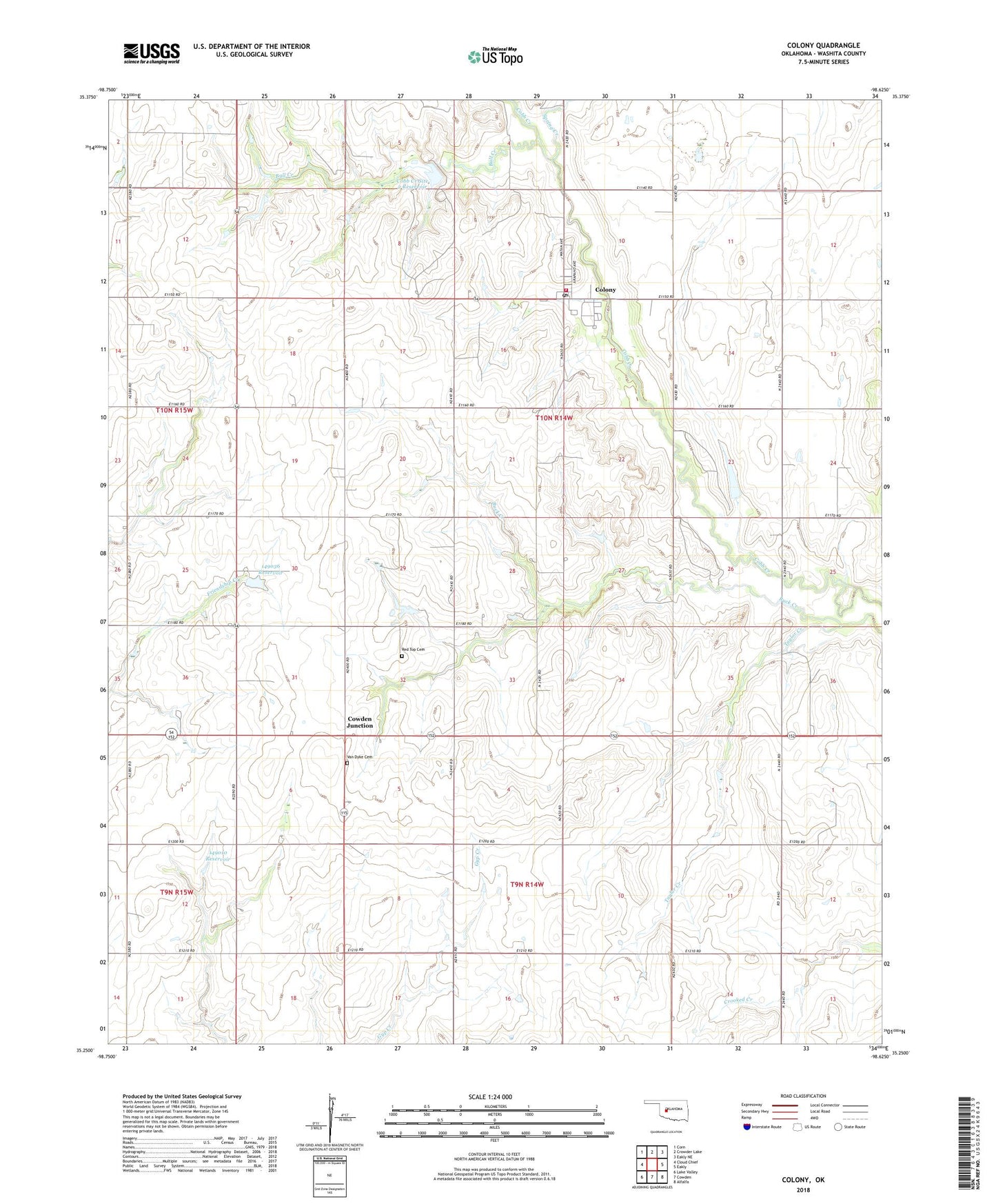
2022 topographic map quadrangle Colony in the state of Oklahoma. Scale: 1:24000. Based on the newly updated USGS 7.5' US Topo map series, this map is in the following counties: Washita. The map contains contour data, water features, and other items you are used to seeing on USGS maps, but also has updated roads and other features. This is the next generation of topographic maps. Printed on high-quality waterproof paper with UV fade-resistant inks.
Quads adjacent to this one:
West: Cloud Chief
Northwest: Corn
North: Crowder Lake
Northeast: Eakly NE
East: Eakly
Southeast: Alfalfa
South: Cowden
Southwest: Lake Valley
This map covers the same area as the classic USGS quad with code o35098c6.
Contains the following named places: Bull Creek, Cobb Creek Site 2 Dam, Cobb Creek Site 2 Reservoir, Colony, Colony Baptist Church, Colony Fire Department, Colony Post Office, Cowden Junction, Indian Cemetery, Lawrence Airport, Oknoname 149003 Dam, Oknoname 149003 Reservoir, Oknoname 149004 Dam, Oknoname 149004 Reservoir, Oknoname 149010 Dam, Oknoname 149010 Reservoir, Oknoname 149036 Dam, Oknoname 149036 Reservoir, Oknoname 149041 Dam, Oknoname 149041 Reservoir, Red Top Cemetery, Spring Creek, Taylor Creek, Town of Colony, Township of Seger, Van Dyke Cemetery, ZIP Code: 73021