MyTopo
Crowder Oklahoma US Topo Map
Couldn't load pickup availability
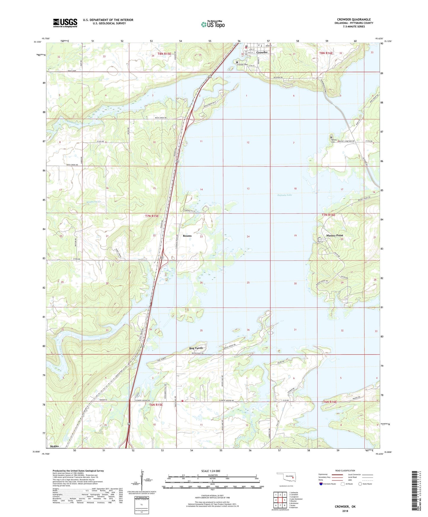
2018 topographic map quadrangle Crowder in the state of Oklahoma. Scale: 1:24000. Based on the newly updated USGS 7.5' US Topo map series, this map is in the following counties: Pittsburg. The map contains contour data, water features, and other items you are used to seeing on USGS maps, but also has updated roads and other features. This is the next generation of topographic maps. Printed on high-quality waterproof paper with UV fade-resistant inks.
Quads adjacent to this one:
West: Lake McAlester
Northwest: Indianola
North: Canadian
Northeast: Longtown
East: Blocker
Southeast: Adamson
South: Krebs
Southwest: McAlester
Contains the following named places: Bug Tussle, Bug Tussle Census Designated Place, Bugtussle Volunteer Fire Department, Cardinal Point Recreation Area, Coal Creek, Crowder, Crowder Cemetery, Crowder Elementary School, Crowder Fire Department, Crowder High School, Crowder Point East Recreation Area, Crowder Point West Recreation Area, Crowder Post Office, Fish Creek, Juniper Point Recreation Area, Massey Cemetery, Massey Point, Reams, Rock Creek, Town of Crowder, Township of Canadian, W C Ranch Stolport