MyTopo
Adamson Oklahoma US Topo Map
Couldn't load pickup availability
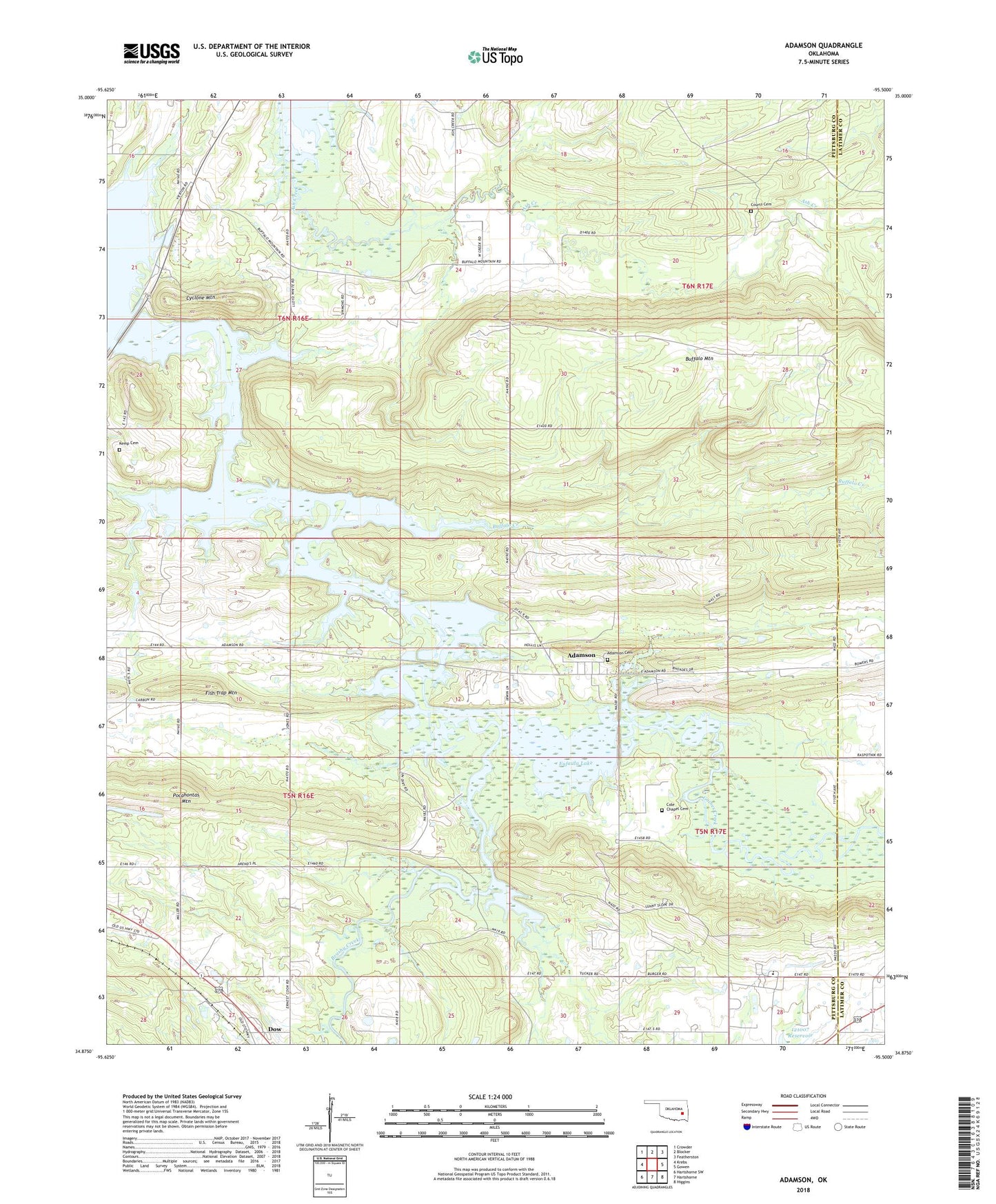
2022 topographic map quadrangle Adamson in the state of Oklahoma. Scale: 1:24000. Based on the newly updated USGS 7.5' US Topo map series, this map is in the following counties: Pittsburg, Latimer. The map contains contour data, water features, and other items you are used to seeing on USGS maps, but also has updated roads and other features. This is the next generation of topographic maps. Printed on high-quality waterproof paper with UV fade-resistant inks.
Quads adjacent to this one:
West: Krebs
Northwest: Crowder
North: Blocker
Northeast: Featherston
East: Gowen
Southeast: Higgins
South: Hartshorne
Southwest: Hartshorne SW
This map covers the same area as the classic USGS quad with code o34095h5.
Contains the following named places: Adamson, Adamson Cemetery, Adamson Census Designated Place, Ash Creek, Ash Creek Church, Brushy Creek, Buffalo Creek, Buffalo Mountain, Cambria Church, Cole Chapel Cemetery, Courts Cemetery, Cyclone Mountain, Dow, Eufala Wildlife Managment Area, Fish Trap Mountain, Gaines Creek, Hickory Point Recreation Area, Jones Academy, Jones Lake, Jones Lake Dam, Kemp Cemetery, Mount Nebo Church, Oknoname 121019 Dam, Oknoname 121019 Reservoir, Oknoname 131007 Reservoir, Pocahontas Mountain, Saint Paul Church, Union Chapel