MyTopo
Canadian Oklahoma US Topo Map
Couldn't load pickup availability
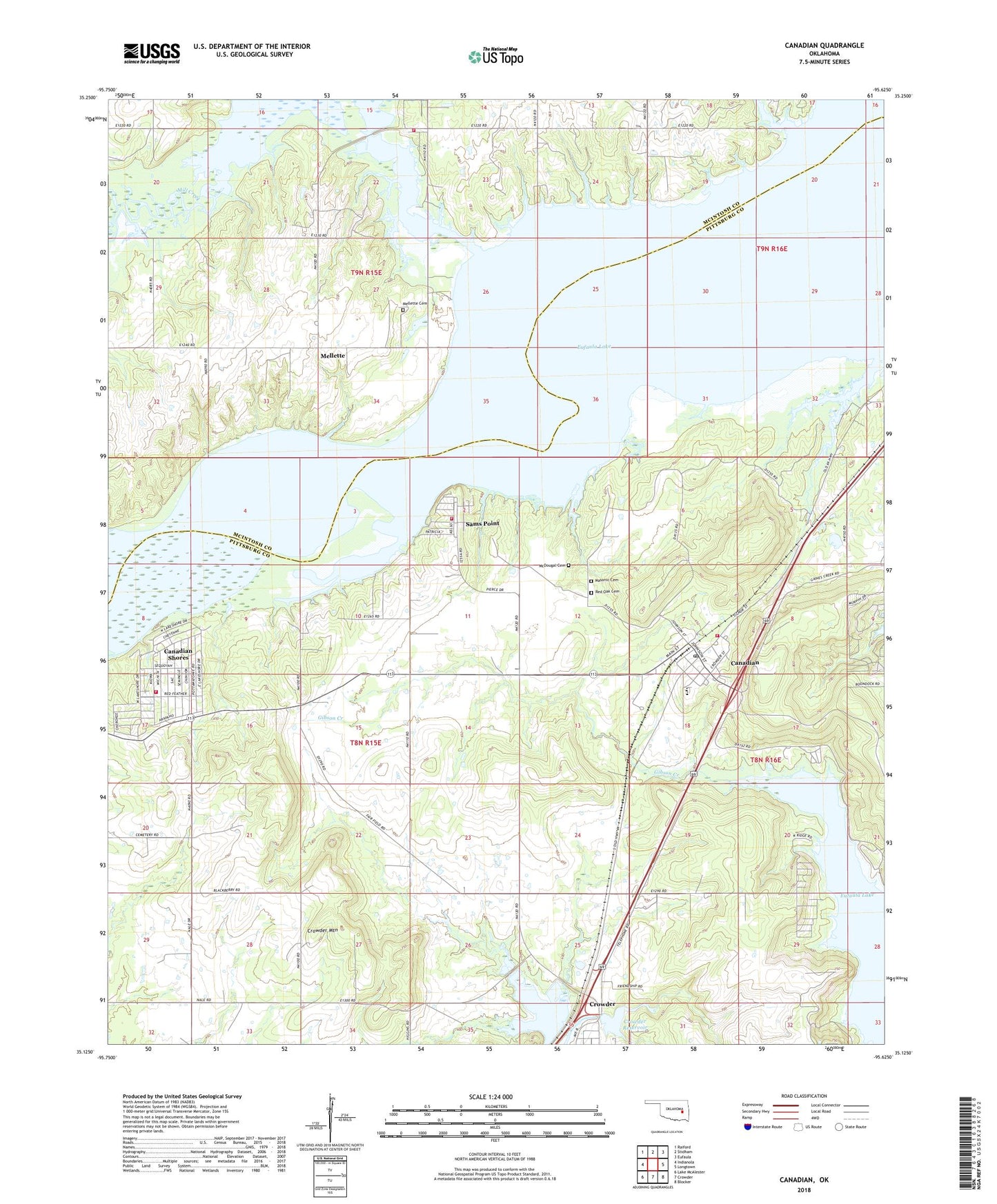
2022 topographic map quadrangle Canadian in the state of Oklahoma. Scale: 1:24000. Based on the newly updated USGS 7.5' US Topo map series, this map is in the following counties: Pittsburg, McIntosh. The map contains contour data, water features, and other items you are used to seeing on USGS maps, but also has updated roads and other features. This is the next generation of topographic maps. Printed on high-quality waterproof paper with UV fade-resistant inks.
Quads adjacent to this one:
West: Indianola
Northwest: Raiford
North: Stidham
Northeast: Eufaula
East: Longtown
Southeast: Blocker
South: Crowder
Southwest: Lake McAlester
This map covers the same area as the classic USGS quad with code o35095b6.
Contains the following named places: Arrowhead State Park, Burns Chapel, Canadian, Canadian Elementary School, Canadian High School, Canadian Post Office, Canadian Shores, Canadian Shores Census Designated Place, Canadian Shores Volunteer Fire Department, Canadian Volunteer Fire Department, Crowder Mountain, Crowder Reservoir, Crowder Reservoir Dam, Flat Rock Creek, Gibson Creek, Masonic Cemetery, McDougal Cemetery, Mellette, Mellette Cemetery, Mill Creek, Mill Creek Wildlife Managment Area, Old Mellette Cemetery, Red Oak Cemetery, Sams Point, Sams Point Volunteer Fire Department, Town of Canadian, Vivian Area Fire Protection Association Mill Creek, Wesley Cemetery, ZIP Codes: 74425, 74430