MyTopo
Durham Oklahoma US Topo Map
Couldn't load pickup availability
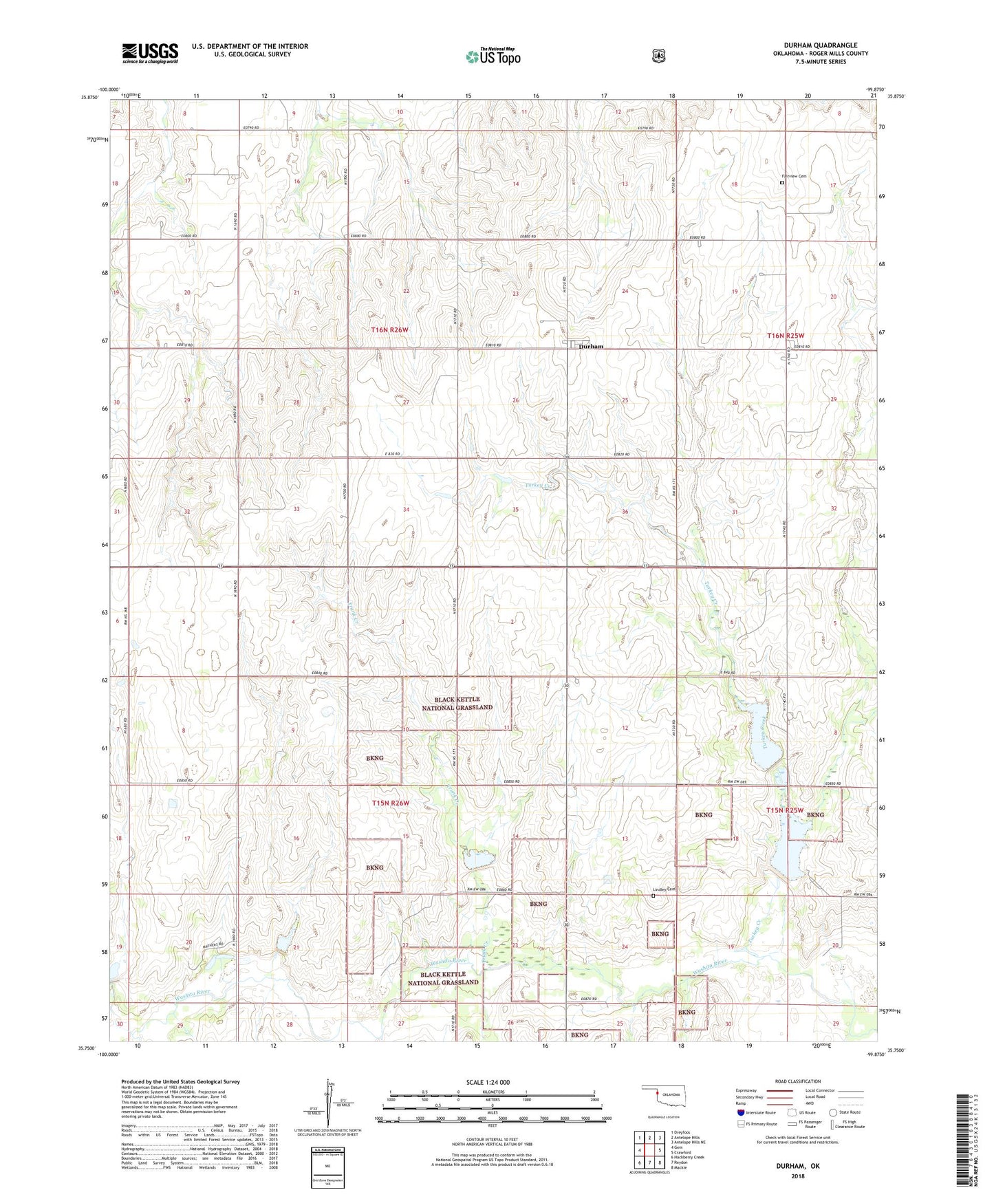
2018 topographic map quadrangle Durham in the state of Oklahoma. Scale: 1:24000. Based on the newly updated USGS 7.5' US Topo map series, this map is in the following counties: Roger Mills. The map contains contour data, water features, and other items you are used to seeing on USGS maps, but also has updated roads and other features. This is the next generation of topographic maps. Printed on high-quality waterproof paper with UV fade-resistant inks.
Quads adjacent to this one:
West: Gem
Northwest: Dreyfoos
North: Antelope Hills
Northeast: Antelope Hills NE
East: Crawford
Southeast: Mackie
South: Reydon
Southwest: Hackberry Creek
Contains the following named places: Durham, Durham Census Designated Place, Durham Post Office, Fairview Cemetery, Lindley Cemetery, Township of Washita, Trunk Creek, Turkey Creek, Upper Washita Site 103 Dam, Upper Washita Site 103 Reservoir, Upper Washita Site 104 Dam, Upper Washita Site 104 Reservoir, Upper Washita Site 33 Dam, Upper Washita Site 33 Reservoir, Upper Washita Site 34 Dam, Upper Washita Site 34 Reservoir, Upper Washita Site 38 Dam, Upper Washita Site 38 Reservoir, Upper Washita Site 39 Dam, Upper Washita Site 39 Reservoir, Upper Washita Site 40 Dam, Upper Washita Site 40 Reservoir, ZIP Code: 73642