MyTopo
Mackie Oklahoma US Topo Map
Couldn't load pickup availability
Also explore the Mackie Forest Service Topo of this same quad for updated USFS data
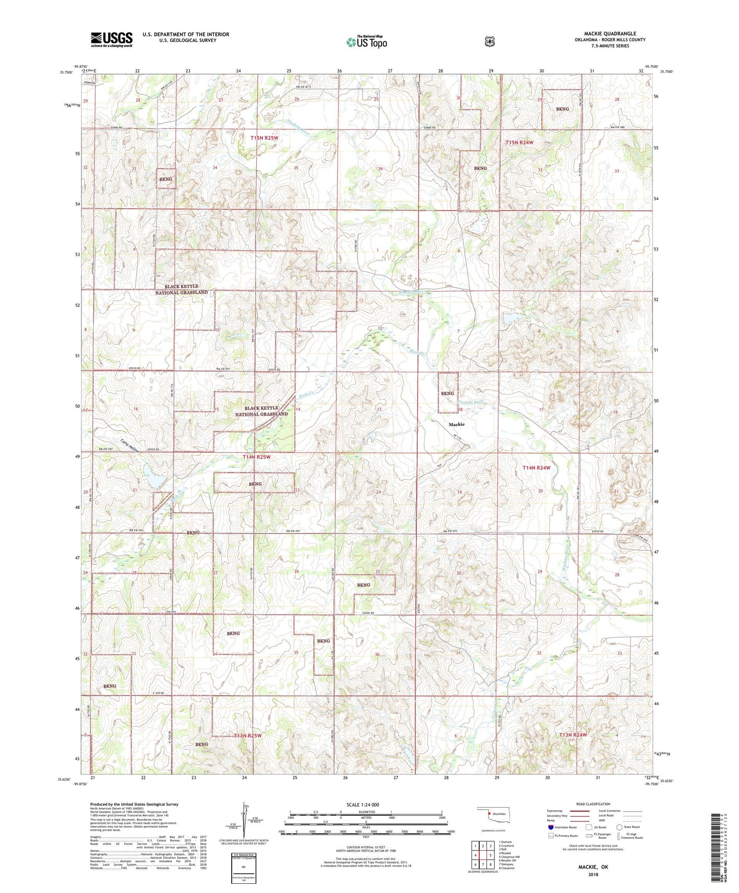
2022 topographic map quadrangle Mackie in the state of Oklahoma. Scale: 1:24000. Based on the newly updated USGS 7.5' US Topo map series, this map is in the following counties: Roger Mills. The map contains contour data, water features, and other items you are used to seeing on USGS maps, but also has updated roads and other features. This is the next generation of topographic maps. Printed on high-quality waterproof paper with UV fade-resistant inks.
Quads adjacent to this one:
West: Reydon
Northwest: Durham
North: Crawford
Northeast: Roll
East: Cheyenne NW
Southeast: Cheyenne
South: Dempsey
Southwest: Reydon SW
This map covers the same area as the classic USGS quad with code o35099f7.
Contains the following named places: Black Kettle National Grassland, Camp Hollow, Cheyenne Division, Croton Creek, Mackie, Rush Creek, Shaller Number 1 Dam, Shaller Number 1 Reservoir, Shaller Number 2 Dam, Shaller Number 2 Reservoir, Shaller Number 3 Dam, Shaller Number 3 Reservoir, Upper Washita Site 44 Dam, Upper Washita Site 44 Reservoir, Upper Washita Site 54 Dam, Upper Washita Site 54 Reservoir, Upper Washita Site 55 Dam, Upper Washita Site 55 Reservoir, Upper Washita Site 61 Dam, Upper Washita Site 61 Reservoir, Upper Washita Site 62 Dam, Upper Washita Site 62 Reservoir, Upper Washita Site 63 Dam, Upper Washita Site 63 Reservoir, Upper Washita Site 64 Dam, Upper Washita Site 64 Reservoir, Upper Washita Site 65 Dam, Upper Washita Site 65 Reservoir