MyTopo
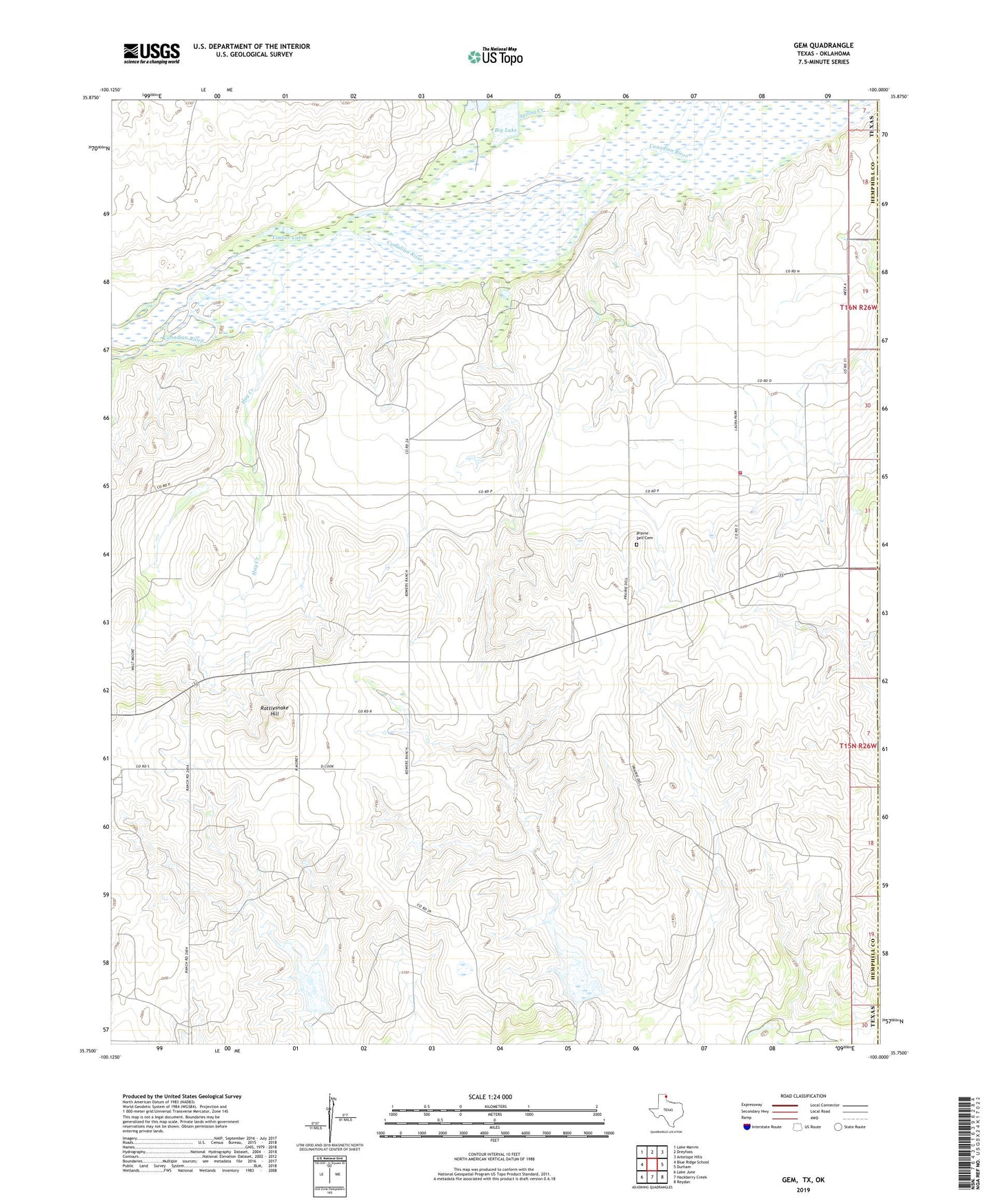
Gem Texas US Topo Map
Couldn't load pickup availability
Also explore the Gem Forest Service Topo of this same quad for updated USFS data
2022 topographic map quadrangle Gem in the state of Texas. Scale: 1:24000. Based on the newly updated USGS 7.5' US Topo map series, this map is in the following counties: Hemphill, Roger Mills. The map contains contour data, water features, and other items you are used to seeing on USGS maps, but also has updated roads and other features. This is the next generation of topographic maps. Printed on high-quality waterproof paper with UV fade-resistant inks.
Quads adjacent to this one:
West: Blue Ridge School
Northwest: Lake Marvin
North: Dreyfoos
Northeast: Antelope Hills
East: Durham
Southeast: Reydon
South: Hackberry Creek
Southwest: Lake June
This map covers the same area as the classic USGS quad with code o35100g1.
Contains the following named places: Big Lake, Cat Creek, Gem, Gem City Fire Department, Hay Creek, Kritzer Lake Dam, Prairie Dell Cemetery, Rattlesnake Hill, Soil Conservation Service Site 29 Dam, Soil Conservation Service Site 29 Reservoir, Soil Conservation Service Site 30 Dam, Soil Conservation Service Site 30 Reservoir, Timber Lakes