MyTopo
Eakly NE Oklahoma US Topo Map
Couldn't load pickup availability
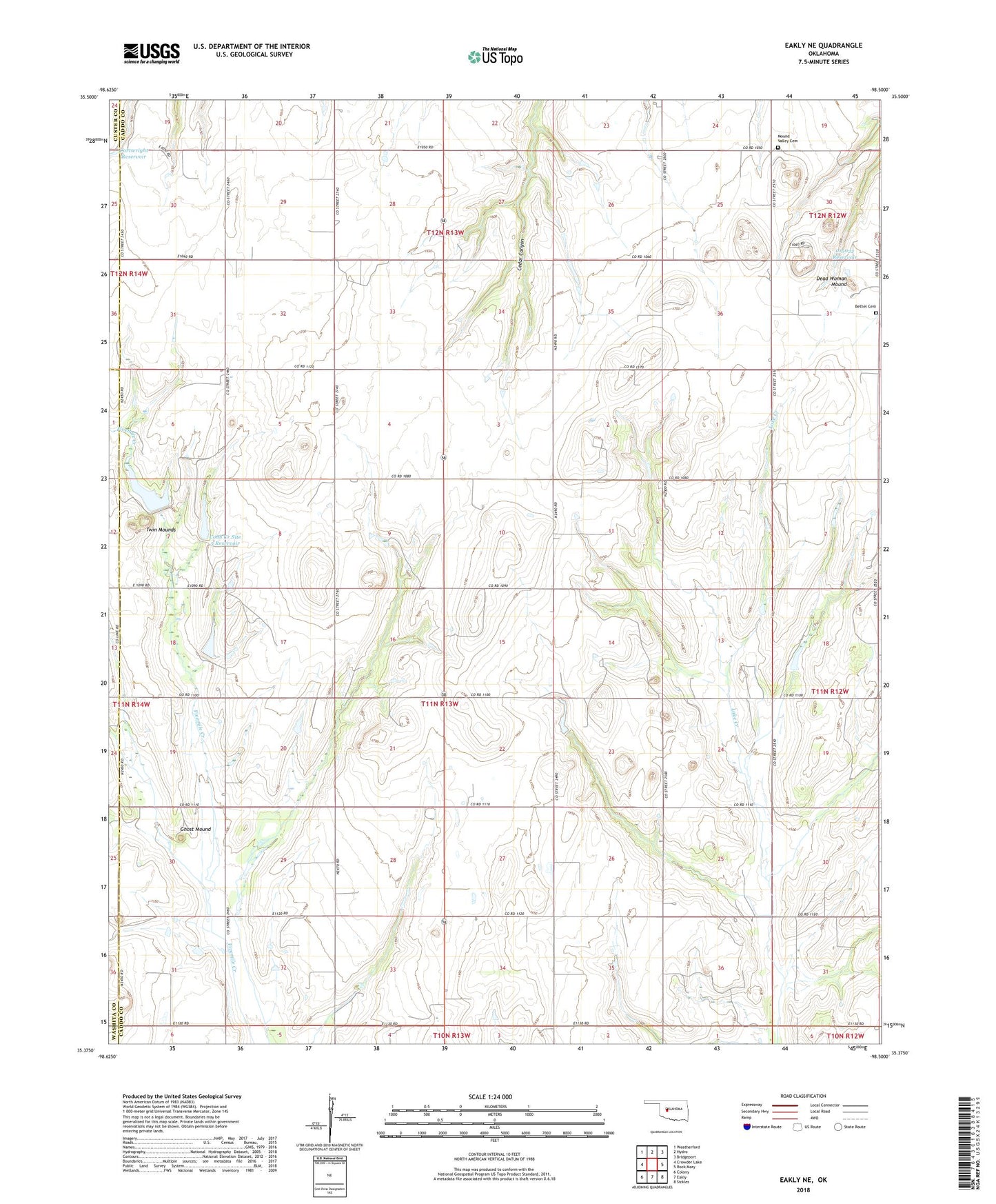
2018 topographic map quadrangle Eakly NE in the state of Oklahoma. Scale: 1:24000. Based on the newly updated USGS 7.5' US Topo map series, this map is in the following counties: Caddo, Washita, Custer. The map contains contour data, water features, and other items you are used to seeing on USGS maps, but also has updated roads and other features. This is the next generation of topographic maps. Printed on high-quality waterproof paper with UV fade-resistant inks.
Quads adjacent to this one:
West: Crowder Lake
Northwest: Weatherford
North: Hydro
Northeast: Bridgeport
East: Rock Mary
Southeast: Sickles
South: Eakly
Southwest: Colony
Contains the following named places: Bethel Cemetery, Bethel Church, Broken B Airport, Cartwright Reservoir, Cobb Creek Site 101 Dam, Cobb Creek Site 101 Reservoir, Cobb Creek Site 102 Dam, Cobb Creek Site 102 Reservoir, Cobb Creek Site 4 Dam, Cobb Creek Site 4 Reservoir, Cobb Creek Site 5 Dam, Cobb Creek Site 5 Reservoir, Cobb Creek Site 6 Dam, Cobb Creek Site 6 Reservoir, Dead Woman Mound, Fost School, Ghost Mound, Hydro Division, Mound Valley Cemetery, Mound Valley School, Mount Zion Church, Muncy Airport, Oknoname 015019 Dam, Oknoname 015019 Reservoir, Oknoname 015022 Dam, Oknoname 015022 Reservoir, Pleasant Valley Church, Township of Caddo, Twin Mounds, ZIP Code: 73048