MyTopo
Bridgeport Oklahoma US Topo Map
Couldn't load pickup availability
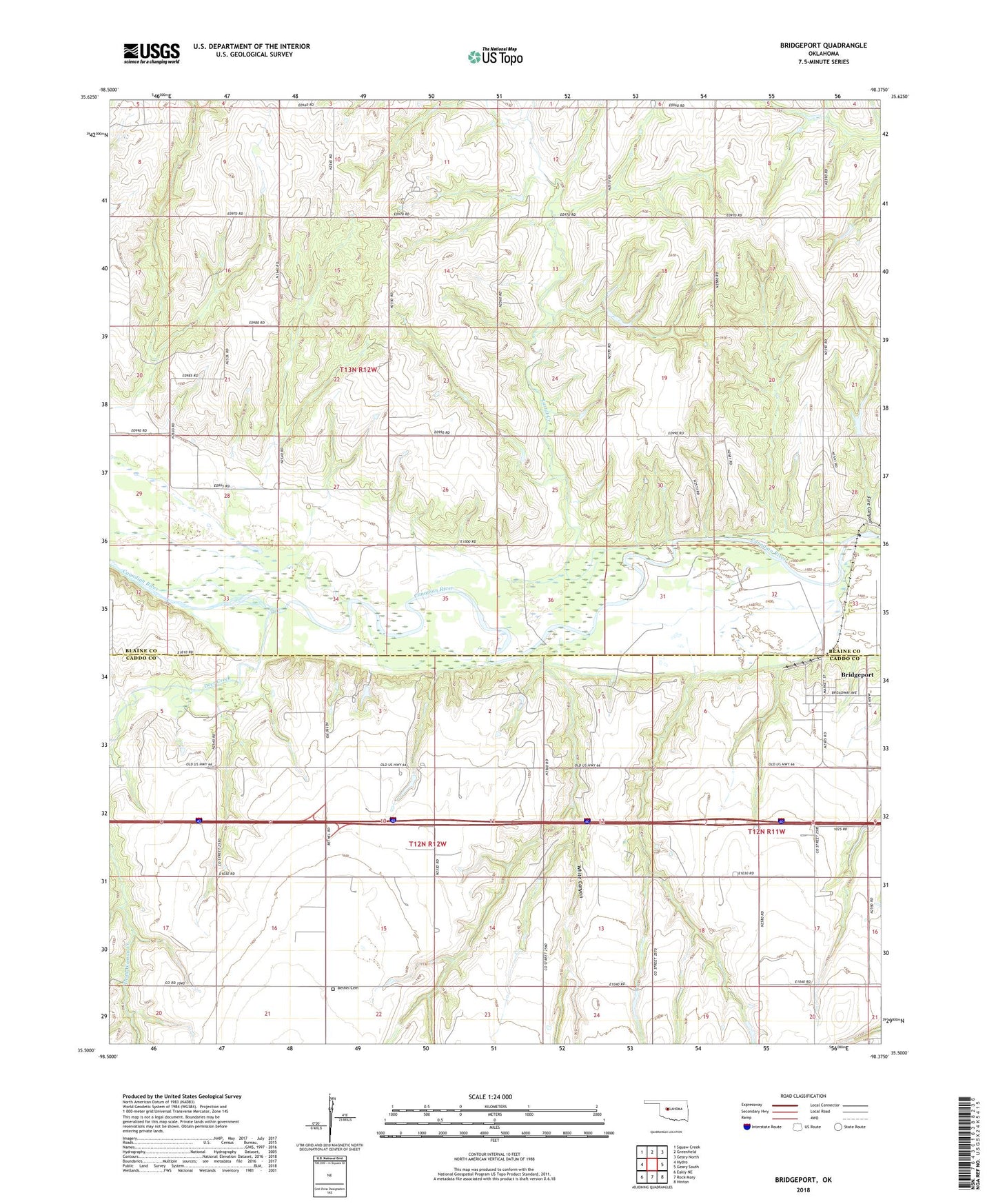
2022 topographic map quadrangle Bridgeport in the state of Oklahoma. Scale: 1:24000. Based on the newly updated USGS 7.5' US Topo map series, this map is in the following counties: Blaine, Caddo. The map contains contour data, water features, and other items you are used to seeing on USGS maps, but also has updated roads and other features. This is the next generation of topographic maps. Printed on high-quality waterproof paper with UV fade-resistant inks.
Quads adjacent to this one:
West: Hydro
Northwest: Squaw Creek
North: Greenfield
Northeast: Geary North
East: Geary South
Southeast: Hinton
South: Rock Mary
Southwest: Eakly NE
This map covers the same area as the classic USGS quad with code o35098e4.
Contains the following named places: Bethel Cemetery, Bridgeport, City of Bridgeport, Deer Creek, Fire Canyon, Lariat Creek, Oknoname 015023 Dam, Oknoname 015023 Reservoir, Oknoname 015024 Dam, Oknoname 015024 Reservoir, Pleasant Ridge Church, Sugar Creek Site 16 Dam, Sugar Creek Site 16 Reservoir, Sugar Creek Site 17 Dam, Sugar Creek Site 17 Reservoir, Sugar Creek Site 18 Dam, Sugar Creek Site 18 Reservoir, Sugar Creek Site 19 Dam, Sugar Creek Site 19 Reservoir, Sugar Creek Site 27 Dam, Sugar Creek Site 27 Reservoir, Sugar Creek Site 28 Dam, Sugar Creek Site 28 Reservoir, TK Airport, Township of Mound Valley, White Canyon