MyTopo
Fargo Oklahoma US Topo Map
Couldn't load pickup availability
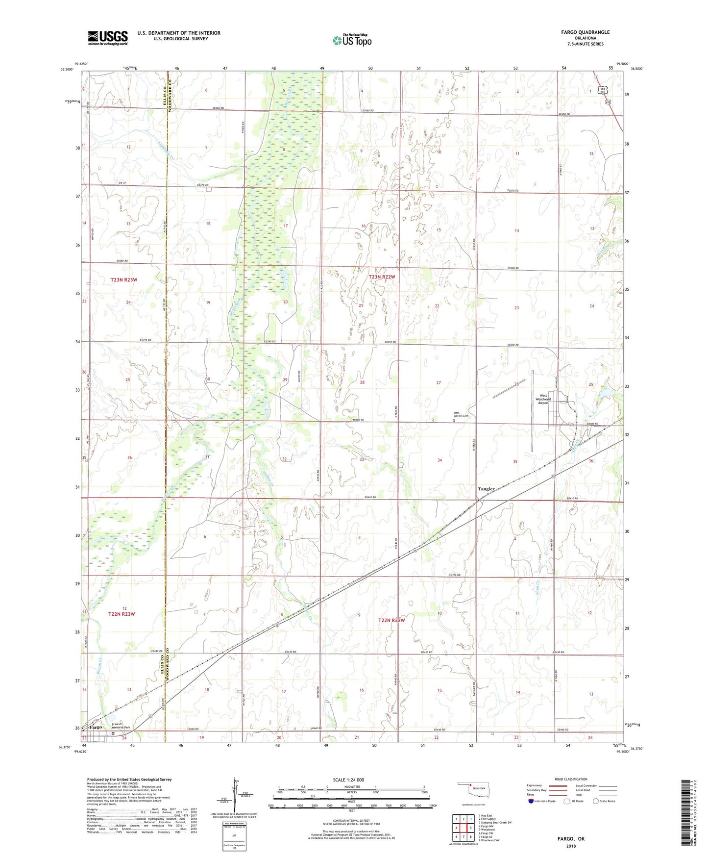
2022 topographic map quadrangle Fargo in the state of Oklahoma. Scale: 1:24000. Based on the newly updated USGS 7.5' US Topo map series, this map is in the following counties: Woodward, Ellis. The map contains contour data, water features, and other items you are used to seeing on USGS maps, but also has updated roads and other features. This is the next generation of topographic maps. Printed on high-quality waterproof paper with UV fade-resistant inks.
Quads adjacent to this one:
West: Fargo NW
Northwest: May East
North: Fort Supply
Northeast: Sleeping Bear Creek SW
East: Woodward
Southeast: Woodward SW
South: Fargo SE
Southwest: Fargo SW
This map covers the same area as the classic USGS quad with code o36099d5.
Contains the following named places: Boggy Creek, Braunch Memorial Park, Eightmile Creek, Fargo, Rest Haven Cemetery, Sixteenmile Creek, Tangier, Turkey Creek, West Woodward Airport, Woodward Army Air Field