MyTopo
Floris Oklahoma US Topo Map
Couldn't load pickup availability
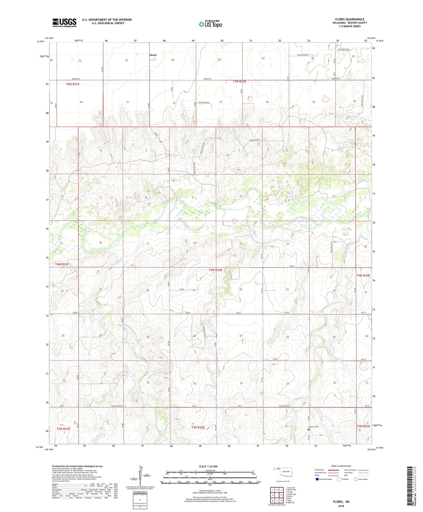
2022 topographic map quadrangle Floris in the state of Oklahoma. Scale: 1:24000. Based on the newly updated USGS 7.5' US Topo map series, this map is in the following counties: Beaver. The map contains contour data, water features, and other items you are used to seeing on USGS maps, but also has updated roads and other features. This is the next generation of topographic maps. Printed on high-quality waterproof paper with UV fade-resistant inks.
Quads adjacent to this one:
West: Turpin East
Northwest: Turpin NE
North: Beaver NW
Northeast: Forgan
East: Beaver
Southeast: Balko NE
South: Balko
Southwest: Boyd
This map covers the same area as the classic USGS quad with code o36100g6.
Contains the following named places: Beaver River Wildlife Management Area, Blakemore Ranch, Davis Number 5 Dam, Davis Number 5 Reservoir, Dugout Creek, Elm Creek, Floris, Overton Cemetery, T Bar T Ranch Airport, Willow Creek, Willow Creek Ranch