MyTopo
Garber Oklahoma US Topo Map
Couldn't load pickup availability
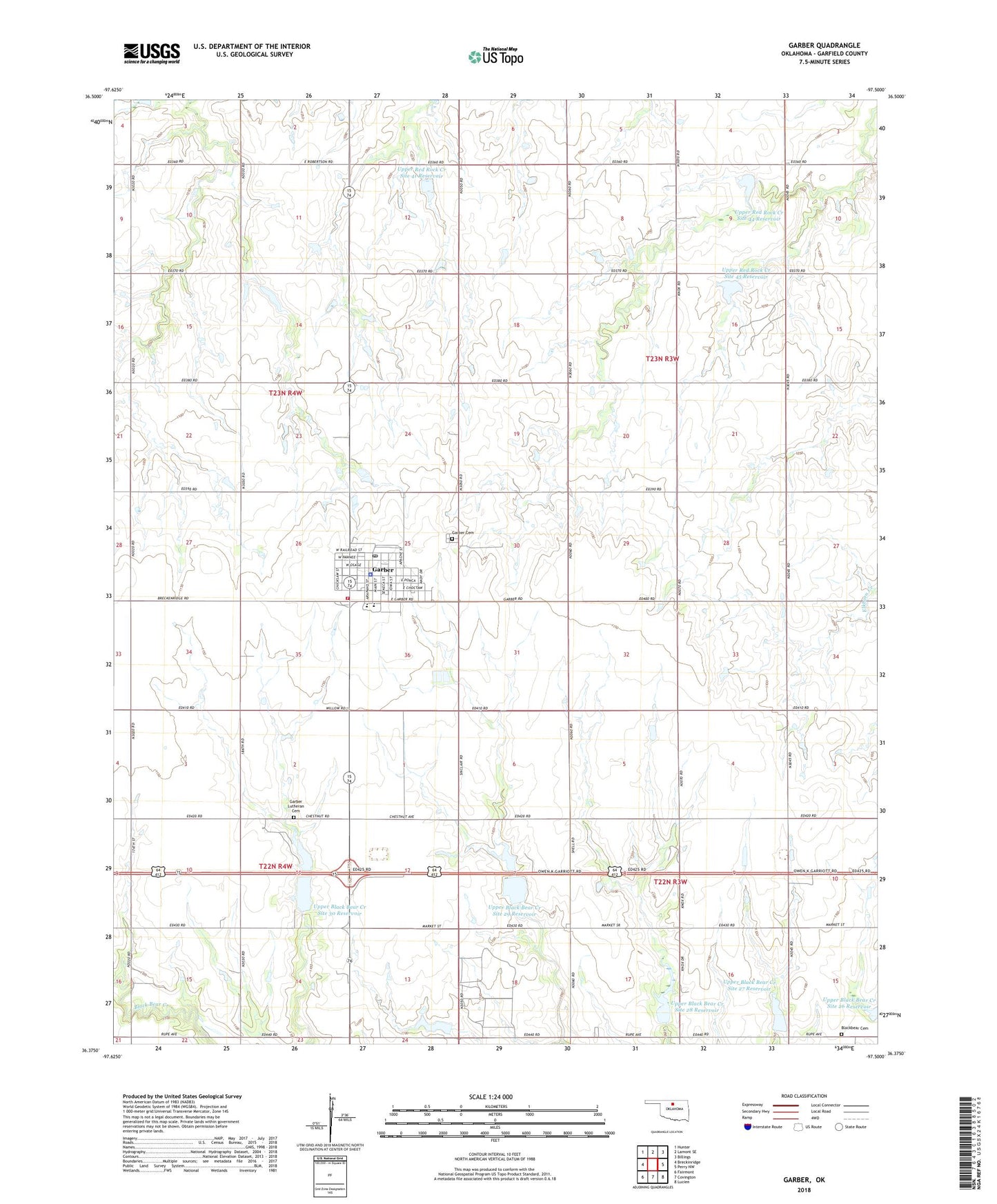
2018 topographic map quadrangle Garber in the state of Oklahoma. Scale: 1:24000. Based on the newly updated USGS 7.5' US Topo map series, this map is in the following counties: Garfield. The map contains contour data, water features, and other items you are used to seeing on USGS maps, but also has updated roads and other features. This is the next generation of topographic maps. Printed on high-quality waterproof paper with UV fade-resistant inks.
Quads adjacent to this one:
West: Breckinridge
Northwest: Hunter
North: Lamont SE
Northeast: Billings
East: Perry NW
Southeast: Lucien
South: Covington
Southwest: Fairmont
Contains the following named places: Assembly of God Church, Baptist Church, Blackbear Cemetery, Christian Church, City of Garber, Garber, Garber Cemetery, Garber Elementary School, Garber Emergency Medical Services, Garber Fire Department, Garber High School, Garber Lutheran Cemetery, Garber Police Department, Garber Post Office, Immanuel Lutheran Church, Methodist Church, New Bethany Church, Township of Allison, Township of Grant, Township of Lincoln, Township of Olive, Union School, Upper Black Bear Creek Site 27 Dam, Upper Black Bear Creek Site 27 Reservoir, Upper Black Bear Creek Site 28 Dam, Upper Black Bear Creek Site 28 Reservoir, Upper Black Bear Creek Site 29 Dam, Upper Black Bear Creek Site 29 Reservoir, Upper Black Bear Creek Site 30 Dam, Upper Black Bear Creek Site 30 Reservoir, Upper Red Rock Creek Site 37 Dam, Upper Red Rock Creek Site 41 Dam, Upper Red Rock Creek Site 41 Reservoir, Upper Red Rock Creek Site 44 Dam, Upper Red Rock Creek Site 44 Reservoir, Upper Red Rock Creek Site 45 Dam, Upper Red Rock Creek Site 45 Reservoir, ZIP Code: 73738