MyTopo
Billings Oklahoma US Topo Map
Couldn't load pickup availability
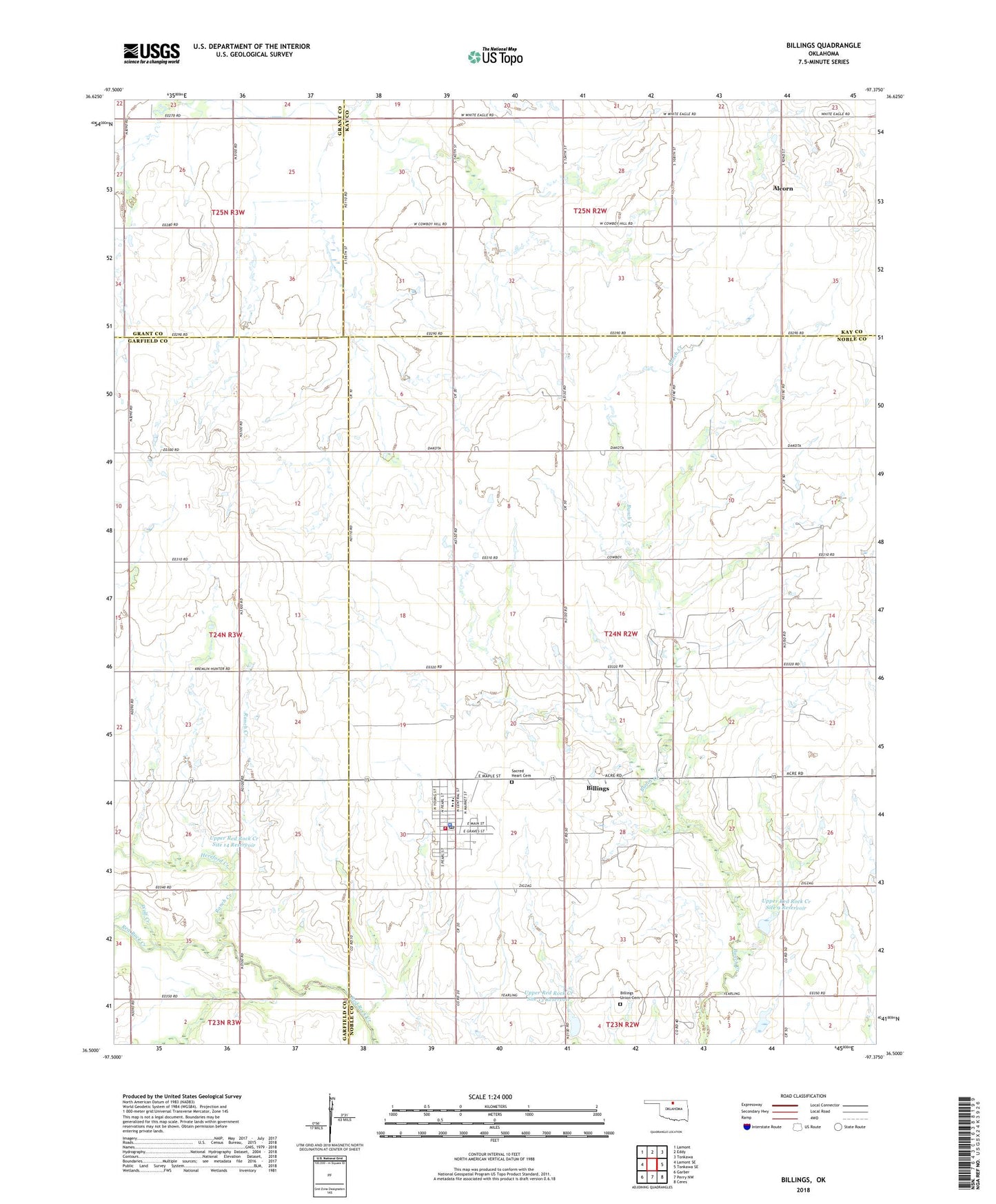
2022 topographic map quadrangle Billings in the state of Oklahoma. Scale: 1:24000. Based on the newly updated USGS 7.5' US Topo map series, this map is in the following counties: Noble, Garfield, Kay, Grant. The map contains contour data, water features, and other items you are used to seeing on USGS maps, but also has updated roads and other features. This is the next generation of topographic maps. Printed on high-quality waterproof paper with UV fade-resistant inks.
Quads adjacent to this one:
West: Lamont SE
Northwest: Lamont
North: Eddy
Northeast: Tonkawa
East: Tonkawa SE
Southeast: Ceres
South: Perry NW
Southwest: Garber
This map covers the same area as the classic USGS quad with code o36097e4.
Contains the following named places: Alcorn, Billings, Billings Elementary School, Billings Fire Department, Billings High School, Billings Police Department, Billings Post Office, Billings Union Cemetery, East Billings Oil Field, First Baptist Church, Hereford Creek, Polk, Polk Post Office, Ranch Creek, Sacred Heart Cemetery, Town of Billings, Township of Bunch Creek, Upper Red Rock Creek Site 11 Dam, Upper Red Rock Creek Site 11 Reservoir, Upper Red Rock Creek Site 13 Dam, Upper Red Rock Creek Site 13 Reservoir, Upper Red Rock Creek Site 14 Dam, Upper Red Rock Creek Site 14 Reservoir, Upper Red Rock Creek Site 9 Dam, Upper Red Rock Creek Site 9 Reservoir, Wolf Creek, ZIP Code: 74630