MyTopo
Grandfield Oklahoma US Topo Map
Couldn't load pickup availability
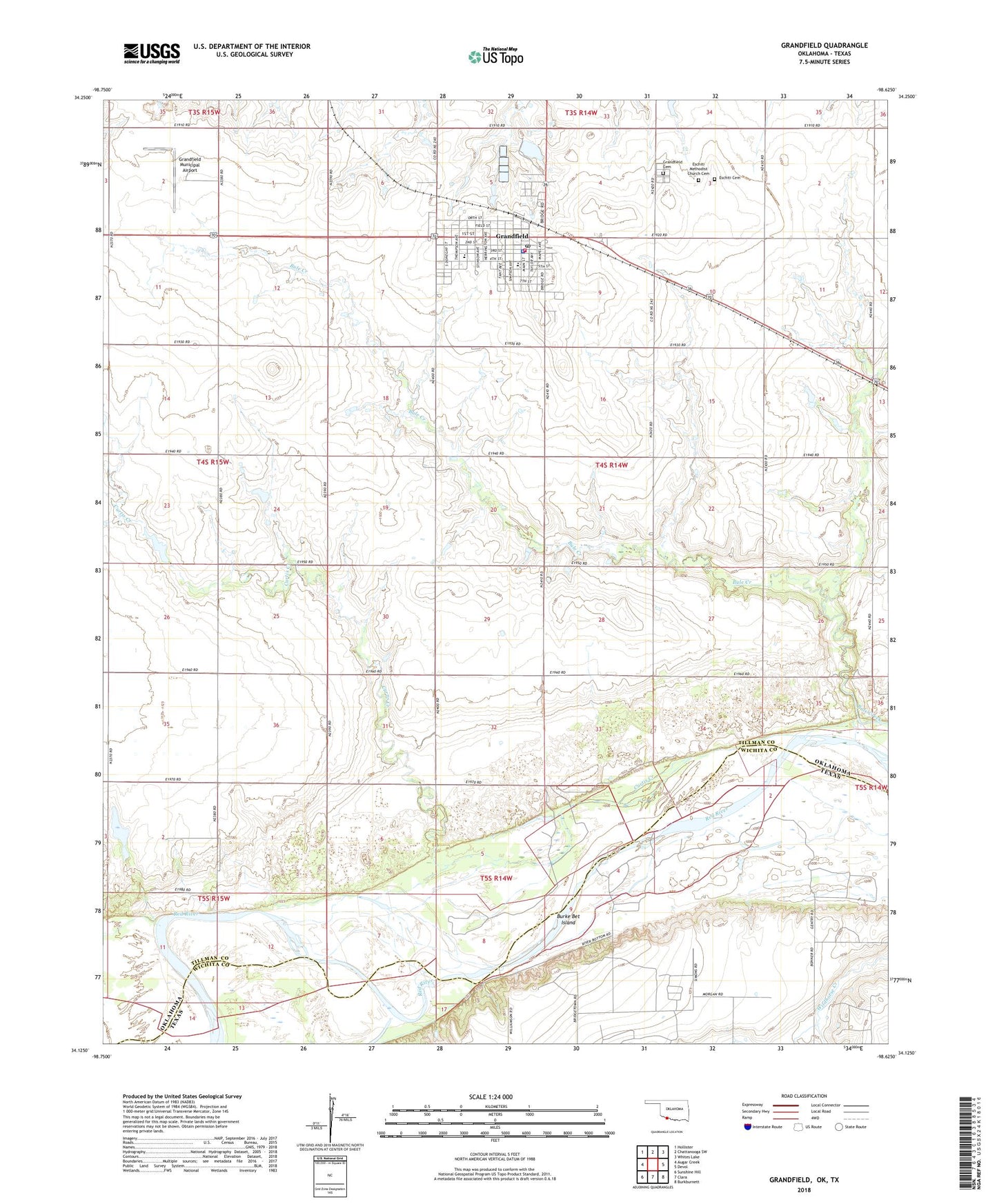
2018 topographic map quadrangle Grandfield in the state of Oklahoma. Scale: 1:24000. Based on the newly updated USGS 7.5' US Topo map series, this map is in the following counties: Tillman, Wichita. The map contains contour data, water features, and other items you are used to seeing on USGS maps, but also has updated roads and other features. This is the next generation of topographic maps. Printed on high-quality waterproof paper with UV fade-resistant inks.
Quads adjacent to this one:
West: Augar Creek
Northwest: Hollister
North: Chattanooga SW
Northeast: Whites Lake
East: Devol
Southeast: Burkburnett
South: Clara
Southwest: Sunshine Hill
Contains the following named places: Bule Creek, Burke Bet Island, City of Grandfield, Curtis Creek, Eschiti Cemetery, Eschiti Methodist Church Cemetery, Grandfield, Grandfield Ambulance Service, Grandfield Cemetery, Grandfield Elementary School, Grandfield High School, Grandfield Municipal Airport, Grandfield Police Department, Grandfield Post Office, Grandfield Volunteer Fire Department, KSWO-TV (Lawton), Lake Murray Park, Northwest Oil Field, Red River Oil Field, Sage School, Township of Alfalfa, ZIP Code: 73546