MyTopo
Whites Lake Oklahoma US Topo Map
Couldn't load pickup availability
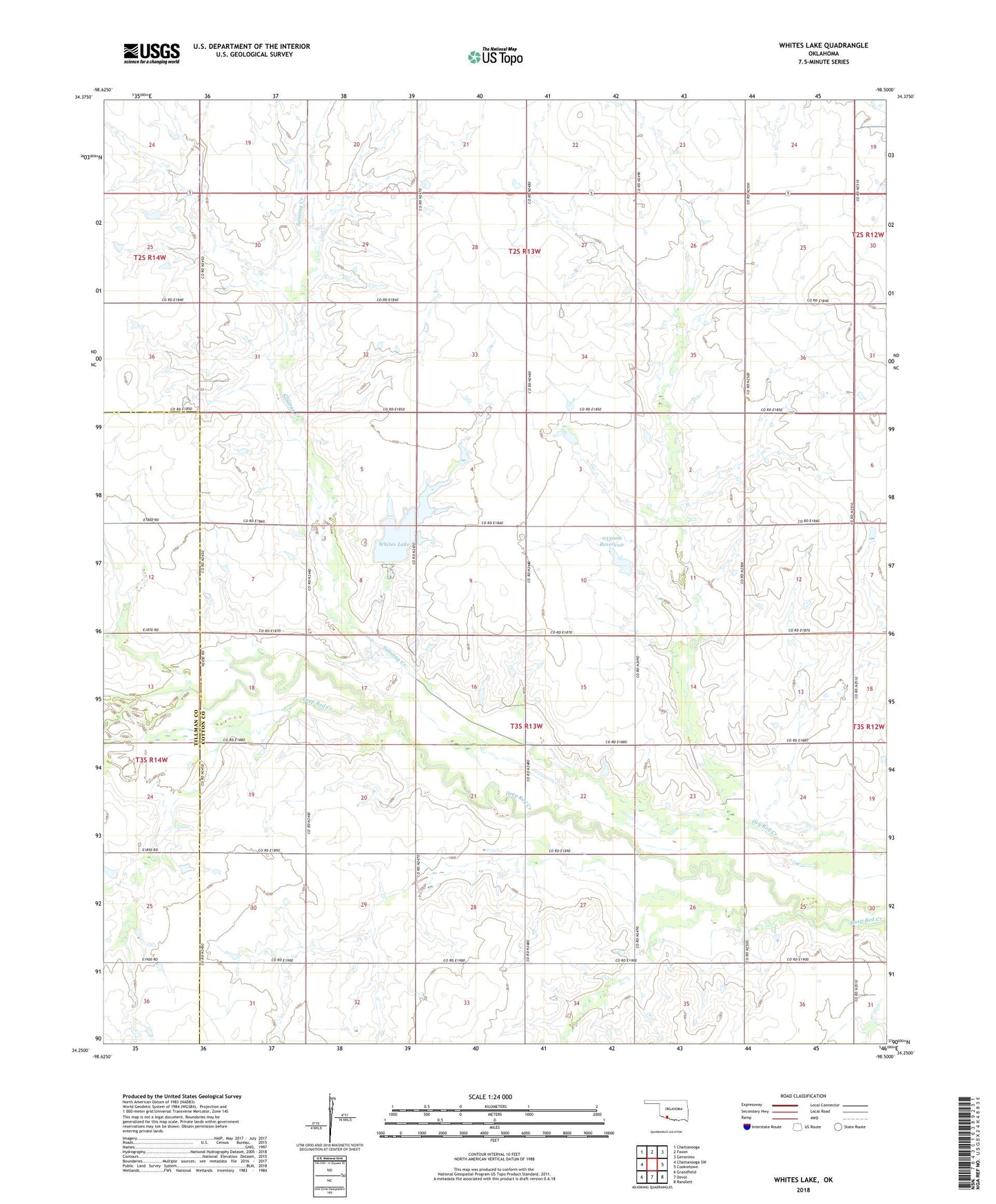
2022 topographic map quadrangle Whites Lake in the state of Oklahoma. Scale: 1:24000. Based on the newly updated USGS 7.5' US Topo map series, this map is in the following counties: Cotton, Tillman. The map contains contour data, water features, and other items you are used to seeing on USGS maps, but also has updated roads and other features. This is the next generation of topographic maps. Printed on high-quality waterproof paper with UV fade-resistant inks.
Quads adjacent to this one:
West: Chattanooga SW
Northwest: Chattanooga
North: Faxon
Northeast: Geronimo
East: Cookietown
Southeast: Randlett
South: Devol
Southwest: Grandfield
This map covers the same area as the classic USGS quad with code o34098c5.
Contains the following named places: Ahpeatone Church, Ahpeatone School, Bible Church, Little Deep Red Creek, Oknoname 031061 Dam, Oknoname 031061 Reservoir, Oknoname 033006 Dam, Oknoname 033006 Reservoir, Sanatag Creek, Township of Bryan, Whites Lake, Whites Lake Dam