MyTopo
Gypsy Oklahoma US Topo Map
Couldn't load pickup availability
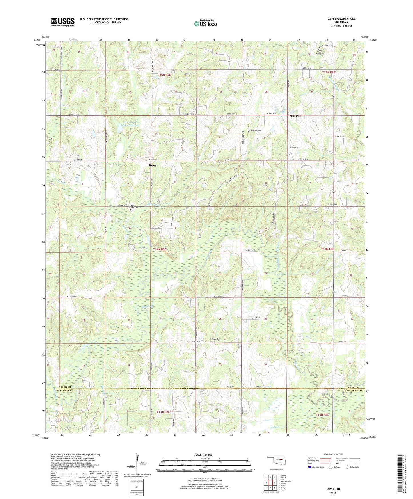
2022 topographic map quadrangle Gypsy in the state of Oklahoma. Scale: 1:24000. Based on the newly updated USGS 7.5' US Topo map series, this map is in the following counties: Creek, Okfuskee. The map contains contour data, water features, and other items you are used to seeing on USGS maps, but also has updated roads and other features. This is the next generation of topographic maps. Printed on high-quality waterproof paper with UV fade-resistant inks.
Quads adjacent to this one:
West: Ritts Junction
Northwest: Depew
North: Bristow
Northeast: Slick
East: Newby
Southeast: Mason
South: Welty
Southwest: Paden
This map covers the same area as the classic USGS quad with code o35096f4.
Contains the following named places: Bachelor Creek, Bethel Church, Bristow South Division, Bucktrot Cemetery, Clifty Creek, Greater Mount Hermon Church, Gypsy, Gypsy Church, Gypsy Public School, Hanna Brown - Tiger Cemetery, Iron Post, Oknoname 037052 Dam, Oknoname 037052 Reservoir, Polly Long Cemetery, Salt Camp Creek Site 4 Dam, Salt Camp Creek Site 4 Reservoir, Salt Creek, Spring Creek, Township of Lakeside, Welty Census Designated Place, Welty Volunteer Fire Department, Wilson Cemetery, Wolfe Creek