MyTopo
Haywood Oklahoma US Topo Map
Couldn't load pickup availability
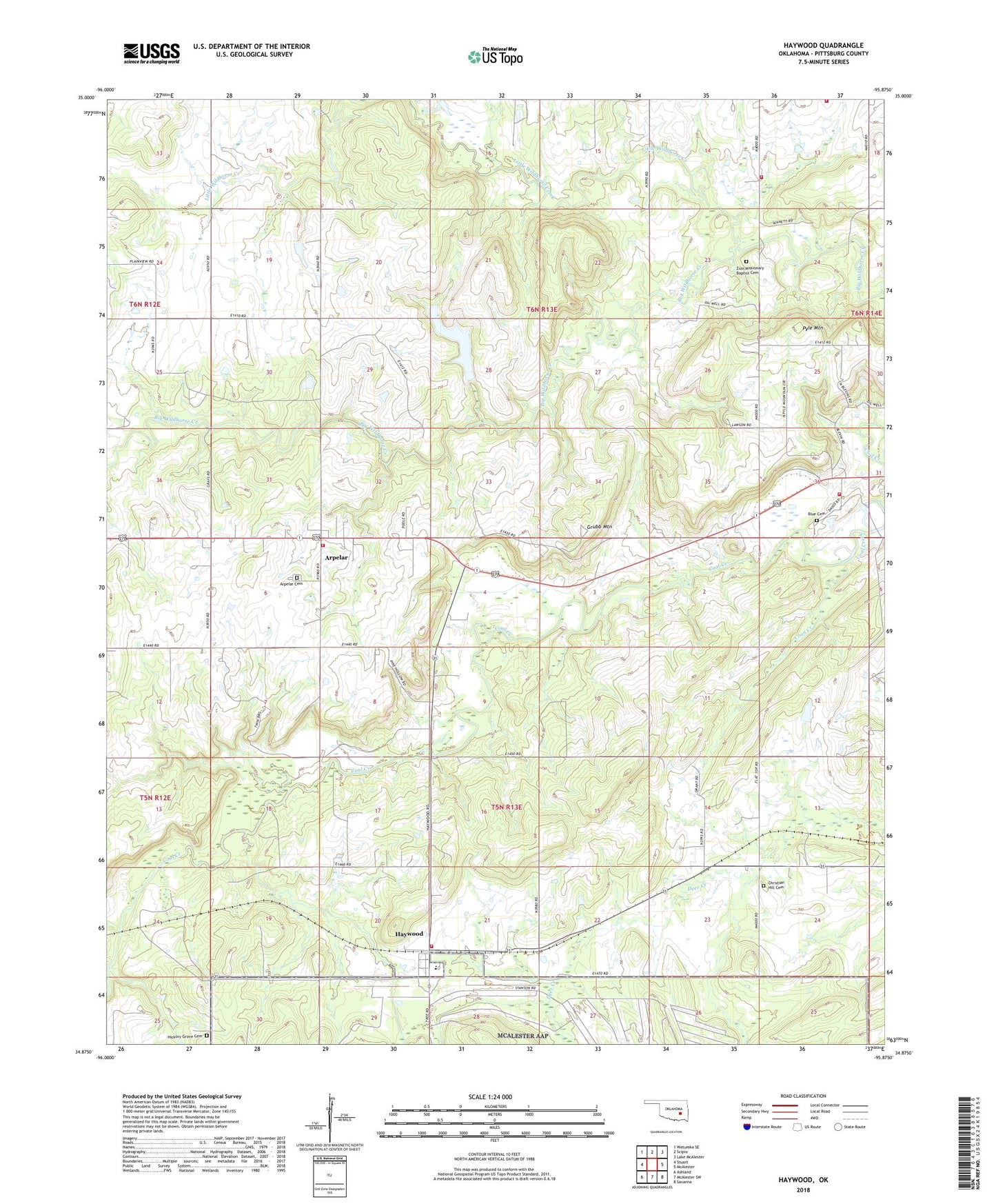
2018 topographic map quadrangle Haywood in the state of Oklahoma. Scale: 1:24000. Based on the newly updated USGS 7.5' US Topo map series, this map is in the following counties: Pittsburg. The map contains contour data, water features, and other items you are used to seeing on USGS maps, but also has updated roads and other features. This is the next generation of topographic maps. Printed on high-quality waterproof paper with UV fade-resistant inks.
Quads adjacent to this one:
West: Stuart
Northwest: Wetumka SE
North: Scipio
Northeast: Lake McAlester
East: McAlester
Southeast: Savanna
South: McAlester SW
Southwest: Ashland
Contains the following named places: Arpelar, Arpelar Cemetery, Arpelar Census Designated Place, Arpelar Church, Blue Cemetery, Blue Church, Blue Volunteer Fire Department, Christian Hill Cemetery, Coon Creek, Grubb Mountain, Haywood, Haywood - Arpelar Volunteer Fire Department Station 1, Haywood - Arpelar Volunteer Fire Department Station 2, Haywood Census Designated Place, Haywood Elementary School, Hickory Grove Cemetery, Little Wildhorse Creek, Northwest Pittsburg Division, Oknoname 121009 Dam, Oknoname 121009 Reservoir, Oknoname 121010 Dam, Oknoname 121010 Reservoir, Pyle Mountain, Tannehill Volunteer Fire Department Main Station, Tannehill Volunteer Fire Department Substation 5, Township of Bucklucksy, Zion Missionary Baptist Cemetery, Zion Missionary Baptist Church